Uploading...
Overall progress...
0%
File progress...
0%
Edit event: Pflach Hahlekopf Frauensee Reutte Hike & Swim
T2 - Pflach Hahlekopf Frauensee Reutte Hike & Swim
 Organized by:
Route
Pflach Hahlekopf Frauensee Reutte
| Elevation gain |
| Elevation loss |
| Distance |
| Duration |
| Highest altitude |
| Rating |
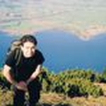
Gallery
Participants
You need to be logged in to see the participants
Weather
°
°
°
°
Description
Slow / Medium pace preferred* please keep the whole day open. Also I do like to have at least 5 people for the hike. If the number of people joining is lower, I might cancel it.
Please message me on WhatsApp +1 512 623 9932/ add in waitlist if you would like to Join :)
Lets go for a beautiful hike together! 😁
Plan : Hike to Hahlekopf
Public Transport :

Hut: There are couple of huts along the way
Weather: It seems ok. If the weather becomes bad, I might cancel the hike
WhatsApp group: https://chat.whatsapp.com/KwMqFElyHcACTeL6RKx17C
Things to bring:
- IDs
- Hiking boots
- Swimming gear
- Rain jacket
- Cash for the hut
- Food/drinks for the way
- Map
- A good smile
- Good to have DAV membership ;)
-Murali
whatsapp +1 512 623 9932
Original description from Marco
Hahlekopf. You probably never heard of it! A not very well known peak with a great view, that's exactly what makes this mountain hike so attractive. We start our hike in Pflach near Reutte, part of the Tiroler Lech Nature Park. Here there is a bird adventure trail with a 17 m high wooden observation tower. From the tower you have a fantastic view over the treetops, to the Reutte basin and over the animal habitats, and in the distance Ehrenberg and Schlossberg castle ruins, before you continue along numerous ponds, a paradise for insects and breeding grounds for many bird species, to the junction, an old fortification wall Lech. The 17m high bird tower is a project of the LIFE project "Tirolean Lech Wild River Landscape" and was built on behalf of the community near the industrial area in Pflach. We proceed along the Lech and we cross it to catch the high altitude panorama trail bringing us first to Kostaries Kapelle, a beautiful vantage point above Wängle with great views towards the Lechtal Alps. From the Kostaries chapel, continue to follow the signs towards Musauer Alm. You will pass the Sulztaler Hütte, keep right here and reach the Hahlealm with a magnificent view of the walls of the Gehrenspitze. After overcoming a steep meadow slope, you find yourself in front of the Schaller Kapelle. When climbing to the Schaller Kapelle, however, your eyes are constantly glued to the beautiful and impressive eastern ridge to the Gehrenspitze. At the chapel there is a sign pointing right to Hahlekopf. the previous path was easy, the transition is a little more challenging, as the path is quite narrow. You reach the pre-summit along the path and then through steep mountain pine alleys you finally reach the summit cross (3 hours). Here your eyes can space from the Tannheimer mountain chain till Neuschwanstein Castle and Füssen, Hohenschwangau and Forgensee. From the small summit area you have a wonderful view of the entire Raintal, the beautiful Ammergau and the Zugspitze area. But the impressive north faces of Gimpel, Kellenspitze and Gehrenspitze are the most impressive. A little next to the cross there is a kind of bench from which you can enjoy the view while taking a leisurely rest. There is a hidden box attached to the rock under the bench with an additional summit book. After enjoying this view, we hike down the valley to get to Frauensee. It is quite hidden through the forrest. That is why many legends flourished. One legend says that a castle sank here many years ago and lies under the water. The natural swimming lake is surrounded by untouched nature and many rare animal species feel at home here. It is quite hidden through the Forrest. We stop at Frauenseestube to get a drink or eat something and we finally head to Reutte to catch the train back.
Good to know
Technical difficulty: The hike difficulty is mentioned in the description of the route, please read the blog to understand the requirements for sac scale
Note: Please unjoin the event well in advance, if you don't plan to come. You cannot unjoin the event, when it is starting in less than 12 hours.
Disclaimer: Hiking can be dangerous. I am not a mountain guide. Everybody is responsible for her/himself. Make yourself familiar with the route and its requirements. It's recommended to download a map and bring a cell phone and first aid kit for emergencies.
Comments

Muralidharan Jagannathan
1 year ago
Please kindly join the whatsapp group: https://chat.whatsapp.com/KwMqFElyHcACTeL6RKx17C
0
|
0
Muralidharan Jagannathan
1 year ago
see you all tomorrow… it is going to be a hot day .. don’t forget your swim wear
0
|
0
Reza Mortazavi
1 year ago
Hello Murali, my daughter has become ill, so unfortunately I cannot come. sorry
0
|
0
Muralidharan Jagannathan
1 year ago
we are inside the train … platform section 28C
0
|
0