Uploading...
Overall progress...
0%
File progress...
0%
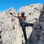
Edit event: Enterrottach – Bodenschneid – Wasserspitz – Rainerkopf – Rottach-Egern - Enterrottach
T3 - Enterrottach – Bodenschneid – Wasserspitz – Rainerkopf – Rottach-Egern - Enterrottach
 Organized by:
Route
Rottach-Egern – Enterrottach – Bodenschneid – Wasserspitz – Rainerkopf – Rottach-Egern
| Elevation gain |
| Elevation loss |
| Distance |
| Duration |
| Highest altitude |
| Rating |
Gallery
Participants
You need to be logged in to see the participants
Weather
°
°
°
°
Description
Not for beginners. The ascent is moderately long and there is one optional tricky (and desired) part around Rinnerspitz.
Route inspired by route 34. described in the Vergessene Pfade Bayerische Hausberge book. I copied over the route from someone else before because I'm lazy :) It's almost exactly the same. The 2 differences are the starting point - Mautstelle in Enterrottach and the more difficult route variant via Rinnerspitz. We go counter-clockwise, so the Bodenschneid will be the first peak to reach.
Overall it will be a gruelling almost 1000m ascent that will reward us with a beautiful walk over 3 peaks. It's my first trip this season with such an elevation gain so I won't rush it. However, in previous seasons though I walked such trips on regular basis and I tend to rush to through boring valley/forrest part.
According to the book it's a middle difficulty. There will be one place - Rinnerspitz - to scramble which can be a bit exposed and slippery (check https://www.youtube.com/watch?v=sFw_hjp1Nm8).
Whole route should take more than 5 hours (excluding breaks).
Good to know
Transportation:
- I can take 4 people with my car.
- Meeting point: I live in Laim and the best would be to pick up everyone from the gas station at Westendstr. U-Bahn station.
- Departure time: 8am latest. I'd be happy to move it up even to 7am.
- The ride takes 1 hour.
- The shortest route (130km round trip) needs roughly ~12l. Parking 2e (https://servus-tegernsee.de/info/parken-am-tegernsee/#parken-in-rottach-egern). I expect max 30e (assuming detours) for the whole trip to be split among all participants
- It can happen that there are traffic jams on A995 or A8 (so the way via Holzkirchen) and we may need to take the longer detour via A95 (via Wolfratshausen). We'll see in the morning. That's why the best meeting point is the Westendstr.
What to take:
Absolute must be are the good hiking shoes and backpack.
There won't be stops at any hut so take enough water (it will be very sunny!) and food.
Note: I am not a professional mountain guide.
Each participant is responsible for him/herself and has to be prepared to participate in this grade of hike and to bring suitable equipment.
Comments
Chris Mirek
1 year ago
We just went on the trip with modification to go to Rinnerspitz and I have to comment on the route for anyone who would like repeat it:
* the unmarked path from Mautparking to Bodenschneid - in a good shape and very enjoyable
* we went from Bodenschneid directly to Rinnerspitz through unmarked path. There is one difficult climbing place which is especially tricky when descending. Requires very technical foot placement and is definitely not easy.
* Rinnerspitz to Wasserspitz - we couldn't find the path. Had to go back to to the saddle and reach the main well marked trail. (1/2)
0
|
0
Chris Mirek
1 year ago
* Reaching Wasserspitz - we still tried the suggested route that leaves the main trail onto the traverse over talus and scree. It's a very bad idea! There is no actual path and we ended up traversing completely off the trail. Rocks are very loose, grass is high so you can't see where you're going. It's easy to slip and takes a lot of time. At the end we found something that resembles a path to the saddle between Rinnerspitz - Wasserspitz. It was very steep with loose dirt and rocks. Overall it would be better to go back with the actual marked trail straight to the hut and decide there where to go next.
* up until Wasserspitz to fork leading to Rainerkopf - the ridge walk is nice and enjoyable. After reaching the fork we decided we had enough of adventure and went back with the suggested walk around the mountain. (2/2)
0
|
0