Uploading...
Overall progress...
0%
File progress...
0%
Edit event: Tour du mont blanc classical counter-clockwise route
T5 - Tour du mont blanc classical counter-clockwise route
 Organized by:
Route
Tour du mont blanc classical counter-clockwise route
| Elevation gain |
| Elevation loss |
| Distance |
| Duration |
| Highest altitude |
| Rating |
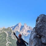
Gallery
Participants
You need to be logged in to see the participants
Weather
°
°
°
°
Description
The Tour du Mont Blanc is an iconic long-distance trek that circles the Mont Blanc massif, taking hikers through three countries: France, Italy, and Switzerland. This 10-day counterclockwise route offers a challenging yet rewarding adventure, covering approximately 170 km (106 miles) with a cumulative elevation gain of about 10,000 meters (32,800 feet). The trail winds through picturesque alpine meadows, past glaciers, and over high mountain passes, providing breathtaking views of Mont Blanc and surrounding peaks throughout the journey.
Beginning in Les Houches, France, the route traverses through charming mountain villages, dense forests, and rocky terrain. Highlights include the Italian Val Ferret, the Swiss Val Ferret, and the Fenêtre d'Arpette passage. Hikers will experience diverse landscapes, rich cultural heritage, and the warm hospitality of mountain refuges along the way. This classic trail offers a perfect blend of natural beauty, physical challenge, and cultural immersion, making it a must-do for avid hikers and outdoor enthusiasts.
I will add people to this event only by personal request.
Good to know
The plan is to start in Chamonix, France rather than Les Houches. So first day is Chamonix lift to Brevent and walking to Les Houches.
Last day accordingly - Brevent -> Lift to Chamonix.
It is still a thing to confirm though.
Getting to: Flight to Geneva -> Bus to Chamonix.
Plan with locations to stay:
Day 1: Les Houches to Les Contamines (Stage 1) (July 27, 2025)
o Garmin data: 21.7 km, 1,524 m gain, 1,310 m loss
o Difficulty: 8 out of 10
Day 2: Les Contamines to Les Chapieux (Stage 2)
o Garmin data: 18.8 km, 1,372 m gain, 1,006 m loss
o Difficulty: 7 out of 10
Day 3: Les Chapieux to Elisabetta (Stage 3)
o Garmin data: 14.5 km, 1,158 m gain, 518 m loss
o Difficulty: 4 out of 10
Day 4: Elisabetta to Courmayeur (Stage 4)
o Garmin data: 16.9 km, 670 m gain, 1,676 m loss
o Difficulty: 6 out of 10
Day 5: Courmayeur to Bonatti (Stage 5)
o Garmin data: 12.1 km, 1,067 m gain, 305 m loss
o Difficulty: 3 out of 10
Day 6: Bonatti to La Fouly (Stage 6)
o Garmin data: 20.9 km, 1,067 m gain, 1,463 m loss
o Difficulty: 5 out of 10
Day 7: La Fouly to Champex (Stage 7)
o Garmin data: 17.7 km, 610 m gain, 762 m loss
o Difficulty: 4 out of 10
Day 8: Champex to Le Peuty/Trient (Stage 8) via Variant
o Garmin data: 18 km, 1,311 m gain, 1,463 m loss
o Difficulty: 8 out of 10
Day 9: Le Puety/Trient to Lac Blanc (Stage 9 + 10.5)
o Garmin data: 19.8 km, 2,134 m gain, 1,128 m loss
o Difficulty: 9 out of 10
Day 10: Lac Blanc to Les Houches (Stage 10.5 + 11)
o Garmin data: 22.5 km, 975 m gain, 2,316 m loss
o Difficulty: 8 out of 10
We book our own accommodations. I can share the ones we booked, however it is your responsibility to obtain lodging. And i recommend starting in October to book for July-August.
Comments
Moti
1 year ago
could you please share the name of accommodations you booked please?? thank you in advance
0
|
0

Sergey Kurson
1 year ago
hi, Motahareh. https://docs.google.com/document/d/1-G39aaVqL1y3R0LbqA-nVEsDPufn3u9IxrCB3p7Vg34/edit. note that some of accommodations are already booked. we also value comfort over budget, so certain places might need to be adjusted if you have different preferences
0
|
0
Scarlet Phan
1 year ago
Hi, please add me to WhatsApp group, I texted you
0
|
0