Uploading...
Overall progress...
0%
File progress...
0%
Edit event: Pyramidenspitze (1,998m)
T4 - Pyramidenspitze (1,998m)
 Organized by:
Route
Durchholzen - Pyramidenspitze - Kufstein
| Elevation gain |
| Elevation loss |
| Distance |
| Duration |
| Highest altitude |
| Rating |
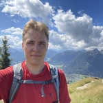
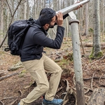
Gallery
Participants
You need to be logged in to see the participants
Weather
°
°
°
°
Description
*Copy pasted the description from Robert's hike last week. Thanks!*
We will meet at München Hbf (Gl. 10)
Public transport: We take RB 54 departing at 7:38 am from Munich Hbf at platform number 10, change in Kufstein to Bus 4030 (Richtung: Kössen Hüttwirt) to Walchsee Durchholzen.
Since Deutschalnd Ticket is valid only to Kufstein, we need to buy a bus ticket for the route from Kufstein to Walchsee Durchholzen (5.8 EUR). You can buy this ticket online at this website: https://tickets.vvt.at/de/ticket
For the way back, we will try to take a train RB 54 from Kufstein at 18:02 or 19:02.
Technical difficulty: The hike has difficulty T4. Please read the blog to understand the requirements for sac scale T4.
Pace: 400 hmph
Huts: We will have food/drinks at Vorderkaiserfeldenhütte. It might be late when we arrive at the hut, so please bring enough food/drinks for the whole day.
Good to know
Things to bring:
- Deutschland Ticket with ID card (UE) or passport (we are crossing boarder);
- cash for bus ticket and hut visit;
- hiking shoes;
- windproof and waterproof clothes;
- water (at least 2 l) and some food;
- sunscreen and sunglasses;
- DAV insurance;
- hiking poles;
- first aid kit;
- GPX file with downloaded route;
- good energy and stamina.
- Good mood as my friend Kipras says
Disclaimer: Hiking can be dangerous. I am not a mountain guide. Everybody is responsible for themselves. Please make yourself familiar with the route and its requirements. Additionally, you could download the map, bring a cell phone and a first aid kit.
Comments
Robert Piecyk
1 year ago
Hi there,
I'd like to offer a few recommendations for your hike. YOu can always text me, or see how we approach this peak on Strava: https://www.strava.com/activities/12703238695/overview. There are several routes to reach the top, but if you're aiming for a T4 difficulty level at most, there's a particular path I'd suggest. As you approach Grinnerkopf, near Karlkopf, instead of taking the right-hand trail, opt for the one that leads through the gorge. So you wouldn't approach Grinnerkopf in that case.
In general, just follow the pale red markings on the stones, and most importantly, take your time and enjoy!
Best,
Robert
0
|
0
Anmol Prakash
1 year ago
Hey!, Thanks for the recommendation. I will have a look at the strava link and reach out to you incase I need more info.
0
|
0