Uploading...
Overall progress...
0%
File progress...
0%
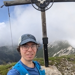
Edit event: Brecherspitz & Bodenschneid (Not T6)
T6 - Brecherspitz & Bodenschneid (Not T6)
 Organized by:
Route
Brecherspitz & Bodenschneid
| Elevation gain |
| Elevation loss |
| Distance |
| Duration |
| Highest altitude |
| Rating |
Gallery
Participants
You need to be logged in to see the participants
Weather
°
°
°
°
Description
Hey everyone,
I couldn't really hike
last weekend, so I am trying to catch up by doing this hike🙂
The weather forecast
for Wednesday seems ok, mainly sunny with some clouds.
You can check the
webcam here:
From the Videos I have
watched, to me, the path seems T4 at most. However, I might be wrong so you
join at your own risk.
I intend to keep a
speed of 500hm/hour and I would like to walk as a group. Before joining,
please, make sure you are comfortable walking at this pace.
Depending on how many
people join the hike, I might create a WhatsApp group and post the link as a
comment the evening before the event.
Please bring a head
lamp, food and drinks for the whole day.
This is my first event in HB as an organizer. Forgive me for any logistic issue 🙂
EDIT:
Following the comment of Imre (thanks🙂), I slightly changed the path to avoid the potentially path-less section at the beginning. I haven't changed the route on HB, as this one below is just a proposal. If someone else joins me, we can decide together which way to take.

Good to know
We will take the train
to Fischhausen-Neuhaus BRB RB55 from Hauptbahnof at 7:03, platform
33.
Disclaimer: By joining
this hike, you are responsible for your own safety and must familiarize
yourself with the route and its requirements. I recommend downloading a map and
bringing a cell phone and first aid kit in case of emergencies.
Comments
Imre Vadász
1 year ago
Just a warning, that route is probably not what it seems like: That route uses an unofficial and partly pathless ascent along the ridge at the beginning (where the section is labeled as T6). I would strongly advise against taking that path, especially if it's your first time organizing. It contains some pathless exposed sections with scrambling, with very steep terrain. You should instead take the signed out hiking route from Neubaus first, and then later turn west up to the ridge (where the standard route to Brecherspitz goes east).
Your route also contains the Eastern ridge ascent to Brecherspitz which is correctly labeled as T4, but is also not an official hiking trail. That may be fine if you are careful, but it's strongly advised not to take that trail downhill, because it's so steep on loose forest ground.
5
|
0
Imre Vadász
1 year ago
The section along the ridge from the "Wasserspitz" peak to "Rinnerspitz" and "Bodenschneid" is also a bit more adventurous. You should add some time, but if it's dry and you have time, it's fine if you have some experience and time (there are some spots where you need to be a bit careful finding the correct route along the overgrown ridge). That whole route is altogether a great adventure, but a few sections can be quite problematic depending on experience and conditions of the day. And it might be a very long day, despite not appearing that long, because of all the steep sections.
That's a great area to go for a Hike, I hope you'll have great weather 😊. I just felt compelled to comment, because it's definitely not obvious in this case which trails/routes are easier and which ones are more dangerous and exposed.
Stay safe but have fun,
Imre
5
|
0

Alessandro Urso
1 year ago
Hi Imre, thanks for your valuable comments. I might adjust the route accordingly 🙂
1
|
0