Uploading...
Overall progress...
0%
File progress...
0%
Edit event: Winter hike to Laubenstein and Hochries from Aschau
T3 - Winter hike to Laubenstein and Hochries from Aschau
 Organized by:
Route
Winter hike to Laubenstein and Hochries from Aschau
| Elevation gain |
| Elevation loss |
| Distance |
| Duration |
| Highest altitude |
| Rating |
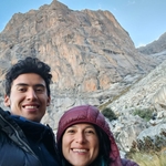
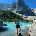
Gallery
Participants
You need to be logged in to see the participants
Weather
°
°
°
°
Description
What do you need to take part to this hike.
1) enough fitness
2) please bring cash (many huts don´t accept card)
3) Team spirit. So put always an eye to the group and no gaps in the group please.
4) Motivation to join the event. At latest you can unjoin event 12 hours before. Thanks for understanding.
5) please be punctual. It is important to not start late!
South of the Bavarian town of Rosenheim on the northern rim of Chiemgau Alps lies a small mountain world of its own: the Hochries subrange that goes from Germany till Austria.
From Aschau station in Chiemgau, we take the Bahnhofstraße to the north, and at the roundabout over the Prien bridge. Then immediately head into Kirchstraße, where you come to the imposing Residenz Heinz Winkler, the hotel of the famous Michelin-starred chef after the church. Before the meadow, turn right into Schützenstraße, which after the kindergartens becomes a dirt road. Follow this over the meadow slope. Here we can enjoy a nice view of Aschau and the Kampenwand behind it. One section further branches off an inconspicuous path immediately after a wooden scale. This guides you along the edge of the forest, sometimes swampy meadow. In the forest, the hiking trail gets better, crosses an alpine meadow, and then meets a wide hiking trail. In some hairpin bends, it winds itself up through the beautiful beech forest to the Hofalm. Our first summit, the Laubenstein, can be seen directly above the alpine pasture. From the Hofalm on the gravel road to the first bend, and continue straight ahead on the meadow path. Shortly before the trail hits the road again, a beautiful forest path branches off at the top on the left. This rises slowly higher on the slope (blue dots), and then ends up with an upswing in a meadow. Walking straight across the meadow, the path soon becomes a forest road, from which a hiking trail branches off in the curve. Turn left here! Next to a mossy small waterfall you climb out of the kettle, to the alpine meadows of the Laubensteinalm. To the right above the alpine pasture, the path runs over the Wiesenkuppe to the summit cross of the Laubenstein (1,350 m). From this flat grass peak you have a magnificent view over the Chiemgau, the Chiemsee and the Chiemgau mountains. Lauenstein not only has a beautiful view, but also an exciting interior. It is crossed by numerous cave systems that you can even enter in summer time. Maybe we can get a look to some of them from outside at least on our way :). One of these caves was discovered in 1996 by A. Hofman in the Laubenstein area (Chiemgau / Bavarian Alps) and contained mainly remains of Ursus spelaeus and Ursus arctos. It is the first alpine cave bear bearing cave in Germany. A test pit was dug and numerous special analyses, for example paleo-DNA, collagen isotopy and absolute datings, were done on the bones. The collagen isotopy confirms the results of other research groups. The datations place the brown bear oocupation of the cave in the alleröd and at the end of the late Dryas as well as in the Würm (>50.000 years).
We then proceed south west to the second summit of the day: the Hochries.
Between
the Laubensteinalmen the path lead to a sign tree on an old stone wall.
Here you continue to the left. The small high stairs on the lower left
is called eiskeller. It is always colder here than the surrounding
aarea. This is why plants are
growing here, which would otherwise only grow thousands of metres higher
interestingly in summertime.
The wide hiking
trail winds beautifully and comfortably through a bright magical forest
below the Spielberg. The ascent to Hochries branches off to the right of
the Almweg. The nice
hiking trail begins with a pleasant climb, and then slowly climbs
steeper, up to the back of the Hochries.
Keeping
on the left, the path then
meets the wider Wigg-Reiter standing from the giant alm. Soon the
buildings of the Hochries summit come into view, especially the
transmission masts and the mountain station of the cable car. Passing
the left you will get to the summit cross. It stands directly in front
of the Hochrieshütte. A fantastic panorama spreads around towards
Chiemsee, Kampenwand, Berchtesgadener Alps, the south over the Wilder
Kaiser Mountains to the snowy peaks of the Central Alps and even the
Großglockner
I
am not a professional guide, hiking can be risky. Everybody is
responsible for him/herself and must familiarize with the route and its
requirements.
In case of problems the hike day you can contact me at 017643285424.
Looking forward to see you!! 😊
Good to know
Waterproof hiking boots
Cash to pay the hütte
Food/drinks for the way
Flashlight
Gaiters and snow spikes
Comments
Sebastian Augusto Ojeda Franco
1 year ago
hello Marco, can I still join? there are no spots.
2
|
1
Raul Fab
1 year ago
Can I Join also?
1
|
1

Marco Mecarozzi
1 year ago
Looking forward to spend a beautiful day together in nature, finally away from grey in the city! :) It should be considerably warmer https://www.bergfex.de/sommer/aschau-im-chiemgau/wetter/
3
|
0
Emma Constantin
1 year ago
😍 looking forward to it as well!
1
|
0
Marco Mecarozzi
1 year ago
Please notice we are meeting in Ostbahnhof. See you 🤗
5
|
0
Thomas T.
1 year ago
Whatsapp group for pictures https://chat.whatsapp.com/FnJMVRQ0Qn61oqGzZhVGqO
0
|
0