Uploading...
Overall progress...
0%
File progress...
0%
Edit event: Winter hike to Schwarzer Berg: the panoramic balcony of Tennengau
T2 - Winter hike to Schwarzer Berg: the panoramic balcony of Tennengau
 Organized by:
Route
Winter hike to Schwarzer Berg: the panoramic balcony of Tennengau
| Elevation gain |
| Elevation loss |
| Distance |
| Duration |
| Highest altitude |
| Rating |
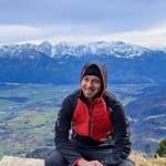
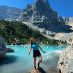
Gallery
Participants
You need to be logged in to see the participants
Weather
°
°
°
°
Description
What do you need to take part to this hike.
1) enough fitness
2) please bring cash (many huts don´t accept card)
3) Team spirit. So put always an eye to the group and no gaps in the group please.
4) Motivation to join the event. At latest you can unjoin event 12 hours before. Thanks for understanding.
5) please be punctual. Train couild be packed and would be nice to sit together!
This Saturday weather looks good! Let´s go for winter hike to an area where we don´t go very often! Salzburgerland!
We will be hiking the Schwarzer Berg. A great circular tour through valleys, plateaus and a
lovely mountain hut. Many great views await us along the way. We start
the tour at Golling station. We follow the Möslstraße uphill and out of
the village till Egelsee. At the first crossroads we come to a signpost
and from here follow the signs for "Ghf Bachrain". Follow the Bründlweg
past a few houses. After 600 metres, we turn left and walk through a
wooded area. At the next crossroads, continue straight on past a
residential building. Behind it begins a meadow path that takes us up to
the St. Anton inn. We keep left behind the inn and follow the road for
500 metres. At the crossroads near the houses and the Gotschenbrücke
bridge, we turn right. We now follow the road and later a forest path for 1.7 kilometres
and then turn left. We continue uphill along a forest track. Passing a
wooden hut, we reach a pasture where we have to turn left. The path now
leads us into the forest and 200 metres after the forest entrance we
turn left onto a steep path. We still follow the signs for "Ghf
Bachrain". At the top, we come to a road and walk a good kilometre to
the right to the Bachrain Alm.
From the Gasthof
Bachrain, the yellow signposted path goes up to the mountain pasture.
Then, after about 15 minutes, a signposted and marked path begins, which
crosses a forest road several times in the forest. A short cart track
section follows, then a wide, marked path. This leads in steep and
sometimes rocky serpentines, partly under trees, partly on a very sunny
clearing, in about another 1.5 hours to a clearing. Here it becomes a
little flatter and it takes about 15 minutes through grass up to the
summit cross. One of the best panoramic points of Tennengebirge
mountains.
The most striking
mountains are the Dachstein (2,995
m) with the Bischofsmütze on the left and the karst plateau of the
Tennengebirge on the right, which is on display here with its broad side
(plateau height approx. 2,000 m, peaks approx. 2,500), the Hochkönig
and the Hoher Göll, just to name a few famous mountains in the area.
When visibility
is good, the Schwarzer Berg offers a view far into the Salzach Valley,
towards Salzburg and even Bavaria and Chiemsee.
We
return along the same path for another kilometre and after another 200
metres we turn right onto a meadow path. We now follow the signposts
"Ghf Hochreit Via the meadow path and later a path, we reach the
Hochreith Alm at the highest point of the tour, where we can also enjoy a
snack. We now head downhill again on the access road and follow
the signs for "Golling". Transports:
München Ost - Salzburg HBF
Gleis 7
BRB RE5 (79007)
S3
I
am not a professional guide, hiking can be risky. Everybody is
responsible for him/herself and must familiarize with the route and its
requirements.
In case of problems the hike day you can contact me at 017643285424.
Looking forward to see you!! 😊
Good to know
Waterproof hiking boots
Cash to pay the hütte and the Einfach Raus Ticket (about 10 EUR)
Food/drinks for the way
Gaiters and snow spikes
flashlight
Comments
Arrigo
1 year ago
Hi Marco! Do we need to get a separate ticket from Salzburg to Grilling Abtenau?
0
|
0

Marco Mecarozzi
1 year ago
Yes. As I wrote in instructions, we are not covered in Austria and the cheapest option should be einfach raus ticket (we could buy two tickets for 5 for example) that we can buy tomorrow either online or at the machines.
1
|
0
Raul Fab
1 year ago
Sorry , Im with Grippe.
0
|
0
Marco Mecarozzi
1 year ago
Get better soon Raul
0
|
0
Marco Mecarozzi
1 year ago
Dear buddies, I had a stupid accident at home a few days ago and seems the thing is more serious than I thought. It doesn't feel wise to me to hike today after the acute pain I felt at my foot. Thomas T will take care of you, guys. Enjoy for me too, take many photos and see you soon
1
|
0
Emma Constantin
1 year ago
Get well soon! I hope it's nothing too serious.
1
|
0
Marco Mecarozzi
1 year ago
Grazie mille!!! :)
0
|
0
Thomas T.
1 year ago
Chat for the hike https://chat.whatsapp.com/KuvdYgdrPHSJttRuq1foVC
0
|
0