Uploading...
Overall progress...
0%
File progress...
0%
Edit event: From Wangenitztal to Hoher Perschitzkopf to Gradental: Journey Through Hidden Lakes and Rugged Peak
T4 - From Wangenitztal to Hoher Perschitzkopf to Gradental: Journey Through Hidden Lakes and Rugged Peak
16Aug
Sat
09:30
Gartlwasserfall Parkplatz, Sagritz, 9843 Winkl, Austria
 Organized by:
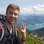
Marco Mecarozzi
Organized by:
Marco Mecarozzi
Route
From Wangenitztal to Hoher Perschitzkopf to Gradental: Journey Through Hidden Lakes and Rugged Peak
| Elevation gain |
| Elevation loss |
| Distance |
| Duration |
| Highest altitude |
| Rating |
Gallery
Participants
You need to be logged in to see the participants
Weather
°
°
°
°
Description
This is a two day hike with overnight sleep in Wangenitzseehštte ( https://www.alpenverein.at/lienz/huetten/wangenitzseehuette.php ). Please read carefully instructions for the hike and don´t just click on coming.
CARPOOL
Schedule: Hike starts at 9,30 am.
Drivers: add your car in carpool and put meeting point and time for it.
Passengers: Click on Carpool button. Read carefully all information about the car you join, check if there are any specific instructions. All the costs for the trip will be shared with people in the same car. Meeting point is decided by the driver, this information is in the "Carpool" button.
Instructions for the hike
Everyone is responsible for his/her own booking https://www.alpenverein.at/wangenitzseehuette/reservierung.php . I will just take care of the routes and leading the group. We go towards summer, so if you are interested, book as soon as possible. I booked for myself a bed in mehrbettzimmer. You can do the same and you will pay 20 euro if you are DAV member (strongly recommended). If you want to save money you can also reserve in matratzenlager for 15 euro. At the current time there are enough beds in rooms to sleep with enough comfort. 40 euro is the cost if you want dinner (three courses, also vegan available) and a good breakfast before the second day. Travelling costs will be shared in each car. Extra any food or drink you will buy along those two days. Hiking can be a dangerous activity. Everyone is responsible for him/herself. I am not a professional guide.
Once booked please confirm with a message to me. Just clicking on partecipating is not enough. Who has never hiked with me please send me a PM.
My telephone Number for the two days hike is +4917643285424.
Hike Description
This breathtaking alpine hike will take you through the heart of the Schober Group in the Austrian Alps, offering stunning views, crystal-clear mountain lakes, and a rewarding summit experience.
These rugged peaks were shaped by glacial activity over millions of years, creating the dramatic landscapes seen today. The region has a long history of human activity, from early shepherds who used the high alpine pastures for grazing to miners who searched for valuable minerals such as copper and iron in the Middle Ages.
The Schober group lies south of Grossglockner group in the Hohe Tauern and is considerably lower, so also covered with less glaciers. Still, 53 peaks exceed 3000 m, some of them are very beautiful and attractive for mountaineering. Only few mountains have easy ascents, many main mountains demand climbing skills in loose but exposed rocks and are not climbed often. The majority of the mountain range is already in East Tyrol, the eastern part still belongs to the federal state of Carinthia. Besides some nice summits an attraction are also some high area with mountain lakes, like Wangenitzsseen, Großer Gradensee, Neualpseen and more.
Our adventure begins in the
scenic Wangenitztal valley, where lush alpine meadows and cascading
streams accompany the ascent. The trail starts quite simply and leads
first through the alpine
landscape of Mörtschach. The scenery is becoming increasingly impressive
till you
will reach a lake plateau that will take your breath away at an
altitude of over
2,500m with the Wangenitzsee - the largest mountain lake in Carinthia,
and the adjacent Kreuzsee, perfectly lined up! The trail follows a
steady incline, winding through rocky paths and past small waterfalls
before reaching the Wangenitzsee Hut (2,508 m).
Wangenitzsee is located at 2,465 meters above sea level, is 700 metres long and a maximum of 350 metres wide. Kreuzsee is located at 2,483 metres above sea level, is 370 metres long and a maximum of 380 metres wide.
The Wangenitzsee Hut itself has served as a base for mountaineers and explorers since the early 20th century, when alpinism became increasingly popular in Austria. The area was also part of historic trade and migration routes, with locals navigating the mountains to connect with nearby valleys. Even during World War II, the remote mountains served as a refuge for resistance fighters and smugglers avoiding detection. Today, the region is protected within the Hohe Tauern National Park, preserving its natural beauty and historical significance.
At the end of the fist day we will be relaxing at the lakes and then having dinner and a lovely evening altogether at the hut.
The second day after breakfast, we start early our summit hunt. The hike begins at Wangenitzseehütte, Behind it you climb on the path no. 918 towards Kreuzseescharte. Shortly before
the number, a signpost points to the right to the summit of the Hoher
Perschitzkopf. The trail ascends steeply towards the Perschitzscharte (2,900 m), a high mountain pass that serves as a gateway to the Hoher Perschitzkopf.
The ascent is rugged and demanding, crossing scree fields and rocky
terrain, with occasional sections requiring careful footing. Along the
way, you’ll pass smaller alpine lakes, shimmering in deep blue and
reflecting the towering peaks around them. These glacial lakes add to
the breathtaking scenery and provide perfect spots for short breaks.
From Perschitzscharte, the final push to the summit involves a mix of steep rocky slopes and light scrambling. This section is partially exposed, requiring surefootedness and caution, but the reward is worth it. Reaching the Hoher Perschitzkopf, you are greeted with a 360° panoramic view of the Hohe Tauern. On clear days, you can see the Großglockner (3,798 m), the highest peak in Austria, as well as the wild and remote valleys of the Schober Group. The view stretches down to the Gradental Valley, your potential next destination and sometimes even the Dolomites and for sure the shimmering Wangenitzsee and Grandsee! Hoher Perschitzkopf not only offers one of the best vantage points in the region but it’s also mostly a hidden gem for hikers and mountaineers seeking solitude and unspoiled alpine panoramas.
We hike down back to the main trail. From here, the trail ascends towards the Niederer Seescharte (2,702 m), a rugged mountain pass that offers spectacular views back toward Wangenitzsee and forward into the Gradental Valley. Descending from the pass, the landscape becomes rockier as the trail winds through the remote Leitenkar Basin, surrounded by jagged peaks. A short but steep climb leads to the Adolf Nossberger Hütte (2,488 m), perched near the shimmering Gradensee. The Adolf Nossberger Hütte was named after an Austrian mountaineering pioneer and has been a key base for climbers in the Schober Group. and is a perfect stop for a break, that is needed during the long descent.
After leaving Adolf Nossberger Hütte, the trail follows a steady descent along Gradensee, one of the most beautiful alpine lakes in the region. The lake’s deep blue waters reflect the surrounding peaks, creating a postcard-worthy scene.
Continuing further, the path follows the Gradentalbach stream as it meanders through rocky terrain. Along the way, you will encounter Mittersee (2,230 m), another hidden gem nestled within the valley. Smaller than Gradensee but incredibly peaceful, offering a secluded spot away from crowds, is Situated at 2,230 meters, surrounded by soft meadows and rocky ridges.
According to local legend, a young shepherd once fell in love with a mountain nymph who lived in Mittersee. She warned him never to return after sunset, but his love was too strong, and he came back one evening. As punishment, the nymph turned him into a stone, which can still be seen as a large boulder near the lake’s shore.
A white chamois is said to roam the valley, only appearing to those with pure hearts. If you see it, legend says you will be blessed with safe travels and good fortune in the mountains. However, those who try to hunt it will face misfortune.
From Mittersee, the trail gradually descends further into the Gradental Valley, transitioning from rocky high-alpine terrain to lush green meadows. The Gradentalbach stream grows wider, and you’ll pass remnants of ancient shepherd huts and grazing lands that have been used for centuries. The Gradental Valley was historically part of old trade and smuggling routes, where goods such as salt, wool, and cheese were exchanged between valleys.
As you descend, the valley widens into a breathtaking U-shaped glacial valley, flanked by towering peaks such as Leitenkopf (2,846 m) and Weisse Wand (2,758 m) where you can spot golden eagles, ibexes, marmots, and rare alpine flowers thanks to its incredible biodiversity. The final stretch of the hike leads through scattered larch forests and alpine pastures before reaching the Gradental Valley trailhead, where the journey concludes.
More info about weather conditions, state of the paths I will give when we get closer to the event.
I wish you all a lovely day! :)
Good to know
Sleeping bag
Waterproof hiking boots
Rain jacket
Cash for the ride and to pay the hütte
Food/drinks for the way
Snow spikes
Flashlight
Comments

Charlie Harding
1 year ago
Is 6:50 early enough? I see a journey time of 3h20, which would be almost 45m after the meeting time.
1
|
0

Marco Mecarozzi
11 months ago
Hi Charlie. I think 3 hours 20 minutes Is probably overestimated but yes I think starting at least at 6,30 from Munich would be a Better idea.
0
|
0
Marco Mecarozzi
11 months ago
Hallo everyone, After First resevation you must have received an email asking for 10 Euro and the Iban to whom send It. Please dont forget to pay or your reservation would not be confirmed.
1
|
0
Marco Mecarozzi
7 months ago
We are looking for a driver. Please contact me before joining me if you are interested.
0
|
0
Marco Mecarozzi
7 months ago
To anybody in the hike too. Three persons are without a car at the Moment since Raul cannot join anymore. Please if you know a driver interested in the hike let me know. I have a bed reserved for the driver. We have still time but Better to find Someone as soon as possible
1
|
0
Miroslav Fecko
7 months ago
Hi, I am not sure, if I have a seat in a car. Did we find a replacement driver in the meantime?
0
|
0
Marco Mecarozzi
7 months ago
Hi Miroslav. Maybe my message didnt get you. Unfortunately you dont have a Seat, plus the hut has no beds anymore since long. I Just checked It again.
0
|
0
Miroslav Fecko
7 months ago
ok, thank you for the information
0
|
0