Uploading...
Overall progress...
0%
File progress...
0%
Edit event: Franconian Switzerland (Bayern) caves and castle loop. Echoes of stone and time
T1 - Franconian Switzerland (Bayern) caves and castle loop. Echoes of stone and time
 Organized by:
Route
Franconian Switzerland caves and castle loop. Echoes of stone and time
| Elevation gain |
| Elevation loss |
| Distance |
| Duration |
| Highest altitude |
| Rating |
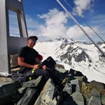
Gallery
Participants
You need to be logged in to see the participants
Weather
°
°
°
°
Description
What do you need to take part to this hike.
1) enough fitness
2) please bring cash (many huts don´t accept card)
3) Team spirit. So put always an eye to the group and no gaps in the group please (very important in such type of trail).
4) Motivation to join the event. At latest you can unjoin event 12 hours before. Thanks for understanding.
5) please be punctual. Train could be packed and would be nice to sit together!
A hike with a lot of hidden gems to search through the
forest. Castles, ruines, caves and many strangely shaped stones! The
climbs are always moderate, and
the paths are mostly well-maintained and signed but still being a trail
that goes often through forest and caves, you need to follow it with
attention. And off the trail we can go often for a quick on-top
adventure, there are several caves to try to explore at least partially.
I have been many
years ago several times to this beautiful region of Bayern known as
Franconian Switzerland and organized also a few hikes there in HB. lets go to Pegnitz river Valley. Our starting and
ending point is in Velden, right on the banks of the Pegnitz.
From
Velden Bahnhof we catch a panoramaweg trail till we reach a picturesque
wooden bridge that takes you to the other side of the river Pegnitz.
Turn right, past the overhanging rocks of the climbing wall known as "The Beach" in Velden to a spot
where you have a beautiful view of the cheerfully gurgling water wheel
of the watermill, a wild romantic view.
Back towards the bridge and a
little further until a stone staircase leads you up, first to the war
memorial flanked by iron crosses, and then, over an iron footbridge, to
the edge of the rock face. Up here, the path
continues to the right along a magnificent climb, always directly along
the edge of The Beach.
Shortly
after this beautiful viewpoint, turn sharply left at the yellow dot and
continue up the slope via a forest staircase. This hiking sign will
accompany you for quite a while.
It leads you past a
pasture and a tennis court, then along a plateau amidst expansive
meadows, until the path leads past a massive rock—turn around after
passing it so you can admire it in all its glory—down into the Kipfen
Valley, which appears particularly dark through the dense forest.
As
you emerge from the Kipfen Valley forest, turn right at the red circle
onto the gravel path. It leads you in a serpentine fashion past several
rock formations, many of which are worth a second look.
Then
your path branches off to the left at the red circle onto a track that
is densely overgrown for the first few meters. Don't worry, after a few
steps the vegetation thins out and you'll walk up a narrow path until
you reach the gravel road again. Alternatively, you can simply continue
along the gravel road. Now you'll hike over to Münzinghof. First, you'll
walk through lush meadows, then through an avenue of chestnut trees. In
the village, turn right at the bus stop, leave the village, and walk to
the edge of the forest.
Follow the "Red Circle"
hiking trail sign into the forest. Behind a forest meadow, turn left.
About 200 meters later, your hiking trail sign points you from the main
trail onto a path to the right. Past a small pond, at a fork in the path
to the right, you soon reach a wooden seating area and, to the left of
it, almost inconspicuous at first, the entrance to the Geisloch Cave.
We
will try to explore at least a small part of it carefully, otherwise we
will have other interesting caves in the way, maybe not as beautiful as
this one but easier to explore. Normally you would descend the stone
steps into the crevice carefully. It gets
cooler inside usually. Now it's time to unpack your jackets and lamps,
take care not hitting with your head, and step into the darkness.
After
just a few meters, you'll be enveloped in deep black. Turn on your lamps
and marvel. To the right and left, shafts lead a short distance down
before abruptly ending. Above you, the cave sky opens up, revealing
fans, sails, and small stalactites.
Your path leads
you slightly left, between rocks, up a short distance on clay soil into
the second chamber. To your right are some beautifully formed sinter
pools, creating the impression of an irrigated lunar landscape. Behind
them, the water of a small cave pool shimmers in the light of the lamps. A
narrow passage leads you straight ahead into the third chamber of the
Geisloch Cave. the cave lake, divided by a natural bridge. And
on the walls, on the ceiling, and in the chambers at the far end of the
lake are wonderful limestone and rock formations.
After the Geisloch, we retrace our
steps back to the main trail, which soon changes direction with a very sharp
left turn onto the gravel road.
At the edge of the
forest, follow the yellow cross/green line to the right. Soon, we go
straight into the forest, climb a short distance, and past the Hohle
Fels (Hollow Rock). This is where the Ankatal Valley (also called
Ankertal) begins.
We follow the gravel path. If you can already see the road ahead, keep
looking up to the left. There, between all the trees, you'll see the
large cave entrance of the Michelhöhle (St. Michel Cave). Two unmarked
paths lead you through the dense bushes up to
the cave. There, you'll be greeted by a large cave from which you can
enjoy a good view down into the valley. The special thing about the
Michelhöhle (St. Michel Cave) is the enormous overhang of its portal.
From
the cave, descend back to the gravel path, walk to the road, cross it,
and take the meadow path marked with the green line on the opposite
side. The Ankatal Valley reveals its pleasant side here: Dense meadows,
garnished with many colorful flowers.
Then
you walk past interesting rock formations into the forest. Keep to the
right. Soon, signs announce the nearby St. Andrew's Church, to which a
path branches off after a few meters.
This cave is
captivating due to the nature of the rock. Somehow, the walls appear as
if they were carved by human hands. To the right,
there's a slender, church-like cave window to marvel at. To the top
left, a chasm through which all sorts of rocks seem to have entered the
interior.
Then
we return to the path and continu hiking, deep into the Anka
Valley. The rocks on the sides become higher and higher and very inspiring.
Up on the slope, you can see
enormous rock formations! The valley becomes narrower. The slopes higher. Then
it opens up, but only briefly, before bidding you farewell once again
with a furious rocky ending at the exit in Rupprechtstegen. The
fascinating Ankatalwand forms the end of the Ankatal valley and leads
you into the Pegnitz Valley, that we get to admire from a ver nice vantage point. The
climbing walls that tower into the sky, often hidden on the slopes in
the forest and only easily visible and explored from the footpath. The
water feature of the Pegnitz River, which has carved its way through the
landscape over millennia.
We keep hiking
direction east till we reach the idyllic village of Hartenstein. Here we
could stop fpr a break at restaurant inside the burg Hartenstein that
should be very lovely.
So from the center of Hartenstein, we take the road up towards Grünreuth to the
southeast and soon reach trail marker no. 4 to the Hirtenberg. A little
later, it leads left up into the forest; high above us, we see the
summit cross. A gentle climb follows to a bend with a beautiful view of a
jagged rock formation. Here, the path turns sharply left and leads up
steps, then over the ridge to the rocky summit: the view of the town and
Hartenstein Castle and the mountain ridges from Hohenstein Castle to
the Fichtel Mountains is magnificent.
Returning
to the bend, we turn left onto an unmarked trail that initially
descends gently, then level off as it traverses a rocky slope. At the
junction with a forest road, we keep left and soon come across the
redpoint, green cross, and blue line trails: they lead us past several
Stations of the Cross, then left, past the imposing Rabesberger Wand,
and steeply up to the Frauenberg Chapel. After a gentle descent, the
path forks: we turn right here, following several markers. Just 10
meters later, the redpoint and trail no. 5 lead right again, descending
more steeply, finally onto a forest path into a small valley. To the
right, we can see the imposing rock massif in which the Hainkirche
church is hidden. Shortly after two trees on the left and right, each
bearing both markers, we find the ascent route: clear trail marks lead
right into the forest, then, keeping left, through the slope, and
finally up in switchbacks to the massif. Finally, you reach the first
cave chamber along the left wall and over a rocky ledge in the steep
slope. A unique structure opens up before us: a
40-meter-long gallery cave with seven entrances, divided by low rock
arches, and side chambers containing sinter decorations.
Soon
we turn right onto a gravel path, where the marker of the Great Cave
Circular Trail (Bear) occasionally appears. Soon we ascend a narrow path to the Petershöhle massif, whose imposing
northern cliffs dominate the scenery. Finally, a path branches off to
the left and leads steeply up the slope, then again to the left to a
saddle below which lies the basin with the cave entrance. Rocky steps
lead us down the left flank to the cave. The main chamber and the upper
level branching off to the left are among the most beautiful cave rooms
in the Alb.
Returning
to the saddle, we descend a short distance and then turn left onto the
Blaupunkt Trail. It leads past bizarre rock formations with small caves,
then descends steeply to the right into the valley. There, we turn
right onto the descending track and follow it till another
forest road crosses, we go left, but after just a few meters, we turn
right onto a path that climbs steeply to the Gotthardsberg massif.
Following faint trail traces, we reach wildly jagged rocks in
switchbacks and, turning right, the final major highlight: we ascend
through the fantastically shaped passageway of the Gotthard Church, or
Witches' Kitchen. From the top, we climb left to the heights and then
follow a clear path over the ridge to the west. A forest road leads us
down to the Grünstrich hiking trail and turns left onto it. We pass the
rocks of the Schollberg and soon reach the edge of Hartenstein. From
here, we walk down till Velden station where our long hike ends.
I
am not a professional guide, hiking can be risky. Everybody is
responsible for him/herself and must familiarize with the route and its
requirements.
In case of problems the hike day you can contact me at 017643285424.
Looking forward to see you!! 😊
Good to know
Flashlight
Waterproof hiking shoes
Cash
Food/drinks for the way
Comments

Muralidharan Jagannathan
11 months ago
macro … you can never have only 10ppl in your hikes … 😂
1
|
0

Marco Mecarozzi
11 months ago
Just extended to 15. But that Will be the max 😅
1
|
0
Marco Mecarozzi
11 months ago
Hallo everyone. Please if you are unsure or not coming anymore, update your status max tomorow morning since there are many people in waiting list. Thanks for understanding.
1
|
0
Marco Mecarozzi
11 months ago
Hallo everybody! Weather looks pretty Good tomorrow in Franconia! 🌞 Looking forward to see you! Please try be punctual. Max 6,55 we go and sit on the train. Train Will leave at 7,05. https://www.wetteronline.de/wetter/neuhaus-bayern
2
|
0
Mario Kodsi
11 months ago
Hey Marco, I'll catch the train from Ingolstadt Nord at 8.
1
|
0
Marco Mecarozzi
11 months ago
See you tomorrow then in the train. Please write me a message on WhatsApp so I can tell wher we are sitting more or less 😅
0
|
0

Philip ISCHEBECK
11 months ago
Hi guys, Im sadly not gonna make it. @marco can you remove me, so someone from the waiting list can go? 🙏
1
|
0
Marco Mecarozzi
11 months ago
Murali, next on the list Is taking your place
1
|
0