Uploading...
Overall progress...
0%
File progress...
0%
Edit event: [CH] Grosser Mythen (from Brunni) - Slow pace
T3 - [CH] Grosser Mythen (from Brunni) - Slow pace
 Organized by:
Route
Gross Mythen (from Brunni)
| Elevation gain |
| Elevation loss |
| Distance |
| Duration |
| Highest altitude |
| Rating |
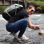
Gallery
Participants
You need to be logged in to see the participants
Weather
°
°
°
°
Description
We already tried two weeks ago, we will try again!
Meeting point
Brunni SZ, Talstation LBH
https://maps.app.goo.gl/5g4h8TpS6dZa2Z7NA
Public transport from Zurich
08:43 Zurcih HB: S25 direction Linthal
09:10 Wadenswil: S13 direction Einsiedeln
09:37 Einsiedeln Bahnhof: B 554 direction Brunni
09:56 Arrive at the starting point
Hike Details
This is a challenging hike with a long segment of technical, difficult terrain (exposed and rocky). Prior experience with hiking is required. There is a cable car from Brunni, but we are not planning to use it.
Elevation gain: 700m.
Pace
This is a slow pace hike. (Slow Pace means 300/350m vertical ascent per hour)
Food
We will have lunch at the top. Pack your own food.
Gear
Please come with proper hiking gear, including:
- Hiking boots with a good grip
- Multiple layers of clothes
- Sun protection (inc. sunglasses and hat)
- Min 1.5 l of water
Weather
Forecast for now is that it will be sunny.
Whatsapp group
https://chat.whatsapp.com/CjzrymV5Ti5F90rOzqXYbN
Safety notices
I am not a professional guide. Everybody is responsible for him/herself. Make yourself familiar with the route and its requirements.
Comments
Hanna Kollo
10 months ago
Whatsapp group for coordination: https://chat.whatsapp.com/CjzrymV5Ti5F90rOzqXYbN
0
|
0