Uploading...
Overall progress...
0%
File progress...
0%
Edit event: Gries Ernst Riml Spitz Bachfallenferner
T4 - Gries Ernst Riml Spitz Bachfallenferner
28Jun
Sat
09:30
Parkplatz Winnebachseehütte (https://g.co/kgs/AX4dLMj) Gries 22,6444, Austria
 Organized by:
Marco Mecarozzi
Organized by:
Marco Mecarozzi
Route
Gries Ernst Riml Spitz Bachfallenferner
| Elevation gain |
| Elevation loss |
| Distance |
| Duration |
| Highest altitude |
| Rating |
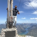
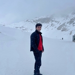
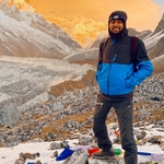
Gallery
Participants
You need to be logged in to see the participants
Weather
°
°
°
°
Description
This is a carpool hike. Please read carefully instructions for the hike and don´t just click on coming.
CARPOOL
Schedule: Hike starts at 9,30 am.
Drivers: add your car in carpool and put meeting point and time for it.
Passengers: Click on Carpool button. Read carefully all information about the car you join, check if there are any specific instructions. All the costs for the trip will be shared with people in the same car. Meeting point is decided by the driver, this information is in the "Carpool" button. (please join the hike only joining a car)
What do you need to take part to this hike.
1) enough fitness
2) please bring cash (many huts don´t accept card)
3) Team spirit. So put always an eye to the group and no gaps in the group please.
4) Motivation to join the event. At latest you can unjoin event 12 hours before. Thanks for understanding.
5) please be punctual. Train couild be packed and would be nice to sit together!
Dear buddies, planning a bit in advance this time this hike in Ötztal!
A short but very charming mountain hike leading to the Winnebachseehütte, nestled in the picturesque landscape of
the Ötztal Valley. The hike through tranquil nature, leading to the
Winnebachseehütte, idyllically situated on Lake Winnebach, is a unique
experience. The Ernst-Riml-Spitze, a modest elevation east of the hut,
proves to be a jewel of peace and seclusion. Despite its proximity to
the hut and its low elevation, this summit offers a majestic view of the
entire Winnebachtal Valley, especially the imposing Gänsekragenspitze
and the mighty summit of the Breiten Grieskogel.
From the hut parking
lot at the upper end of Gries, we first head back a few metres towards the village and then follow the ascending asphalt road to the hamlet of Winnebach, 1692 metres , which you reach after just 10 minutes. follow the road to Winnebach (1691 m), passing between the cluster
of houses and following the marked cart track no. 141, winding up
through the forest.
After passing the last houses in the hamlet, hiking trail 141 leads moderately steeply into the mountain forest in several switchbacks. Hikers can repeatedly catch magnificent views of the entire Sulztal valley before leaving the forest path at a signpost at an elevation of 1,850 meters and following trail 141 – now a narrow path – further uphill.
The mountain forest gradually thins out and gives way to a vast scree field (on the Grießern). Shortly after the tree line, the 2000-meter bench
invites you to take a short break. Now the beautiful valley opens up,
and the path becomes less steep, climbing the southern slopes of the
Gänsekragen to the Winnebachalp at 2180 meters . From here, there is also a magnificent view of the Bachfalle waterfall, which plunges thunderously into the depths. The
trail continues, initially climbing gently, to the junction for the
"Kleinkanada" climbing area, which you ignore to the left. About ten
minutes after the junction, you reach the Winnebachsee Hut, 2,362 meters
high, perched above the steep path . From the hut terrace or the
restaurant, you can enjoy the magnificent panorama of the waterfall
opposite while enjoying a hearty snack. .Directly behind the hut, cross the lake outlet over a wooden
bridge on the right and continue eastward to the left of a moraine ridge
into the Iss River
you cross the Winnebach stream directly behind the hut and climb the final 150 meters to the Ernst-Riml-Spitze, 2,512 meters , initially over boulders and later over meadows and rocks (careful in wet conditions) . Upon reaching the summit cross, hikers are treated to a magnificent panoramic view of the surrounding three-thousand-meter peaks and the wildly romantic Winnebach Valley.
After signing the summit book, we hike further till we reach the Bachfallferner. Here we get to admire the lake that is forming from the glacier melting just above it, dominated from Gaislehnkogel (3218m). From the eternal ice of the glacier you have a magnificent view of the surrounding rugged peaks
Like many other alpine glacier, also this one is getting smaller and smaller. Material
transported through the glacier and washed out of the glacier forms a
valley plain in which the glacier streams flow.
Here small lakes have formed on the plateau or the valley plain of the
glacier. This glacier stream plunges here at a demolition edge of the
plateau into the Winnebach valley, a deep cut into the folded rock
massif of the Alps through which the Winnebach has ground itself for
many thousands of years.
We finally take the same route back to the Winnebachseehütte (where we can have a long stop enjoying the lake and drinking and eating something) and later we can hike back to the starting point at the hiking car park in Gries .
I
am not a professional guide, hiking can be risky. Everybody is
responsible for him/herself and must familiarize with the route and its
requirements.
In case of problems the hike day you can contact me at 017643285424.
Looking forward to see you!! 😊
Good to know
Hiking shoes
Cash to pay the hütte
Food/drinks for the way
Comments

Marco Mecarozzi
9 months ago
Please join the hike only joining a car..unfortunately there is an option to join the hike Even without being in a car nowadays in carpool hikes that only generates confusion
5
|
0
Marco Mecarozzi
9 months ago
Google Is saying about 2 hours and half till destination. So I Guess meetup in Munich around 6,50 should be ok. But there Is enough time to discuss about It.
1
|
0

Muralidharan Jagannathan
9 months ago
I am up for renting a car if people are interested..
3
|
0
Marco Mecarozzi
9 months ago
I had to kick out three people that joined the hike without being in a car. That way you block three seats in a car. Thanks for understanding. Please read carefullt the descriptiom in future 🙏
2
|
0
Marco Mecarozzi
9 months ago
I had to kick out three people that joined the hike without being in a car. That way you block three seats in a car. Thanks for understanding. Please read carefullt the descriptiom in future 🙏
0
|
0
Marco Mecarozzi
9 months ago
I had to kick out three people that joined the hike without being in a car. That way you block three seats in a car. Thanks for understanding. Please read carefullt the descriptiom in future 🙏
0
|
0
Marco Mecarozzi
9 months ago
Hallo everyone. Weather looks great and warm. So the intention is to go with a relaxed pace in this hike and enjoying the nice landscapes the hike offers. Bring your swimming suit because on the way back we could stop at Piburgersee on the way and have a swim. 🏖️🤩
8
|
0

Deborah
9 months ago
Wonderful! Looking forward to it! :-)
1
|
0
Marco Mecarozzi
9 months ago
Me too 🤩
1
|
0
Muralidharan Jagannathan
8 months ago
we swimming at the top as well no?
0
|
0
Marco Mecarozzi
8 months ago
Who wants, can. I guess a lake at 2350 m will be quite cold 😅 but still possible.
0
|
0
J Mann3
9 months ago
For my carpool I have changed the location to Arnulfstraße 15, 80335 München near the central bus station for convenience
2
|
0
Prakash Pandey
8 months ago
Plese let me know the time
0
|
0
niladri deb
8 months ago
For my carpool, the Meeting point is outside Ostbhf. Friedenstraße 18, 81671 München
0
|
0

Sree
8 months ago
Thank you for the adress. I will be there at 6:30AM
1
|
0
Prakash Pandey
8 months ago
please create WhatsApp group it’s creating confusion which carpool I’m in actually
0
|
0
Marco Mecarozzi
8 months ago
Guys. Was a very nice day with you! Join this whatsapp chat to share photos. https://chat.whatsapp.com/EqUdVionoYPIY2lUMkQahY
3
|
0