Uploading...
Overall progress...
0%
File progress...
0%
Edit event: [CH] 124. Thursday's after-work Uetliberg (from Albisgütli)
T2 - [CH] 124. Thursday's after-work Uetliberg (from Albisgütli)
 Organized by:
Route
Uetliberg (from Albisgütli)
| Elevation gain |
| Elevation loss |
| Distance |
| Duration |
| Highest altitude |
| Rating |
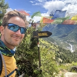
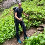
Gallery
Participants
You need to be logged in to see the participants
Weather
°
°
°
°
Description
General information
Meeting point: Near the bench at the start of the trail. Maps link: https://goo.gl/maps/LgCULujv3g9gct269

Easily accessible by public transport.
By bike, you need a little uphill endurance, which could be a good warmup activity.
There is also payable parking.
Starting time: 18h30. That is the starting time, we don't wait for latecomers
Pace: beginner-friendly
Route: T2. We will use a diverse route through the woods, which partly uses stairs to ascend. We will use the attractive exit to the viewing platform. We will need approximately 40 minutes to go up. We will use the panoramic path to descend.
Weather: Good weather is expected. The event is held in any weather; bring a rain jacket or an umbrella in rainy weather.
Swimming: If there is interest, we go after the hike to swim in the Zurich lake (Rentenwiese): https://maps.app.goo.gl/Dj9SDyJM8yV3vYTV7
Recommended gear: hiking or approach boots, clothes to dress up on top, water, repellent against ticks
WhatsApp group of Uetliberg hikes: https://chat.whatsapp.com/HwckumAUhsd7AJvn6NUJqa
Comments
Ben Steudler
9 months ago
hey Borut, there is a traffic jam on the tram, going to take too long to get there. I will give today a miss and see you guys next time!
0
|
0
Borut Jansa
9 months ago
OK.
0
|
0