Uploading...
Overall progress...
0%
File progress...
0%
Edit event: Drachenkopf via Seebensee, Drachensee
T4 - Drachenkopf via Seebensee, Drachensee
 Organized by:
Route
Ehrwald to Drachenkopf via Seeben-, Drachensee and Hoher Gang
| Elevation gain |
| Elevation loss |
| Distance |
| Duration |
| Highest altitude |
| Rating |
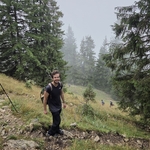
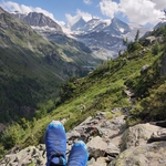
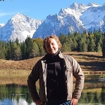
Gallery
Participants
You need to be logged in to see the participants
Weather
°
°
°
°
Description
Let's enjoy amazing alpine lakes and a nice scramble to a peak with great views.
Foreword:
- The confidence of the weather forecast is not perfect yet, I may cancel/adapt this if the rain probability increases dramatically.
- The last part of the hike seems to be a scramble, so please be very comfortable with such climbs. It may be very steep and partially exposed near the peak.
- Overall this is a challenging hike due to overall length, elevation gain and final push before the peak.
Logistics:
Let's meet latest at 7:00 at Munich Hbf next to the RE62 train, track #31. You can also get on the train in Pasing.
Morning itinerary:
7:13 Munich - 8:54 Ehrwald Zugspitzbahn (RE 62)
Return journey:
We aim to take one of the direct trains which depart every hour until and including 19:31.
Example: RB60 18:31 Ehrwald Zugspitzbahn - 20:26 Munich Hbf (1h55min trip time)
Optional in Ehrwald:
Instead of walking in the city, it's possible to cut about 2km of the hike each way by taking a bus that costs ~1.5eur.
Buses 1/2/3 from Ehrwald Bf. to Ehrwald Martinsplatz or Ehrwald Hofkapelle (5-8 min)
But these buses don't run often, there is one at 8:54 (exactly when our train arrives), next one is at 9:35
WhatsApp group link to be posted later.
Disclaimer:
I am not a guide, hiking can be dangerous and everyone is responsible for themselves. Please make sure you have the required physical fitness and familiarize yourself with the hike.
Good to know
To bring:
- Deutschland Ticket. Ehrwald is in Austria but this train stop is included in the ticket.
- Minimum 2 liters of water, ideally more (while it won't be the hottest/sunniest day, this it is still important). You may want to consider adding some electrolytes to that water.
- ID/Passport. We will be crossing the border.
- DAV or similar mountain insurance if you have it
- Sunscreen !!
- Food
- Upload gpx on your device
- Good to have: hat, some cash.
Comments
Berk Erol
8 months ago
Florin, what do you think about the short T6 section on the way back? Do you think it's manageable without equipment?
0
|
0
Florin
8 months ago
Hello Berk. I have checked in several place and haven't found anything suggesting equipment on the regular south route which we will be taking. It is however a scramble with the usual concerns: narrow path, loose rocks, somewhat exposed. If it is wet then we will have to skip the peak but so far the forecast looks fine.
0
|
0
Florin
8 months ago
I have seen it described as anything from T4 to T6 but it's basically a scramble where you need to use sometimes your hands and make sure where you walk. Typical scramble.
0
|
0
Florin
8 months ago
Actually now I realize that you didn't mean the peak part but that small section on what we can call the "main path". I will check more. The other maps I checked don't show anything special there. We have options if need be, for example we can do that going up to make it easier, or we ask at the huts.
0
|
0
Florin
8 months ago
There are some webpages suggesting that the trail connecting Biberwier to Coburger Huette (AV Weg 814) is closed. That's the left part of the hike on the map. I will check for updates. In any case, if need be, we can avoid that part by taking the same path (right part on the map) both up and down. If we do that, the distance and elevation gain actually decrease a bit and it doesn't affect at all our access to the 3 main attractions (the 2 lakes and the peak).
0
|
0
Yaroslav Stefaniv
8 months ago
I found this info: "11.6.2025: Die „Biberwiere Scharte“ (Weg Nr. 814) in Biberwier wurde saniert wurde und ist ab sofort wieder offiziell geöffnet und begehbar."
0
|
0
Florin
8 months ago
Nice 👍 thank you 🙏
1
|
0
Florin
8 months ago
https://chat.whatsapp.com/CSBqzu98eNMJcNWXaSqC0X?mode=ac_t
0
|
0