Uploading...
Overall progress...
0%
File progress...
0%
Edit event: Griesen – Sunkenkopf – Schellschlicht – Brandjoch – Hoher Brand – Griesen
T4 - Griesen – Sunkenkopf – Schellschlicht – Brandjoch – Hoher Brand – Griesen
20Sep
Sat
08:00
Between Griesen 22, 82467 Griesen, and the bridge over Neidernach, entrance into the forest, https://maps.app.goo.gl/U2pyr4BMk94tsJ2o9
 Organized by:
Alex M.
Organized by:
Alex M.
Route
Griesen – Sunkenkopf – Schellschlicht – Brandjoch – Hoher Brand – Griesen
| Elevation gain |
| Elevation loss |
| Distance |
| Duration |
| Highest altitude |
| Rating |
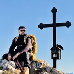
Gallery
Participants
You need to be logged in to see the participants
Weather
°
°
°
°
Description
Embark on a breathtaking ≈ 14 km loop over scenic ridges—through forest, past waterfalls, and up to sweeping alpine views—perfect for those craving adventure and unforgettable moments. Cf. https://www.komoot.com/de-de/tour/2535199037?share_token=a9d9qS51qefp525KZByY1HaESzZ4U3q6yNkmUo2sYBMIbQHfU6&ref=wtd for the route and https://www.meteoblue.com/de/wetter/woche/schellschlicht_deutschland_2839795 for the weather forecast. If certain pathless route segments seem impassable, we don't need to force them and might turn around.
Necessary: hiking boots, ⩾ 3 L of water, and a bit of food. There are no huts on the way.
This hike is unguided. Hiking is a dangerous activity. Each participant is fully responsible for himself/herself, including all the risks he/she takes; don't count on me.
In case of very few participants, the hike may be canceled or postponed.Comments
Shakeel Danish
6 months ago
Hi Alex. whats a plan on Satuday about meeting point and which time exactly we will meet there ???
0
|
0