Uploading...
Overall progress...
0%
File progress...
0%
Edit event: Geitau – Türkenköpfl – Wendelstein – Geitau clockwise
T2 - Geitau – Türkenköpfl – Wendelstein – Geitau clockwise
15Oct
Wed
08:00
parking lot at the Geitau train station, https://maps.app.goo.gl/zmVNtFyhvtQJVaeH9
 Organized by:
Alex M.
Organized by:
Alex M.
Route
Geitau – Türkenköpfl – Wendelstein – Geitau clockwise
| Elevation gain |
| Elevation loss |
| Distance |
| Duration |
| Highest altitude |
| Rating |
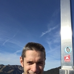
Gallery
Participants
You need to be logged in to see the participants
Weather
°
°
°
°
Description
Head out on a dramatic alpine loop from Geitau over Türkenköpfl and Wendelstein—through ridgelines, forest paths, and sweeping views—for a day of challenging joy and lasting memories. See https://www.komoot.com/de-de/tour/2619468093?share_token=aOZOSCpa4L3CeDQSkp5NsRQc9cgyVkhKphaqG4cwtcaTldfLHB&ref=wtd for the route and https://www.meteoblue.com/de/wetter/woche/wendelstein_deutschland_2811293 for the weather forecast.
Necessary: ankle-covering hiking boots and ⩾ 3 L of water.
Optional: a bit of food.
This hike is unguided. Hiking is a dangerous activity. Each participant is fully responsible for himself/herself, including all the risks he/she takes.
In case of very few participants or harsh weather, the hike may be postponed or canceled.Comments

Analia M.
5 months ago
Hi Alex. interested on join you tomorrow, but looking that it would take me a bit more than 1 hr to get to the meeting point from Poing(!). So i guess, I will wait for another tour that starts later ;)
0
|
0
Alex M.
5 months ago
@Analia M.: As of now, I plan to travel according to https://maps.app.goo.gl/toxPNrhxpM43p41q8 and I can't deviate from the route that much. A good pickup place for me is, e.g., the parking lot at St.-Quirin-Platz, namely, https://maps.app.goo.gl/eHkUAMAkG2zbQmkd8.
0
|
0
Analia M.
5 months ago
Any place with no deviation from your way, easy to park, around Brunnthal or Suerlach? I may have a car to get there.
0
|
0
Analia M.
5 months ago
All good. Somethings coming on my to do list for tomorrow. Enjoy the hike!
0
|
0
Alex M.
5 months ago
@Analia M.: For future hikes, Tank & Rast Raststätte Hofoldinger Forst Süd, https://maps.app.goo.gl/AtRjND9yUHZb98cz7, and Pendlerparkplatz Sauerlach, https://maps.app.goo.gl/rqvDP8d8LGqQiK798, are possible. Enjoy your Wednesday!
1
|
0
Analia M.
5 months ago
Great! I see you like Wednesdays that also fit my schedule ;). Happy hike tomorrow!
0
|
0