Uploading...
Overall progress...
0%
File progress...
0%
Edit event: T3 Brunnsteinspitze und Rotwandlspitze
T2 - T3 Brunnsteinspitze und Rotwandlspitze
 Organized by:
Route
Brunnsteinspitze und Rotwandlspitze
| Elevation gain |
| Elevation loss |
| Distance |
| Duration |
| Highest altitude |
| Rating |
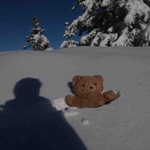
Gallery
Participants
You need to be logged in to see the participants
Weather
°
°
°
°
Description
Read carefully before joining
Pace : 400 hm/h
Good footing is essential. We’ll be walking on snow, so make sure to bring your winter gear, such as spikes and poles. Some of the snow may have melted by the weekend, but it’s better to be prepared.
The tour leads from the Scharnitz train station steeply over the Pürzelgrat to the Brunnsteinspitze (sometimes also called Brunnensteinspitze) and Rotwandlspitze peaks. Even during the ascent, you can enjoy the ever-improving views of both the Karwendel and Arnspitze ranges, and later, the Wetterstein range. Due to the challenging nature of the climb, there are usually not too many people at the summit.
The descent is initially steep, then becomes easier, leading to the Brunnsteinhütte (a hut with a service) and then on to Mittenwald, or alternatively, back to Scharnitz.
The descent is initially steep, then becomes easier, leading to the Brunnsteinhütte (a hut with a service) and then on to Mittenwald, or alternatively, back to Scharnitz.
Author's tip
Due to the favorable orientation of the tour suggestion, it is particularly suitable for sunny autumn days!
Directions
Leave the train station onto the main road and turn left. At the first opportunity, cross the railway line and follow the signs to Pürzelgrat to the left into the forest.
The next section continues upwards to the summit, following the ridge. The path is sometimes steep, sometimes very steep. Occasionally, there are small ledges that offer a few meters of rest on flat terrain.
On the final ledge at the Brunnsteinkopf, there are two options: the old markings lead directly up a steep and rugged step to the Brunnsteinspitze, while the newer markings take a much easier route to the Tiroler Hütte, from which the summit is easily reached.
After a long and scenic rest on the Brunnstein or Rotwandlspitze peaks, the trail continues in serpentines past the (closed) Tiroler Hütte (Tiroler Hut) to the saddle at Kirchlspitz. There, climbers from the Mittenwalder Höhenweg (via ferrata trail) join the group, who continue the descent. A descent of approximately 500 meters in elevation over partly scree-covered terrain awaits, until the trail finally levels out and the slope to the Brunnsteinhütte is crossed.
The trail continues downhill through the forest, and near the valley, you have the option of returning to Scharnitz or continuing on to Mittenwald. In the latter case, the route continues straight to the valley floor. From there, you can already see the houses of Mittenwald. After passing under the main road, you cross the Isar River and, depending on your mood, reach the well-signposted train station via the center of Mittenwald.
Good to know
1. **Not a Guided Tour**: This hike is not a guided tour. I am only facilitating the organization of transportation to the starting point for like-minded, qualified, properly equipped, and reliable individuals.
2. **Self-Navigation**: Each participant is responsible for navigating themselves on the suggested route. You must have the necessary skills, experience, and equipment to independently complete the hike.
3. **Acknowledgement of Risk**: By joining this hike, you acknowledge that hiking can be dangerous. You understand and accept the inherent risks involved.
4. **Personal Responsibility**: You are fully responsible for your own safety and well-being during the hike. This includes being prepared for all weather conditions, having adequate supplies, and ensuring your physical readiness for the hike.
5. **Insurance**: You confirm that you have sufficient insurance coverage, such as membership with the German Alpine Club (DAV), Mountain Rescue Service (Bergrettung), or a similar organization. This insurance should cover any potential accidents or emergencies that may occur during the hike.
By participating in this hike, you agree to release the organizer from any liability for injuries, accidents, or other incidents that may occur. You participate at your own risk and responsibility.
If you decide to leave the group (go in front by yourself, or stopping for no reason), then we won’t search for you and you officially left the group, it is also the same if you don't bring required gears
Comments
Benni
4 months ago
Brunnsteinhütte is already closed, but I expect the sunroom in front of it to be open.
1
|
0
Amir ak
4 months ago
We missed you in crowd to say goodbye,see u soon
0
|
0
Amir ak
4 months ago
Please note that we have to board the train in passing as there would be no departure from Munich hbf . We will take folllowing connection München Hbf Gl.27-36 → Scharnitz
01.11.2025
RE 70 (3874) / RE 76 (7874)
To Lindau-Insel
From 7:20 München Hbf Gl.27-36, Platform 29
To 7:26 München-Pasing, Platform 4
RB 6 (5411) / S 6 (5411)
To Seefeld in Tirol
From 7:38 München-Pasing, Platform 3
To 9:43 Scharnitz, Platform 2
View journey:
https://int.bahn.de/en/buchung/start?vbid=1584bdc3%2D25a4%2D467a%2D8945%2D1f9f51321e42.
Also my number 015205846584
0
|
0
Benni
4 months ago
I'm sitting in the last part of the first train which is going to Seefeld
0
|
0
Amir ak
4 months ago
We are also siting in this part and sitting close to toilet
0
|
0