Uploading...
Overall progress...
0%
File progress...
0%
Edit event: [CH][Snowshoeing] Kronberg
T4 - [CH][Snowshoeing] Kronberg
 Organized by:
Route
[Snowshoeing] Gontenbad - Kronberg - Schwägalp
| Elevation gain |
| Elevation loss |
| Distance |
| Duration |
| Highest altitude |
| Rating |
Gallery
Participants
You need to be logged in to see the participants
Weather
°
°
°
°
Description
Route: We first follow https://en.kronberg.ch/erlebnisse/winter/schneeschuhwandern/gontenbad-kronberg.html up to Kronberg. From there we follow https://en.kronberg.ch/erlebnisse/winter/schneeschuhwandern/schwaegalp-kronberg.html (https://schweizmobil.ch/de/schneeschuhwandern/route-669) in reverse down to Schwägalp. Alternatively, it's possible to take a cable car down to Jakobsbad.
Please have the route downloaded on your phone in case we split, the recommended app is SwissTopo: https://swisstopo.app/i/5/68F3E6MM.
Conditions: As of Thursday avalanche level is at level 1 for the first part of the trail, and 2 for the second part of the trail (level 3 above 1800m, but our route stays below that), no new snowfall forecasted until Saturday. The tour might be cancelled/modified based on the real-life conditions encountered.
Pace: Moderate (on the faster side - with multiplier approximately 1.2x compared to the SwissTopo time). Some experience with snowshoeing is recommended. This hike is not suitable for beginners - both of the routes individually are described as "hard".
Starting point: Gontenbad train stop
End point: Schwägalp, Passhöhe bus station
How to get there: Train IR13 from Zurich HB departs at 8:08. Change in Gossau SG. https://a.sbbmobile.ch/s/q2stjqd5
How to get back: Bus, going twice per hour.
What to take:
- Snowshoes + poles (with wide baskets).
- Winter hiking equipment.
- Food (we’ll have picnic lunch somewhere on the way).
- Usual stuff: water, sunscreen, sunglasses.
Photos: I might take photos during the hike that might afterwards be shared on the HB group. If you don't want to be on the pictures, please let me know in advance. I will also create a Google Photos album and asked everyone to contribute their photos.
Disclaimer: I'm not a guide - everyone hikes at their responsibility and risk.
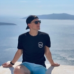
Photo credit: myself, picture from the previous hike
Comments
Jarek
2 months ago
I'm planning to go to the starting point with a car. If someone wants to join me, I'll be leaving from Rushlikon Bahnhof tomorrow morning.
1
|
0

Aleksander Matusiak
2 months ago
WhatsApp chat: https://chat.whatsapp.com/FfTRzVm0ofL8pkb7Wa2y5e
0
|
0