Uploading...
Overall progress...
0%
File progress...
0%
Edit event: [CH][Snowshoeing] Blattenegg - Salwideli - Chlus
T3 - [CH][Snowshoeing] Blattenegg - Salwideli - Chlus
 Organized by:
Route
[Snowshoeing] Blattenegg -Salwideli - Chlus
| Elevation gain |
| Elevation loss |
| Distance |
| Duration |
| Highest altitude |
| Rating |
Gallery
Participants
You need to be logged in to see the participants
Weather
°
°
°
°
Description
Route: This route is a combination of parts of various different trails: https://schweizmobil.ch/en/snowshoe-trekking/route-910 , https://schweizmobil.ch/en/winter-hiking/route-670 , https://www.skitourenguru.ch/?id=12951 , https://schweizmobil.ch/en/snowshoe-trekking/route-912
Please have the route downloaded on your phone in case we split, the recommended app is SwissTopo: https://swisstopo.app/i/5/J6N28YFG .
Conditions: As of Thursday avalanche level is at level 2 for above 2000m. The trail stays below that, so it should be level 1. The tour might be cancelled/modified based on the real-life conditions encountered.
Pace: Moderate, on the faster side - with multiplier approximately 1.2x compared to the SwissTopo time. Some experience with snowshoeing is recommended. This hike is not suitable for beginners, as it's quite long for a snowshoe hike.
Starting point: Sörenberg, Rothornbahn bus stop
End point: Sörenberg, Hirsegg bus stop
How to get there: Train IR70 from Zurich HB departs at 7:10. Change in Luzern, Schüpfheim and Sörenberg. https://a.sbbmobile.ch/s/ogIWnKH7 . Apologies for an early start, but the hike will take a while.
How to get back: Bus every hour. We'll be aiming for 16:59 one.
What to take:
- Snowshoes + poles (with wide baskets).
- Winter hiking equipment.
- Food (we’ll have picnic lunch somewhere on the way).
- Usual stuff: water, sunscreen, sunglasses.
Photos: I might take photos during the hike that might afterwards be shared on the HB group. If you don't want to be on the pictures, please let me know in advance. I will also create a Google Photos album and asked everyone to contribute their photos.
Disclaimer: I'm not a guide - everyone hikes at their responsibility and risk.
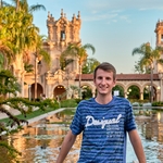
Photo credit: Myself, picture from the previous hike
Comments
Mami Murakami
2 months ago
Hi Aleksander, thank you for organizing event. Will we go tomorrow? Since I live in Basel, I will join from Schupfheim
0
|
0
Aleksander Matusiak
2 months ago
Yes! The weather forecast actually got better, so it should be a nice day 😎 See you then!
0
|
0
Aleksander Matusiak
2 months ago
Mami, I see you left the event. Do you not plan on joining anymore?
0
|
0
Mami Murakami
2 months ago
Sorry, I do not join. See you next time
0
|
0
Aleksander Matusiak
2 months ago
If anyone wants to join last moment, I will start hiking one hour later, so at 10:05.
0
|
0
Aleksander Matusiak
2 months ago
In the end it will start as planned.
0
|
0