Uploading...
Overall progress...
0%
File progress...
0%
Edit event: T3 | Bayerischer Wald Panorama Loop
T1 - T3 | Bayerischer Wald Panorama Loop
 Organized by:
Route
Bayerischer Wald Runde
| Elevation gain |
| Elevation loss |
| Distance |
| Duration |
| Highest altitude |
| Rating |
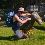
Gallery
Participants
You need to be logged in to see the participants
Weather
°
°
°
°
Description
I’ll be spending the weekend in the Bayerischer Wald and plan to hike a beautiful panoramic loop starting near Bernried, passing through:
Burgstein → Riedberg → Rauher Kulm → Klausenstein → Hirschenstein → Waldmannstein → Schopf → Knogler Berg → Höhenberg
Expect forest ridges, rocky viewpoints, and wide Bavarian horizon moments 🌲⛰️
Special thanks and kudos to Irina for creating the map and shaping this route 🙌🗺️
Details:
- Duration: ~8 hours (including photo stops, lunch break, tea & sweets breaks)
- Pace: Easy and steady. No running. We hike to enjoy
- Terrain: Forest paths with some elevation, typical Bavarian Wald mix
- Vibe: Relaxed, nature-focused, good conversations welcome
- Webcam: https://www.foto-webcam.eu/webcam/grandsberg
[Edited] Logistics:
- Carpool starts from Munich Ostbahnhof at 07:00
- We drive together to Bernried
- After the hike, we drive back together to Munich
- WhatsApp Group: https://chat.whatsapp.com/EuP0qOp8nH49zRr74IyrjT
If you enjoy long scenic days in nature without rushing, this one’s for you.
⚠️Disclaimer: Bergsport can be dangerous. I am not a mountain guide and don't even pretend to be. Everybody is responsible for themselves. Please make yourself familiar with the route and its requirements.
Comments
Dimitrios Daskalakis
1 month ago
Updated Description
0
|
0

Reza Mortazavi
1 month ago
Hello Dimitrios,
on which side of the Ostbahnhof (East Station) is the meeting point?
0
|
0
Dimitrios Daskalakis
1 month ago
it's on the south side, join the WhatsApp group, I'll share details there
0
|
0