Uploading...
Overall progress...
0%
File progress...
0%
Edit event: Kampenwand (Ostgipfel) und Sulten (from Aschau im Chiemgau)
T4 - Kampenwand (Ostgipfel) und Sulten (from Aschau im Chiemgau)
 Organized by:
Route
Kampenwand (Ostgipfel) und Sulten (from Aschau im Chiemgau)
| Elevation gain |
| Elevation loss |
| Distance |
| Duration |
| Highest altitude |
| Rating |
Gallery
Participants
You need to be logged in to see the participants
Weather
°
°
°
°
Description
Thanks to Irina for the route planning, I just had to create the event :P
We will be meeting at Ostbahnhof and taking the below transportation.
Onward Journey:
RE5 towards Salzburg and getting down at Prien am Chiemsee. RB52 will be the connection from Prien to Aschau.
We ill arrive at 10.16am and start hiking by 10.20am. We prefer taking photos and videos, so be sure that we wont rush unless we are happy :).
I prefer hiking as a group, in case you want to speed up and go away from the group feel free to create your own event.
Return Journey:
We will aim for 16.25 and in case we chill then 17.43.
As it will be windy it is mandatory to gear up properly .
- warm clothes
- food&drink
- spikes /poles/snowshoes
- headlamp
- Deutchlandticket/DAV card (if you have it)
Kampenwand
Kampenwand is one of the Bavarian classics and the peak where the heaviest 12-meter-high cross stands.
https://de.wikipedia.org/wiki/Kampenwand
I would prefer to do both the ascent and descent from Steinlingalm and also include Sulten along the way.
On Friday, Steinlingalm will be closed, so we can enjoy a nice Brotzeit either on Kampenwand Ostgipfel or on Sulten, with the best views of Kampenwand.
Steinlingalm: https://www.steinlingalm.de/
Webcam @Kampenwandbahn: https://webtv.feratel.com/webtv/?design=v5&cam=3010
Disclaimer: Please note that this list is not exhaustive and every participant should conduct their own research and self-assessment before joining. Additionally, please be advised that I am not a mountain guide and hiking can be risky. Therefore, you are responsible for your own safety and must familiarize yourself with the route and its requirements. I recommend downloading a map and bringing a cell phone for emergencies.
Good to know
Disclaimer: Please note that this list is not exhaustive and every participant should conduct their own research and self-assessment before joining. Additionally, please be advised that I am not a mountain guide and hiking can be risky. Therefore, you are responsible for your own safety and must familiarize yourself with the route and its requirements. I recommend downloading a map and bringing a cell phone for emergencies.
Comments
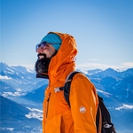
Amyth Mishra
2 months ago
would be nice if someone joining from HBF can reserve some seats for us... Thank you.
0
|
0

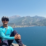
Jérôme De Bavière
2 months ago
hello, sorry guys, but even from Hbf, the train is packed. Coke to the front of the train is still a bit better for standing...
0
|
0
Zakaria SEMGAT AZBAKH
2 months ago
Hey Amith, I tried to reach you but without answer, I have 2 places for you in the front of the train but it's difficult to keep them so come quickly plz
0
|
0