Uploading...
Overall progress...
0%
File progress...
0%
Edit event: [Switzerland] Interlaken-Sörenberg
T3 - [Switzerland] Interlaken-Sörenberg
25Apr
Sat
09:25
Interlaken West, in front of avec shop ( https://maps.app.goo.gl/PqQi7rcWnQbBc6vp8 )
 Organized by:
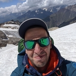
Levan Varamashvili
Organized by:
Levan Varamashvili
Route
[Switzerland] Interlaken - Sörenberg [T2]
| Elevation gain |
| Elevation loss |
| Distance |
| Duration |
| Highest altitude |
| Rating |
Gallery
Participants
You need to be logged in to see the participants
Weather
°
°
°
°
Description
Hi buddies,
Let's go to the valley between Emmental and Berner Oberland. The plan would be to hike from canton Bern to canton Luzern (Interlaken to Soerenberg). Optionally, whoever still has energy, can extend the hike to Schrattenflue (~additional 5 km and 850m elevation).
This would be a good preparation for Rigimarsch 2026: https://www.hiking-buddies.com/routes/events/12584/ .
======================================
Difficulty: T3, hiking trail. If you need more info what T3 means, SAC website has a description: https://www.sac-cas.ch/fileadmin/Ausbildung_und_Sicherheit/Tourenplanung/Alpinmerkbl%C3%A4tter/20230601_SAC-Wanderskala_D.pdf .
Meeting point and time: Interlaken West train station, in front of avec shop at 09:25. If you are coming from Zürich, you can take a train at 07:38 and change in Spiez.
Profile: 29km, 1550m up, 950m down.
Pace: Easy (~400 uphill meters / hour), no running. We aim to be in Sörenberg by around 18:30.
Lunch: We bring our own food and have lunch at around 13:00.
Recommended gear: Hiking shoes/boots; Waterproof jacket in case it rains; Sunscreen; Sunglasses.
Weather: ~14°C is expected in Sörenberg, and no rain. This hike will take place in any weather except thunderstorms.
Disclaimer: I am not a mountain guide. Everybody joins at his/her own risk. I am not responsible for anything.
*Photo from SAC website.
Comments
Levan Varamashvili
1 month ago
WhatsApp chat:
https://chat.whatsapp.com/LNoRmPYIbWiF4JixknbY2r
1
|
0
Levan Varamashvili
1 month ago
fyi, I posted this on Zurich hike in Zurich hike and outdoor meetup group too.
1
|
0