Uploading...
Overall progress...
0%
File progress...
0%
Edit event: [CH] Relaxed city escape with BBQ, Zurich & streamside ascent to Loorenkopfturm
T1 - [CH] Relaxed city escape with BBQ, Zurich & streamside ascent to Loorenkopfturm
24May
Sun
11:30
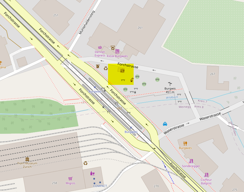
Burgwies https://www.openstreetmap.org/#map=18/47.3582799/8.5718146 (Forchstrasse 261B, 8032 Zürich)
 Organized by:
She Hikes
Organized by:
She Hikes
Route
[ZH] Burgwies - Elefantenbach - Aussichtsturm Loorenkopf - Grillplatz - Bergstation Dolderbahn
| Elevation gain |
| Elevation loss |
| Distance |
| Duration |
| Highest altitude |
| Rating |
Participants
You need to be logged in to see the participants
Weather
°
°
°
°
Description
Meeting point
Züri WC, near tram stop Burgwies (OSM: 47,3582799, 8,5718146) (Maps: Forchstrasse 261B, 8032 Zürich)
Start at 11:30 am!
Tour summary:
- Duration: approx. 2 h 20 min
- Distance: 6.79 km
- Average speed: 2.9 km/h
- Ascent: 270 m
- Descent: 110 m
A quiet, nature-rich hike with a mix of forest paths, scenic spots, and a rewarding viewpoint—ideal for a relaxed escape from the city on a hot day.
The hike starts near the tram stop Burgwies in Witikon. From here, the trail quickly leads into nature toward the peaceful Elefantenbach. The path winds through the romantic and slightly wild Stöckenbach ravine, offering a surprisingly quiet atmosphere despite being close to the city. Continuing through shaded forest, the trail gradually ascends past a pleasant barbecue area—perfect for a first, small break. From there, we head uphill toward the Loorenkopfturm on the Adlisberg. The wooden tower, about 33 meters high, rewards those who are comfortable with heights with impressive panoramic views above the treetops and across the Zurich region. Shortly after, we'll head to the bbq place which is only a few minutes away. The final stretch leads gently through the forest to the upper station of the Dolderbahn, where the hike officially ends.
What to bring
- Bring your favourite food for the grill, a plate and cutlery, or whatever you need.
- The usual (proper footwear, water, sun protection, towel if needed).
Wood & grill available on site. I'll bring a lighter.
Important:
- You need to figure out yourself which tram / bus station you need to reach in order to be on time at the above mentioned starting point of the route.
- We leave the place clean, no trash left on the ground.
- Although we live in a digital era, human connection and real-world experiences are what matters most. Refrain from taking photos of other persons without their permission. The same applies when sharing content online—always make sure you have consent before posting images or information involving others.
How to sign up?
Case 1: By public transport: Click on the Carpool button & join the fake car I already created for that purpose.
Case 2: By car: Click on the Carpool button & either add your car or join an existing one.
Good to know
Disclaimer: This is
an informal meetup, not a guided tour. Every participant is 100% responsible for their own safety,
fitness level, and equipment.
Comments