Uploading...
Overall progress...
0%
File progress...
0%
Edit event: Bergkameraden Klettersteig (Ottenalm / Walchsee)
T5 - Bergkameraden Klettersteig (Ottenalm / Walchsee)
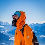
 Organized by:
Route
Bergkameraden Klettersteig (Ottenalm / Walchsee)
| Elevation gain |
| Elevation loss |
| Distance |
| Duration |
| Highest altitude |
| Rating |
Gallery
Participants
You need to be logged in to see the participants
Weather
°
°
°
°
Photo & Film Consent:
Participants of this event consent to being photographed and/or filmed.
Description
We will be taking the train to Kufstein followed by bus connection to Dorfplatz. We will arrive around 09.49am and will start hiking towards the start point of ferata by 10am. We will aim for 13.28 return bus or 14.38.
Mandatory Things:
- Should have already done ferata up to level C.
- Via Ferata Se & Helmet
- Cash for bus ticket
- Good Mood
- Food & Drinks
- Deutchlandticket/DAV card (if you have it)
- Sunscreen
- First Aid Kit
**Bergkameraden Klettersteig – Scenic Via Ferrata above Walchsee with Bridges & Summit Views**
The Bergkameraden Klettersteig is a short but varied via ferrata located above Walchsee in the Kaiserwinkl region of Tyrol, Austria. Starting from the Ottenalm, the route quickly leads into rocky terrain with secured cable sections, ladders, and exposed traverses. One of its highlights is a series of suspension bridges that add an adventurous and playful element to the climb.
Despite its moderate length, the ferrata offers sections up to grade C/D, making it engaging for climbers with some experience. The route culminates at the Harauer Spitze, where hikers are rewarded with wide views over the Kaiser Mountains and the surrounding valleys.
The descent follows a scenic forest path back to the Ottenalm, completing a well-rounded loop that combines hiking, climbing, and alpine panorama in a compact adventure.
Ideal for:
* Intermediate via ferrata climbers
* Half-day alpine outings
Difficulty: B–D (moderate to moderately difficult)
Total duration: ~2.5–3.5 hours round trip
WhatsApp Group https://chat.whatsapp.com/LNu6l8wInvaIjML5XeObt3
Good to know
Disclaimer: Please note that this list is not exhaustive and every participant should conduct their own research and self-assessment before joining. Additionally, please be advised that I am not a mountain guide and hiking can be risky. Therefore, you are responsible for your own safety and must familiarize yourself with the route and its requirements. I recommend downloading a map and bringing a cell phone for emergencies.
Comments
Amyth Mishra
1 month ago
Hey Guys, kindly join the WhatsApp group. https://chat.whatsapp.com/LNu6l8wInvaIjML5XeObt3 also updated it in description.
0
|
0