Uploading...
Overall progress...
0%
File progress...
0%
Edit event: Petersberg - Hohe Asten - Wolfsschlucht - Waterfalls
T3 - Petersberg - Hohe Asten - Wolfsschlucht - Waterfalls
 Organized by:
Route
Petersberg - Hohe Asten - Wolfsschlucht - Waterfalls
| Elevation gain |
| Elevation loss |
| Distance |
| Duration |
| Highest altitude |
| Rating |
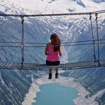
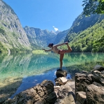
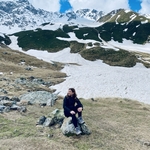
Gallery
Participants
You need to be logged in to see the participants
Weather
°
°
°
°
Description
Hike to Hohe Asten via Wolfsschlucht and Petersberg
• Date: Tuesday, June 16, 2026
• Meeting Point: 08:30 AM in front of the platform 9 (Central Station / Hauptbahnhof) or at the station Flintsbach at 9:50 am.
• Departure: 08:43 AM by train RE5 to Flintsbach fom Hauptbahnhof Platform 9. We have to change in Rosenheim to RB54 at 09:37 from platform 6.
Tour Details (approx.):
• Distance: approx. 12–13 km (loop trail)
• Elevation Gain/Loss: approx. 660 hm (komoot says 650hm, no idea why hiking budfies says 867hm)no idea why
• Pure Hiking Time: approx. 4 to 4.5 hours (excluding breaks and lunch)
• Difficulty: Intermediate (good basic fitness and sure-footedness required, especially through the Wolfsschlucht)
We will have lunch at Hohe Asten. Please take cash with you, since they don't accept cards.
Description:
Together, we will hike from Flintsbach through the wild and impressive Wolfsschlucht (Wolf's Gorge) up to Petersberg (featuring a beautiful panoramic chapel!). From there, we continue our ascent to Hohe Asten, Germany's highest year-round operating mountain farm at 1,106 meters. After the climb, we will stop there for a cozy mountain hut lunch to refuel for the way back.
Please remember to bring sturdy, broken-in footwear (hiking boots with good grip), weather-appropriate clothing, and enough water for the duration of the hike!
This is a purely private hike. Participation is entirely at your own risk and responsibility. As a private individual, I assume no liability for any accidents, injuries, property damage, or other incidents during the entire tour (including travel to and from the location). Each participant is personally responsible for ensuring they meet the physical requirements (fitness, sure-footedness) for the described mountain hike.
Good to know
Tbd
Comments
Vera
1 week ago
Hello, i'm happy that you all join me tomorrow. We meet 8:30 am in front of the platform 9.
I will wear tomorrow morning a pink softshell jacket, so you will definitely find me😅
Please take cash with you for the hut, they don't accept card.
Please also check the platform of the train tomorrow morning, since they might change it again. Our train is RE5 starting at 8:43 from currently platform 9 at Hauptbanhof
3
|
0
Magdalena A.
1 week ago
Thank you for all the information Vera! You're a 🌟
1
|
0
janina kannengiesser
1 week ago
Big thank you also from me. looking forward to meet you all tomorrow
1
|
0