Uploading...
Overall progress...
0%
File progress...
0%
Edit event: Hochstaufen berg
T3 - Hochstaufen berg
 Organized by:
Route
Hochstaufen berg
| Elevation gain |
| Elevation loss |
| Distance |
| Duration |
| Highest altitude |
| Rating |
Participants
You need to be logged in to see the participants
Weather
°
°
°
°
Photo & Film Consent:
Participants of this event consent to being photographed and/or filmed.
Description
📅Saturday 27 june | 👫 This time this week for only Boys
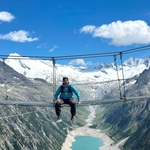
The hike to Hochstaufen is a rewarding mountain adventure offering spectacular panoramic views of the Bavarian Alps, Bad Reichenhall, and the surrounding valleys. The trail climbs through forests, alpine meadows, and rocky sections before reaching the 1,771-meter summit. Hikers are rewarded with stunning scenery and the nearby Reichenhaller Haus, a traditional mountain hut just below the peak. The route is moderately challenging and best suited for hikers with good fitness and sure-footedness. (bad-reichenhall.de)
Contact: +4917681055522 About Car. In my car just will go 4 person. Please if you want and sure than join event otherweis skip please . We will share our sprit cost over all members.
🚗 Meeting & Pickup Point:
85375 Neufahrn bei Freising Bahnhof
We’ll carpool from here, please be on time.
07:30 AM – 85375 Neufahrn bei Freising Bahnhof
Meetingpoint Link. 👉 Google Maps Link
09:30 AM- Start Hike from Nonn 82, 83435 Bad Reichenhall Wandenpark platz
Start Hiking Point link- 👉 Google Maps Link
13:00 PM – Reached, Slowly On a peak
14:30 PM -- After break eat rest photos then turn back
17:00 PM-- Reach turn back parking area
19:15 PM-- Reach back München 85375 Neufahrn bei Freising Bahnhof
🎒 What to Bring No compromise
This is a friendly group hike, and we aim to keep the group together and enjoy the experience as a team.
Snacks (optional, breakfast and lunch as planned above)
Plenty of water – it will be a Required During hiking
Hiking shoes
Hiking poles
Sun Cream
Clothes acording weather and satuation
Good vibes and team spirit! 😊
Good to know
⚠️ Disclaimer
This is not a guided tour. I’m simply organizing and sharing the plan. Everyone is responsible for their own safety and participation.
*Legal Disclaimer**
I am not a guide. Everybody is responsible for themselves. Make yourself familiar with the route and its requirements. The organizer holds no responsibility for any injuries or death that might result directly or indirectly from this event. The organizer does not warrant the accuracy of the description of the event. By joining the event, you accept the terms explained above. Please be aware that you join at your own risk.
Please read the following carefully before participating in the hike:
1. **Not a Guided Tour**: This hike is not a guided tour. I am only facilitating the organization of transportation to the starting point for like-minded, qualified, properly equipped, and reliable individuals.
2. **Self-Navigation**: Each participant is responsible for navigating themselves on the suggested route. You must have the necessary skills, experience, and equipment to independently complete the hike.
3. **Acknowledgement of Risk**: By joining this hike, you acknowledge that hiking can be dangerous. You understand and accept the inherent risks involved.
4. **Personal Responsibility**: You are fully responsible for your own safety and well-being during the hike. This includes being prepared for all weather conditions, having adequate supplies, and ensuring your physical readiness for the hike.
5. **Insurance**: You confirm that you have sufficient insurance coverage, such as membership with the German Alpine Club (DAV), Mountain Rescue Service (Bergrettung), or a similar organization. This insurance should cover any potential accidents or emergencies that may occur during the hike.
By participating in this hike, you agree to release the organizer from any liability for injuries, accidents, or other incidents that may occur. You participate at your own risk and responsibility.
If you decide to leave the group (go in front by yourself, or stopping for no reason), then we won’t search for you and you officially left the group, it is also the same if you don't bring required gears
Comments

Barış Bayraktar
11 hours ago
Hi! The ascent according to your GPX is called Goldtropfsteig. It includes Grade I scrambling, only sparsely marked and lacks signposts. The route was altered by a rockfall in 2022. FYI and have fun!
1
|
0
Shakeel Danish
11 hours ago
thanks info Baris you have good experience than me we will avoid than route and turn back also same route which we will use go up.
0
|
0