Uploading...
Overall progress...
0%
File progress...
0%
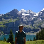
Edit event: Trailrun Garmisch-Mittenwald #2 [25.9 Km, 1311 m gain]
T2 - Trailrun Garmisch-Mittenwald #2 [25.9 Km, 1311 m gain]
 Organized by:
Route
Trailrun Garmisch-Mittenwald #2
| Elevation gain |
| Elevation loss |
| Distance |
| Duration |
| Highest altitude |
| Rating |
Gallery
Participants
You need to be logged in to see the participants
Weather
°
°
°
°
Description
We take the train at 7:13
Instead of the route to Mittenwald from Hoher Kranzberg we can also descend to Klais. The road to Mittenwald is mostly Asphalt and quite steep downhill so can be a bit uncomfortable. The route for that is here:
https://www.hiking-buddies.com/routes/routes_list/1406/?fbclid=IwAR07gmgLzrIoSrZHpyC8YkW0j83kU_CM8UQgJrgFppmPcHOXKgx70wh4XFQ
Please have both GPX on your watch/phone.
Requirements:
Good fitness level. You should be running regularly.
Long sleeve running top and bottoms
Gloves
Hat
Trail running shoes
Trail running backpack
Waterproof and breathable lightweight jacket
Water
Trail food
First aid kit and emergency blanket
Money, ID
Charged mobile phone. Load the gpx file onto a navigation app. Familiarise yourself with the route. Make sure have my number and the emergency services number saved. The route has a small glitch in the middle where it seems to go up a forest road that does not exist. The trick is to follow the road and not the gpx. Will correct the route after tracking this run.
Suggested:
Trail running spikes and running gaiters
Good to know
Note:
This is a long-slow-distance run. We'll be hiking the uphills and running the flats and downhills. We run our pace and wait at the end until everyone has finished.
I'm not a guide, this is not a guided tour.
Comments
Shane Cunneff
6 years ago
Hey buddies. Given the weather I actually decided to run this route today, and just wanted to pass on some info that I think would be helpful. The route, as presented, from Elmau until Ferchensee is completely under snow... some parts upwards of 30-40cm (to my knees and I’m 193cm) . I recommend you have water proof shoes and running gaiters, or alternatively skip this ascent. If you decide to go for it , you’ll see my solo tracks in the snow lol. Anyhow, good luck tomorrow and thanks for giving me the idea !
4
|
0

Mariia Lukianets
6 years ago
thanks for making the tracks! was really helpful :D
1
|
0