Uploading...
Overall progress...
0%
File progress...
0%
Edit event: Hoher Göll & Hohes Brett [18.5 Km, 1681 m gain, I]
T5 - Hoher Göll & Hohes Brett [18.5 Km, 1681 m gain, I]
09Aug
Sun
07:15
Scharitzkehlstraße 10-12 Parking, 83471 Berchtesgaden, 47.604077, 13.030510
 Organized by:
Andrea
Organized by:
Andrea
Route
Hoher Göll
| Elevation gain |
| Elevation loss |
| Distance |
| Duration |
| Highest altitude |
| Rating |
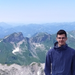
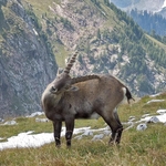
Gallery
Participants
You need to be logged in to see the participants
Weather
°
°
°
°
Description
Traverse of the second highest mountain in the Königssee area via Mannlsteig. Amazing views guaranteed.
Route: From parking lot Scharitzkehlalm to the Kehlsteinhaus via Sappensteig. Then via Mannlsteig to Hoher Göll. Descent via Hohes Brett and either Brettgablel (shorter,steeper) or Jägerkreuz and Mitterkaser-Alm (longer).
Technical Difficulty: This hike is NOT suitable for beginners. It involves some scrambling (UIAA I). The difficult segments are secured by ropes. There are vertical and exposed segments. You have to be absolutely surefooted and no fear of heights. You should have above average pace (>450m gain/hour) and stamina.
This is not a guided tour. I merely organize the trip from the starting point with like-minded, qualified, properly equipped and reliable persons. Every participant must be able to navigate her/himself on the suggested route. If you join, you acknowledge that hiking is dangerous, you are fully responsible for yourself and that you have sufficient insurance (DAV, Bergrettung or similar).
Good to know
Things to bring (mandatory):
- good mood & patience
- water
- food
- your passport or ID (!) because we are passing the border
- charged smartphone, emergency no 112 saved, optionally powerbank
- sun glasses, sunscreen
- helmet, via ferrata set
- wind breaker/jacket or raincoat (just in case)
- optional: hiking poles, gloves for scrambling
Note: Please unjoin the event well in advance, if you don't want to come. You cannot unjoin the event when it is starting in less than 12 hours.
Comments
Corentin P.
5 years ago
Hi Andrea, as I wrote in the message I sent you, I just clicked by mistake on join event because I thought it was a car pool, sorry for the trouble!
1
|
0
Andrea
5 years ago
No worries. Thanks for letting me know.
0
|
0