Uploading...
Overall progress...
0%
File progress...
0%
Edit event: Schellschlicht [13.8 Km, 1266 m gain]
T4 - Schellschlicht [13.8 Km, 1266 m gain]
 Organized by:
Route
Schellschlicht
| Elevation gain |
| Elevation loss |
| Distance |
| Duration |
| Highest altitude |
| Rating |
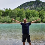
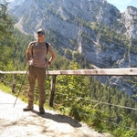
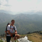
Gallery
Participants
You need to be logged in to see the participants
Weather
°
°
°
°
Description
Weather looks beater on Sunday than Saturday and it is a good day
for some high peak with extensive views on the
Wetterstein walls to the south, the
Plansee to Reutte on the west, and a view north into the heart of the Ammergau
range, dominated by the Geierköpfe and Kreuzspitze.
Schellschlicht is a
moderately rugged Ammergau peak with a distinctive bowl between two ridges on
its southern flanks and with a northern ridge, which is a sort of backbone of
the mountain, continuing to the north with Austrian Kreuzspitze (or
Kreuzspitzl), German Kreuzspitze, Kuchelbergkopf and Kuchelbergspitz.
The southern bowl contains many little creeks which are
accumulated to the Schellaine creek, cutting a deep valley and a canyon into
the limestone of southern Schellschlicht.
The two southern ridges can be named after their subsummits:
Sunkenkopf ridge to the southeast and Brandjoch ridge to the southwest. Marked
trails on the two ridges allow for a nice loop hike to the summit and back.
Good to know
Meting point München HBF Gleis 27
at 06:10
Train starts at 06:30 at 08:20 we are coming to Griesen(Oberbay) which is also the start point and the end point of our tour.
- Highest peak is 2052 m
- Total gain 1266 m
- Total loss 1266.
- Duration cca 6 hours
The hike is very attractive but like every mountain it has its challenges. During the hike please stay focused and watch on your self and other members of the group.
I am not a mountain guide so you are responsible for your self.
My phone number is 015752618887
Comments
Alireza
5 years ago
Hi Ivan, would it be possible to extend the number of participants?
2
|
0
Dmitry
5 years ago
Will we buy Bayern tickets for 5? I will need a ticket earlier and can buy for 5 ppl starting from my station.
0
|
0

Divi Đi-vi
5 years ago
I'm so sorry! I completely forgot to unjoin the event! So my slot is free! Sorry sorry sorry! My mistake! :(
0
|
0
Kiran Kumar
5 years ago
SORRY!!! I have changed plan. I am also not joining and I am really sorry for late informing. My slot is also free.
0
|
0
Ivan Valio
5 years ago
Hi guys via this link you can join WhatsApp group https://chat.whatsapp.com/GlixQRIfgyvDtLJzdlcLQ9
0
|
0