Uploading...
Overall progress...
0%
File progress...
0%
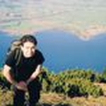
Edit event: Hochstaufen over Steinernen Jäger [16.0 Km, 1299 m gain]
T3 - Hochstaufen over Steinernen Jäger [16.0 Km, 1299 m gain]
 Organized by:
Route
Hochstaufen over Steinernen Jäger
| Elevation gain |
| Elevation loss |
| Distance |
| Duration |
| Highest altitude |
| Rating |
Gallery
Participants
You need to be logged in to see the participants
Weather
°
°
°
°
Description
We are travelling by different cars now and i could not accomodate anyone now in the event , incase if someone wanted to tag along and catch up in the trail , then only join the event at your own risk .
This mentioned below route will be customised based on the spot situation
Reference :
R-1 https://www.bergtour-online.de/bergtouren/bergwanderungen/mittel/hochstaufen/
R-2 https://www.hoehenrausch.de/berge/hochstaufen/steinerne-jaeger/
Transportation : Likely i will go by car if i get someones in my Hiking Buddy circle , however if someone wanted to tag along - please be there on the waiting list . I will reach out .
Public Transportation : TBD
Pace : Slow and Steady between 360 to 400 gain \ hr . I have no rush to come back to Munich early in the evening.
After Hike , i am thinking to go to any close by restaurant for Beers and Dinner .
Mentioned below description copied from previous route in HBM :
Hochstaufen is a prominent rocky mountain and a well-known eye-catcher that rises between Bad Reichenhall, Piding and Anger (Berchtesgadener Land). It belongs to the Staufen massif and is the easternmost mountain in the Chiemgau Alps. From the summit you have a good panoramic view, especially to the Berchtesgaden Alps.
The name Staufen comes from the Middle High German ("stouf") and means "steeply towering rock". From about 1350 to 1810, the border between Bavaria and Salzburg crossed the ridge. Mining continued until the middle of the 18th century, the most famous being the Doktor-Oswald tunnel, which was only 60 metres below the summit. Lead and zinc were mined [wikipedia].
Ascent: The ascent is T3 and requires scrambling upto grade I+ in exposed sections. It's not suitable for beginners. Sure-footedness and no fear of heights are required. There are sometimes steel ropes and hooks to assist.
Good to know
Gears : Please carry all your Hiking Gears ( specially spikes and poles )
COVID 19 : If you are not keeping well and had symptoms related to cold , cough and fever - Kindly do not join the event .
GPX : I would expect , folks who will join will have the GPX app installed and can navigate by themself without any support . Else , please Google it by yourself.
Disclaimer : I am not a mountain guide or specialist , therefore you are responsible for yourself when you are on the mountains .Kindly have your mountain insurance handy and emergency number saved in your dial .
Comments
Reza Mortazavi
4 years ago
Fahrt ihr mit dem Auto oder mit dem Zug?
0
|
0
Reza Mortazavi
4 years ago
Als Treffpunkt steht: HBF Bahnsteig 10.
0
|
0