Uploading...
Overall progress...
0%
File progress...
0%
Edit event: Grän Große Schlicke Round tour 15,3 km (+1195m)
T3 - Grän Große Schlicke Round tour 15,3 km (+1195m)
30Oct
Sat
09:15
Parkplatz Grän/Enge - Bad Kissinger Hütte ( https://goo.gl/maps/7GeeLGmtL1Sue3qq6 )
 Organized by:
Marco Mecarozzi
Organized by:
Marco Mecarozzi
Route
Grän Große Schlicke Round tour 15,3 km (+1195m)
| Elevation gain |
| Elevation loss |
| Distance |
| Duration |
| Highest altitude |
| Rating |
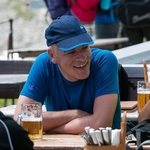
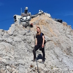
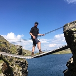
Gallery
Participants
You need to be logged in to see the participants
Weather
°
°
°
°
Description
This Is a carpool hike. Please read carefully instructions for the hike and don´t just click on coming.
CARPOOL
Schedule: Hike starts at 9,15 am.
Drivers: add your car in carpool and put meeting point and time for it.
Passengers: Click on Carpool button. Read carefully all information about the car you join, check if there are any specific instructions. All the costs for the trip will be shared with people in the same car. Meeting point is decided by the driver, this information is in the "Carpool" button.
Please be punctual.
The hike is in Austria, that means All travellers need to show either a negative COVID test or proof of vaccination/past infection upon entry.
Instructions for the hike
Pace won´t be fast. The aim of the hike is to enjoy the beautiful views that this route has to offer. Travelling costs will be shared in each car.
Hiking can be a dangerous activity. Everyone is responsible for him/herself. I am not a professional guide.
Hike Description
Let´s go this Saturday for a journey to Tannheimertal.
We start from Grän and we go up till we catch the GEO-Path where you will learn all kinds of interesting facts about the origin of the mountains till the Füssner Jöchle. The path is always well signposted and reaches the first lookout point at Reintaler Jöchle, from here you have the first, spectacular view of the steep north faces of the famous Tannheimer mountain peaks Gehrenspitze, Köllenspitze, Gimpel and Rote Flüh. The partly very rooty hiking trail leads from the Reintaler Jöchle a short distance downhill to the Otto-Mayer-Hütte - Füssener Hütte junction. Always rising slightly, the path now crosses the mountain pine-covered southern slopes of the Hahnenkopf. Shortly afterwards you reach the Vilser Scharte. We follow the hiking trail through the southern slopes of the Kleine Schlicke to the fork in the Große Schlicke - Otto-Mayer-Hütte. From here the path is much steeper through the rocky summit meadows of the Große Schlicke. The summit of the Große Schlicke is reached after about an hour and a half. The effort to climb is rewarded with an overwhelming view, Große Schlicke is the highest point of a west – east running ridge, starting at Füssener Jöchl above Tannheimer valley and ending north of Reutte and Pflach / Lech valley. To the south Große Schlicke towers over the beautiful mountain valley of Saba creek (Raintal) to the north there is the Hundsarschtal and the adjacent Vilser Kegel. You will see Forgenseeand the impressing northern rock walls of the Tannheimer main ridge and it is a great hike in late autumn when the sun still heats up the south slopes. We then come back till Füssener Jöchl and from there we go down the valley till our cars after a beer at Füssener Jöchl for sure :)
The route we gonna take is this one: Grän Grosse Schlicke round tour • Wanderung » outdooractive.com
Will try to fix the issue. For some reasons the system doesn´t want to accept the route I planned. :D
Good to know
Waterproof hiking boots
Flashlight
Cash for the auto
Food/drinks for the way (not sure we will have the chance to stop at any hut till the valley, so consider to Carry 2-3 liters with you).
Good Mood
Get familiar with the route before we go
Comments

Marco Mecarozzi
4 years ago
This is gonna be the route we take. Will try to fix the issue with the website: https://www.outdooractive.com/de/route/wanderung/tannheimer-tal/graen-grosse-schlicke-round-tour/228711627/?share=%7Ezrrksyuc%244ossoquq
0
|
0
Christian Epp
4 years ago
hi Marco, we could arrange a variant over Sebenspitze for easy-climbing-folks ;-))) https://www.facebook.com/christian.ppe/posts/10210267594830287 see map there
1
|
0
Christian Epp
4 years ago
or Lumberger Grat for easy-ridge-lovers ^^ https://www.hikr.org/tour/post102295.html
1
|
0

Lakshaya Sood
4 years ago
is there a way to reach by public transport?
0
|
0
Marco Mecarozzi
4 years ago
There are normally busses from Reutte. The thing Is the route to Reutte tskes Forever this weekend by public transports. Normally I have been travelling to Reutte in about two hours by train. This weekend takes more than three hours. Really a lot!
1
|
0

Agnes Lei
4 years ago
I am interested and will come from Munich, any available seats? :)
0
|
0
Marco Mecarozzi
4 years ago
There Is a free Seat in Luis car
0
|
0
Marco Mecarozzi
4 years ago
Weather should be quite Good tomorrow. 10° and sunny at about 2000m. Looking forward to see some buddies tomorrow that I have not been seeing for a while. Have a great evening :)
0
|
0
Virág Réthelyi
4 years ago
Are we expecting snow there? 😀
0
|
0
James Neuhaus
4 years ago
No snow
2
|
0
Marco Mecarozzi
4 years ago
Confirm what James said. No snow ;)
1
|
0
Thomas T.
4 years ago
One seat free in my car for spontaeous people. Send me a pm
0
|
0
Marco Mecarozzi
4 years ago
Here are my photos from the hike. If Someone has other photos to share, feel free to add here. :) https://drive.google.com/folderview?id=1OEaSpTq_Ujb7Utktej2gGCogyr2yG7VU
1
|
0