Uploading...
Overall progress...
0%
File progress...
0%
Edit event: Schellschlicht 2052m (Wanderung zwischen Garmisch und Ehrwald, Ammergauer Alpen)
T4 - Schellschlicht 2052m (Wanderung zwischen Garmisch und Ehrwald, Ammergauer Alpen)
30Oct
Sat
09:00
Wertstoff-Sammelstelle: https://goo.gl/maps/1PWBvN4nPeM4XKNA6
 Organized by:
Alpana Chaphalkar
Organized by:
Alpana Chaphalkar
Route
Schellschlicht
| Elevation gain |
| Elevation loss |
| Distance |
| Duration |
| Highest altitude |
| Rating |
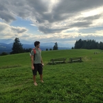
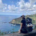
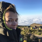
Gallery
Participants
You need to be logged in to see the participants
Weather
°
°
°
°
Description
Thanks Thomas Siegler for creating the route!
Schellschlicht is a moderately rugged Ammergau peak with a distinctive bowl between two ridges on its southern flanks and with a northern ridge, which is a sort of backbone of the mountain, continuing to the north with Austrian Kreuzspitze (or Kreuzspitzl), German Kreuzspitze, Kuchelbergkopf and Kuchelbergspitz.
The southern bowl contains many little creeks which are accumulated to the Schellaine creek, cutting a deep valley and a canyon into the limestone of southern Schellschlicht.
The two southern ridges can be named after their subsummits: Sunkenkopf ridge to the southeast and Brandjoch ridge to the southwest. Marked trails on the two ridges allow for a nice loop hike to the summit and back. Views are extensive, especially of the Wetterstein walls to the south, looking across the Plansee to Reutte on the west, and a view north into the heart of the Ammergau range, dominated by the Geierköpfe and Kreuzspitze.
The hike is likely popular in late or early season because both trails are on southern slopes of meadow and latschen, where snow will not linger. At over 1200 meters elevation gain from the valley, it's good to get an early start if you come in high summer.
Check the video
The difficultiy is between T3+and T4-
It is also possible to do the tour the other way round, especially on hot days it is recommended, then the ascent is in the shade.
Photo: Thomas Siegler / Gopala-Krishna Achar
CARPOOL
Schedule: Hike starts at 9.00 am.
Drivers: add your car in carpool and put meeting point and time for it.
Passengers: Click on Carpool button. Read carefully all information about the car you join, check if there are any specific instructions. All the costs for the trip will be shared with people in the same car. Meeting point is decided by the driver, this information is in the "Carpool" button.
Please be punctual.
Instructions for the hike
Pace would be average. Travelling costs will be shared in each car.
Hiking can be a dangerous activity. Everyone is responsible for him/herself. I am not a professional guide.
Good to know
Please go through the following list:
- Waterproof hiking boots
- Hiking poles (optional)
- Spikes (there might be snow at the top, but optional)
- Gloves
- Impfpass or Negative Covid Test
- Mask
- Flashlight
- Mobile charger or powerbank
- Cash
- House Keys
- Food/drinks for the way (not sure we will have the chance to stop at any hut till the valley, so consider to Carry 1-2 liters with you).
- Good Mood
- Download .gpx file and app like komoot or outdooractive or OSMAnd or any other gpx viewing application. (I started hiking since last year, so i do not have all the answers to questions regarding this route. Never hiked on this route.)
- Get familiar with the route before we go
The pace would be average but we will hike together as a group. Also, in case someone finds that pace is slow and they want to go faster, please inform me or someone in the group about the meeting point.
Comments
Alpana Chaphalkar
4 years ago
I will create the whatsapp group tomorrow, and share the link of it via email.
1
|
0
Almin Causevic
4 years ago
Hey! Is that with purpose and you really stand behind this in the description? Test or even shot proof? Sad, then I will be more happy on my own :)). Blessings!
0
|
0
Alpana Chaphalkar
4 years ago
Hi, i do not understand your question??
1
|
0
Almin Causevic
4 years ago
Is it important for you, a covid test or a pass for an outdoor hiking trip in nature? Because it is in the description. Thanks!
0
|
0
Almin Causevic
4 years ago
I can also have a car and transport people from Munich to there. I would go with a friend, so there would be 3 places and we do not have covid rules therein :D, so no stress! If an additional car can come in handy :) for your group, I would gladly help out!
0
|
0
Alpana Chaphalkar
4 years ago
Hi Almin, if there is any Hut on the way and if we stop there then they might ask for it. So that's why i put it there. So it's your choice now, no mandatory thing for me. Yes sure! So it would be great if you can add your car into the carpool so that more people can join in
1
|
0
Samantha Oswald
4 years ago
Would be great if you add your car Almin!
0
|
0
Justyna K
4 years ago
Almin!!! add the car :) I am coming with Erensu 100% & then I can see Samantha as well active here and we are done ;)
0
|
0
Almin Causevic
4 years ago
Hey Justyna and the others :D. Yes sure I can add it, but what is with Sagar and maybe Matthias? Would not be so fair to start earlier, as he gave the suggestion for you all. The hike takes about 6 1/2 hours, so 10:30 should really be no problem at all! It is starting to get a bit darker at about 6pm. Hmmm.
1
|
0
Justyna K
4 years ago
yeah yeah, totally correct, we discussed bout that with Erensu. we keep it as it is! so it is 4 of us there for now. see you on the hike :)
0
|
0
Almin Causevic
4 years ago
But if you want to go by car still I can take you, it might be easier for you the travel :). I asked Sagar if he can be there at 9 in the morning, otherwise maybe we can wait or start later. As you wish!
0
|
0
Justyna K
4 years ago
I have no problem with train and I don’t want to drop out on Sagar like this even though I was discussing other options here 😎 just an open mind thinking with Sev etc. We keep it as it is :)
0
|
0
Almin Causevic
4 years ago
See you tomorrow then hopefully
0
|
0
Alpana Chaphalkar
4 years ago
Hello everyone, i have sent you the WhatsApp group link via email. Please join it asap. Also if i missed someone let me know.
0
|
0
Alpana Chaphalkar
4 years ago
i have added 1 more seat in my car, as my car is relatively big enough to accommodate 5 people.
0
|
0
Alpana Chaphalkar
4 years ago
In case another car is not added by someone else in the carpool. People who are interested in doing this hike can come to the meeting point by public transport. But please note that in Garmisch public transport by train is affected by SEV: https://www.facebook.com/groups/hikingbuddiesmunich/permalink/4436108029841164/ So if you take the public transport at 7:30 am, you will reach by 10:30 am at the meeting point. Let me know, then according to that i will adjust the timings.
0
|
0