Uploading...
Overall progress...
0%
File progress...
0%
Edit event: Kilimanjaro - Machame Route
T1 - Kilimanjaro - Machame Route
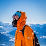
 Organized by:
Route
Kilimanjaro - Machame Route
| Elevation gain |
| Elevation loss |
| Distance |
| Duration |
| Highest altitude |
| Rating |
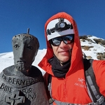
Gallery
Participants
You need to be logged in to see the participants
Weather
°
°
°
°
Description
Top of Africa: Kilimanjaro
The Machame Route - also known as the Whisky Route, the Machame Route leads in 7 days up to Africa's highest peak in the Kilimanjaro massif, Uhuru Peak.
In terms of scenery, this stage is probably the most beautiful route, as each day you hike through completely different vegetation zones.
Overall, it is technically very doable. The varied altitude profile allows a very good acclimatization and through the climbing passage at the "Barranco Wall" one or the other is also technically challenged.
Route description
DAY 1: MACHAME GATE – MACHAME CAMP: 10.75k /7mi | 5-6 hrs | Rainforest
Elevation: 1811m/5942ft to 3021m/9911ft
Altitude gained: 1210m
DAY 2: MACHAME CAMP – SHIRA CAMP: 5.3km/3mi | 4-5hrs | Moorland
Elevation: 3021m/9911ft to 3839m/12,595ft
Altitude gained: 818m
DAY 3: SHIRA CAMP – LAVA TOWER – BARRANCO CAMP: 10.75km/6mi | 5-6hrs | Semi-Desert
Elevation: 3839m/12,595ft to 3986m/13,077ft
Altitude gained: 147m
DAY 4: BARRANCO CAMP – KARANGA CAMP: 5.2km/3mi | 3-4hrs | Alpine Desert
Elevation: 3986m/13,077ft to 4034m/13,235ft
Altitude gained: 48m
DAY 5: HIKE KARANGA CAMP – BARAFU CAMP: 3.3km /2 mi | 3-4hrs | Alpine Desert
Elevation: 4034m/13,235ft to 4662m/15,295ft
Altitude gained: 628m
DAY 6: BARAFU CAMP – SUMMIT: 4.86km /3mi up | 5-7hrs | – MWEKA CAMP: 11.5km /7.2mi down | 5-6hrs |
Glaciers, Snow Capped Summit
Elevation: 4662m/15,295ft to 5895m/19,341ft
Altitude gained: 1233m
Descent to 3106m/10,190ft
Altitude lost: 2789m
DAY 7: MWEKA CAMP – MWEKA GATE – MOSHI: 9.1km/6mi |3-4hrs | Rainforest
Elevation: 3106m/10,190ft to 1633m/5358ft
Altitude lost: 1473m
Comments
Amith Mishra
4 years ago
Can you help with the agent contact info through which you have booked? I am planning for it. thank you
0
|
0
Cosmin Mihoreanu
4 years ago
Sure Amit. Take a look here: https://almightykilimanjaro.co.tz/
0
|
0