Uploading...
Overall progress...
0%
File progress...
0%
Edit event: Tschachaun: the flower Mountain of Lechtal
T4 - Tschachaun: the flower Mountain of Lechtal
 Organized by:
Route
Tschachaun: the flower Mountain of Lechtal
| Elevation gain |
| Elevation loss |
| Distance |
| Duration |
| Highest altitude |
| Rating |
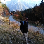
Gallery
Participants
You need to be logged in to see the participants
Weather
°
°
°
°
Description
Carpool: If you have a car, please add it to the carpool, if you don't have a car you can join one of the existing cars in the carpool. If there is no convenient car for you, you can join waiting list and you will be notified when a car is added to the carpool.
I want to be back to Mountains with my buddies this weekend after a long pause. Let´s go for a medium hike to Tschachaun!
The Tschachaun is a 2334 m high peak in the Lechtal Alps. The Tschachaun is characterized by the variety and wealth of alpine flowers. It is not without reason that it is called Blumenberg Tschachaun. In addition, the ascent of the summit is relatively easy and at the foot of the Tschachaun lies Anhalter Hütte. The Alpenvereinshütte is an excellent place to stop for refreshments and as a base. Well-known peaks near the Tschachaun are the Namloser Wetterspitze, the Maldongrat and the Falscher Kogel. We go up from Namlos through the Brennhüttental Valley. We follow the forest path in a southeasterly direction (yellow signpost "Anhalter Hütte/Wetterspitze/Dreiensee"). After a short time we meet the Brentersbach, which will accompany us on the right hand side from now on. We pass smaller waterfalls and walk along the rushing stream without gaining any significant height. After a good quarter of an hour the valley widens and we pass open alpine meadows. Looking back, we recognize the Knittelkarspitze and as soon as the valley narrows again, we see the Imster Mitterberg in front of us, to which we are now hiking. We soon see the prominent pyramid of the Namloser Wetterspitze diagonally to our right. On the left we are accompanied by the walls of the Imster Mitterberg. We hike further south and see the rock wall of the Maldon ridge and the striking Falscher Kogel. Both peaks are separated by the Steinjöchl, over which the transition path to the Hahntennjoch leads. The path then leads past the Anhalter Hütte to the Kromsattel and then along the steep grassy slopes up to the Tschachaun. AFter enjoying panorama from the peak, we have a break at Anhalter Hutte. for the way down we take the way to Namlos crossing Faselfeiltal. To do this, first hike back along the ascent path to the Anhalter Hütte and then turn right at the hut (yellow signpost "Faselfeital/Namlos). In a crossing you reach the Faselfeiljöchl and from there climb down into the Faselfeital. You reach a small hut on the valley floor and Now follow the partly steep and gravelly path down and often cross the stream. Afterwards, after a hunting hut, we come to the bridge over which we tackled the ascent through the Brennhüttental valley, we stroll back to our starting point in Namlos.
Note: Please unjoin the event well in advance, if you don't plan to come. You cannot unjoin the event, when it is starting in less than 12 hours. Also please get familiar with the route before hiking.
Disclaimer: Hiking can be dangerous. I am not a mountain guide. Everybody is responsible for her/himself. Make yourself familiar with the route and its requirements. It's recommended to download a map and bring a cell phone. Here Is my telephone Number to contact me during the day: 017643285424
Good to know
Hiking shoes
Passport/ID
Food/drinks for the way
Comments
Fabio B
3 years ago
hi Thomas, I sent you a PN. I have issues with PayPal, can you email me your IBAN?
0
|
0

Marco Mecarozzi
3 years ago
Weather looking great tomorrow. No Need to rush. My intention Is to have a slow pace, enjoy sun, lake and peak. See you all tomorrow ☺️ https://www.bergfex.com/sommer/lechtal/wetter/berg/
4
|
0

Yasmin
3 years ago
https://chat.whatsapp.com/JIKhfJTKFmN3MvDStA7LaJ
0
|
0