Uploading...
Overall progress...
0%
File progress...
0%
Edit event: [Switzerland] Thursday's afterwork Uetliberg (from Albisrieden)
T2 - [Switzerland] Thursday's afterwork Uetliberg (from Albisrieden)
 Organized by:
Route
[Switzerland] Uetliberg (from Albisrieden)
| Elevation gain |
| Elevation loss |
| Distance |
| Duration |
| Highest altitude |
| Rating |
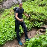
Gallery
Participants
You need to be logged in to see the participants
Weather
°
°
°
°
Description

Meeting point: Tram station in Albisrieden
Maps link: https://goo.gl/maps/op8t4JzvJj55huLQ9
Easily accessible by public transportation.
Easily accessible by bike.
Starting time: 18h30. That is the starting time, we don't wait for latecomers
Pace: beginner-friendly
Route: T2. The route is quite easy, there are almost no steep parts. The route is a little longer in comparison to other routes to Ueltiberg. One hour approximately is needed for ascent. Also, the landscape is a little different from what we are used from other hikes here (we pass a horse farm, railway, etc...)
Weather: The event is held In any weather, bring a rain jacket or an umbrella in case of rainy weather. More pleasant temperatures are expected to those in the city.
Comments
Borut Jansa
3 years ago
I got two cancelations so if somebody else wants to join still can. I can not change the number of participants now.
0
|
0