Uploading...
Overall progress...
0%
File progress...
0%
Edit event: Cycling: Südpark - Starnberg - west of Westfriedhof
T1 - Cycling: Südpark - Starnberg - west of Westfriedhof
15Aug
Mon
13:00
Turnstile in Südpark, München, https://goo.gl/maps/3BeXCpupTggiJbfD8
 Organized by:
Alex M.
Organized by:
Alex M.
Route
Cycling: Südpark - Starnberg - west of Westfriedhof
| Elevation gain |
| Elevation loss |
| Distance |
| Duration |
| Highest altitude |
| Rating |
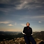
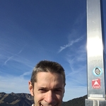
Gallery
Participants
You need to be logged in to see the participants
Weather
°
°
°
°
Description
We cycle from Südpark to Starnberger See through the forest (Max-Joseph-Geräumt) and Olympiastraße (i.e., the east route) and back through Buchendorf and forest (i.e., the west route) to Westfriedhof. A city bike would be ideal, a mountain bike would most likely be suitable, whereas a racing bike would be difficult in the forest. The pure cycling duration is 5-6 h (the calculation of the hiking-buddies Web site is to be ignored, as they don't calculate cycling time properly); naturally, the breaks and stops take extra time. Take a lot to drink and a bit of food with you.
Legal disclaimer: I'm not a guide; every participant cycles at his/her own risk and is responsible for himself/herself.
Comments
SUN
3 years ago
Pls wait for me, i am going to be there by 1:15pm
0
|
0
Alex M.
3 years ago
O.k.
0
|
0
Alex M.
3 years ago
Start at 1:15.
0
|
0
Alex M.
3 years ago
O.k.
0
|
0
SUN
3 years ago
made it to home safely
0
|
0