Uploading...
Overall progress...
0%
File progress...
0%
Edit event: [Switzerland] Thursday's after-work night Uetliberg (from Albisgütli)
T2 - [Switzerland] Thursday's after-work night Uetliberg (from Albisgütli)
 Organized by:
Route
Uetliberg (from Albisgütli)
| Elevation gain |
| Elevation loss |
| Distance |
| Duration |
| Highest altitude |
| Rating |
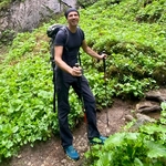
Gallery
Participants
You need to be logged in to see the participants
Weather
°
°
°
°
Description
General information
Meeting point: Near the bench at the start of the trail. Maps link: https://goo.gl/maps/agFACpY7Yt1w3Yb8A

Easily accessible by public transport.
By bike, you need a little uphill endurance which could be a good warmup activity.
There is also payable parking.
Starting time: 18h30. That is the starting time, we don't wait for latecomers
Pace: beginner-friendly
Route: T2. We will use the panoramic route to ascent and the normal route to descant. We will need approximately 40 minutes to go up. We will not stay long on the top so that we don't cool down.
Weather: The weather will improve during the day so we expect good weather at the start. The event is held In any weather, bring a rain jacket or an umbrella in case of rainy weather.
Recommended: We will descend in the dark so a headlamp is recommended.
Gear
Recommended: hiking or approach boots, worm clothes, headlamp
Comments

Roxana Feier
3 years ago
Hi Borut, unfortunately I‘ll need to work longer today and won‘t be able to join this time, sorry for cancelling!
0
|
0
Borut Jansa
3 years ago
No worries, see you next time, hope your pancakes from last time went well :)
0
|
0