Uploading...
Overall progress...
0%
File progress...
0%
Edit event: Steinberg Zireiner See Marchspitze
T2 - Steinberg Zireiner See Marchspitze
 Organized by:
Route
Steinberg Zireiner See Marchspitze
| Elevation gain |
| Elevation loss |
| Distance |
| Duration |
| Highest altitude |
| Rating |
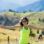
Gallery
Participants
You need to be logged in to see the participants
Weather
°
°
°
°
Description
Read carefully before joining the hike
This is a carpool hike.
Please read carefully instructions for the hike and don´t just click on coming.
CARPOOL
Schedule: Hike starts at 9 am from Wandernoparkplatz Mühlbach close to Steinberg am Rofan.
Drivers: add your car in carpool and put meeting point and time for it.
Passengers: Click on Carpool button. Read carefully all information about the car you join, check if there are any specific instructions. All the costs for the trip will be shared with people in the same car. Meeting point is decided by the driver, this information is in the "Carpool" button.
You can unjoin at latest 12 hours before the event but I would appreciate that only people really motivated to come on Sunday join withhout last minute changes unless illness or serious issues.
Let´s go this Sunday for a long but not technically demanding tour that requires a certain level of fitness, but is rewarded with a magnificent and mostly lonely mountain landscape, beautiful lakes and a summit rarely visited.
We travel to Rofans. Rofan is a mountain of contrasts. In the south, gentle meadow slopes reach up to the peaks, easily accessible via a cable car and a dense network of hiking trails. The north side, on the other hand, breaks off almost vertically in impressive walls, a forbidding rock bastion that seems almost not reachable. But for those who are not afraid of long hikes, there are loopholes in the Rofan castle, steep cirques that lead inside of it.
From the car park we follow the asphalted road straight ahead over the Grundache valley. The Grundache faces north and has created a small canyon in its lower part with cliffs carved by erosion. Where it squeezes through a gorge, a tunnel has been blasted out of the rock for the road. The north side of Rofans slowly appears on the horizon. We reach then a rugged creek valley. The path splits again: to the right a sign points to Schauertal and Zireiner see. We hike high above the Grundache gorge to the meadows of the Kühlermahdalm, then cross a stream with a waterfall and branch off left onto a narrow path. It leads flat along the wooded slope until we meet a signpost again. Now it goes left uphill along a stream. A steep path finally leads up the slope to a forest road. On the right we come to a fork in the road and choose the road on the left, which soon turns into a trail and leads uphill along a romantic brook. Balancing over stones, we follow the markings across the stream and climb over a ridge that separates two stream valleys to the meadows of the (uncultivated) Schauertalalm. The Schauertal is rightly named: the ascent can get terribly hot. Countless small hairpin bends meander uphill through mountain pines. A spring gushes out of the ground 20 minutes below the saddle. Then it goes up a sloping grass slope in a direct line to the Schauertalsattel and on the other side along the left edge of a swampy hollow. We are on the famous Adlerweg. Our climb meets the path that leads from the cable car mountain station at Sonnwendjoch and leads west to the shore of Lake Zirein, the right place to rest and enjoy. A very special treasure: soft grass full of flowers around Lake Zirein invite you to linger. The smoothly polished east face of the Rofanspitze is beautifully reflected upside down in the clear mountain water. The Zireinsee is a small paradise.
No wonder shepherds and hunters ascribed so much scenic beauty to the work of a sea maiden. She is said to have transformed the shore of the lake into a lovely garden and fed the trout with grains of gold. Such grains were also said to be found in the stomachs of cows that had quenched their thirst in the lake. And sheep are said to have got golden teeth from drinking there. After a good break at Zireinersee, we then walk along its left bank and climb uphill over alpine pastures and through mountain pines. At a fork, the path to the Bayreuther Hütte branches off to the left. The further path leads up to the Marchgatterl on the right. From here shortly we climb the summit of the day: Marchspitze (2004m). There, at the highest point of the tour, an impressive view opens up over the rock formations of the Rofan. At the very back, the Hochiss, the highest Rofan summit, stretches its rocky outcrop into the sky.
For the descent we go straight through the pasture gate to a junction. The path to the right via the Angeralm is a little shorter. But the impressions while walking under the Rofan Walls are so grandiose that an encore is worthwhile. To do this, we keep to the left and shortly afterwards pass the Marchalm, where fresh spring water quenches our thirst. We follow the sign "Ampmoosalm" downhill to the left to the idyllic Hirschlacke, framed by boulders, above which the cliffs of the Rofanturm tower into the sky. Then we climb briefly to a saddle below the Rofanturm, walk above a basin filled with boulders towards the Hochiss and hike down to the shingle-covered Ampmoosalm. The path now turns north and leads between the alpine huts into the Eselkar, which is framed by rock faces. It winds increasingly steeply, first through mountain pines, later through larch forest and finally leads over a stream. Shortly thereafter we cross a flat meadow and continue descending to a bridge. We remain there on the right side of the stream in the direction of Steinberg.
It is a long tour that requires a certain level of fitness, but is rewarded with a magnificent and mostly lonely mountain landscape, beautiful lakes and a summit rarely visited.
Disclaimer: Hiking can be dangerous. I am not a mountain guide. Everybody is responsible for her/himself. Make yourself familiar with the route and its requirements. It's recommended to download a map and bring a cell phone. Here is my telephone number to contact me during the day: 017643285424
Good to know
Hiking shoes
Passport/ID (we travel to Austria)
Food/drinks for the way (not sure we gonna find open huts till the end so you must have at least 2 liters of water with you)
Rain jacket
Spikes (probably not needed but never a bad idea to have just in case?)
Comments

Marco Mecarozzi
2 years ago
Weather conditions look perfect at the moment for Sunday. Not too hot and Sunny. 😊https://www.bergfex.at/steinberg/wetter/
6
|
0
Sibel Turgut
2 years ago
I have to cancel I’m sorry. I got sick today:((
0
|
0
Marco Mecarozzi
2 years ago
Sorry to hear that. Those Who were in the car with her can join again any other car coming
0
|
0
Marco Mecarozzi
2 years ago
Cool to see many good friends there tomorrow! Looking forward. See you all tomorrow 🤗
1
|
0
Batman K
2 years ago
Hello Marco, you need to add more capacity to the event so we can join the free places in cars
0
|
0
Marco Mecarozzi
2 years ago
Not possible since Mukul Car has a issue and me and him are only virtually in that car. We are travelling both with other cars. If he cancel his car, I would get canceled and if organizer gets canceled, hike gets canceled too. It sounds Crazy I know but so It Is. That Is why. And anyway had already decided from beginning to bring 12 people. We are 13. We Will have many chances to hike together along the Summer. No worries
1
|
0