Uploading...
Overall progress...
0%
File progress...
0%
Edit event: Gschnitztal- Rifugio Cremona alla Stua - Weisswandspitze
T5 - Gschnitztal- Rifugio Cremona alla Stua - Weisswandspitze
 Organized by:
Route
Gschnitztal Rifugio Cremona alla Stua Weisswandspitze
| Elevation gain |
| Elevation loss |
| Distance |
| Duration |
| Highest altitude |
| Rating |
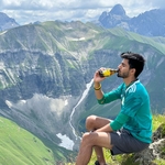
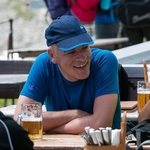
Gallery
Participants
You need to be logged in to see the participants
Weather
°
°
°
°
Description
Read carefully before joining the hike
This is a two day hike with overnight sleep in Rifugio Cremona alla Stua. https://rifugiocremona.com/
Please read carefully instructions for the hike and don´t just click on coming.
CARPOOL
Schedule: Hike starts at 9,30 am from Parkplatz in Gasthof Feuerstein in Gschnitztal.
Drivers: add your car in carpool and put meeting point and time for it.
Passengers: Click on Carpool button. Read carefully all information about the car you join, check if there are any specific instructions. All the costs for the trip will be shared with people in the same car. Meeting point is decided by the driver, this information is in the "Carpool" button.
Instructions for the hike
I booked for 8 persons at Rifugio Cremona alla Stua. You will pay at the hut (17,5 euro if member of any Alpenverein, 31 if no membership). You can book also halb Pension. That includes dinner and breakfast and costs 55 euro, 65 if no DAV membership. Just clicking on partecipating is not enough. Please write me a private message once you have a spot in a auto where you communicate to me if you want halb Pension or not. Travelling costs will be shared in each car. Extra any food or drink you will buy along those two days.
You can unjoin event at latest 4 days in advance otherwise you will pay 10 Euro to the hut.
Gschnitztal is still one of those valleys in North Tyrol that have fully retained their authenticity. Here, nature is not disturbed by hotel complexes, ski areas, golf. The imposing head of the valley is framed by mighty three-thousanders.
Let's go for a unique tour in a less crowded hiking area with extraordinary landscapes and some culinary highlights in the huts too.
Day 1: Gschnitztal - Magdeburger Hütte
The ascent begins in the upper Gschnitz valley at the Gasthof Feuerstein (parking lot subject to a charge) and leads to the Laponisalm in about an hour. From Laponis, continue on the service road for a bit until the trail (signpost) to the Bremer Hütte branches off to the right. Now it goes steeply uphill through the forest and over slopes partly covered with bushes and open terrain you reach the Simmingboden. After the Prangerstadl you come to a small bridge and change to the left side of the valley. Passing the Simmingsee, the route climbs steeply again and you reach the glacier ridge of the Mitteregg, from where you continue to the Bremer Hütte where we can have a break. The Bremer Hütte lies like an eagle's nest on a terrain pulpit east of the Inner Wetterspitze in the rear Gschnitz Valley and offers an impressive panoramic view of the surrounding peaks and glaciers. In the immediate vicinity there are also a few mountain lakes that invite you to relax. After the break we head to our daily target. Rifugio Cremona alla Stua (known as Magdeburger Hütte as well).
It starts slightly downhill from the Bremer Hütte to the "Hohen Boden". From the Bremer Hütte we first follow the path towards Simmingjöchl. After about ten minutes, our route to the Magdeburger Hütte branches off down a slight incline. Marked path tracks lead down to the rear Simmingboden, which we cross to the other side. A creek has to be jumped over. Then on a clear climb diagonally left upwards. Later, the first glacial sections appear, which are sometimes secured in steeper places. We gain a prominent flat area that was covered by glacial ice not too long ago. Now there are only remnants of the Simmingferner under the following steep bar. The ascent to the Bremer Scharte at 2,890 m follows. The crossing is one of the highest in the Stubai Alps. The path leads through glacial striations and over ridges. From the Scharte down to the Magdeburger Hütte, the path has been redesigned and leads through rocky terrain. It is an invitation for all mountain hikers who have tried their best in the high Alps to set off on undiscovered paths. The change over the main Alpine ridge is of course a temptation and opens up new horizons, especially at the Bremer Scharte. When the weather is clear, the show reaches as far as the Dolomites.
On the South Tyrolean side we see a new mountain area. The framing of the Pflersch valley and other mountain ranges, which are enchantingly staggered one after the other. The well-laid trail pulls away from the saddle to the left and loses moderately steeply in height. At the rock base of the Schafkampspitze you have to cross into a gully (briefly insured). Slightly lower out of the loose scree to the left and gradually into grassy terrain. Our path winds its way down over various steps, crosses the stream on the crosses the stream on the threshold of a beautiful floor and leads along glacial striations to the Magdeburger Hütte.
Day 2: Magdeburger Hütte - Weisswandspitze (3018m) Gshnitztal
Near the Magdeburger Hütte is the Stuben Lake, where beautiful cotton grass mats can be observed in summer.
The path itself does not present any major difficulties. However, between Weißwand (3,018 m) and Hohem Zahn (2,924 m) a ledge has to be crossed, where caution is needed especially with snow. The ascent to the summit of the Weißwand is worthwhile. When the weather is clear, there is a wonderful view of the Zillertal Alps and the Dolomites, the Ortler Group and the Ötztal Alps all the way to the Zugspitze!
Once the two peaks are done, we go further east and we head to Rifugio Calciati al Tribulaun (italian Tribulaun Haus). Here we have a well deserved break before heading to the valley. The hut is wonderfully located in Pflerschtal close to Sandes lake. After the break we head to valley going first up to the Pflerscher Scharte at 2,599m. From here the descent to the Austrian Tribulauenhaus 2,054m begins. Finally from the Tribulauenhaus the descent to the Feuerstein can be mastered in about 1-2 hours
Hiking can be dangerous. I am not a mountain guide. Everybody is responsible for her/himself. Make yourself familiar with the route and its requirements. It's recommended to download a map and bring a cell phone. Here is my telephone number to contact me during the day: 017643285424
Good to know
Hiking shoes
Hut sleeping bag
Passport/ID
Food/drinks for the way (we have some huts on the way both days but you must have at least 2 liters of water with you)
Spikes
Rain jacket
Comments

Marco Mecarozzi
2 years ago
Hallo everyone. As for info. The last Place Is taken already. Next days Will update about conditions but weather seems improving finally. Have a nice evening
3
|
0
Marco Mecarozzi
2 years ago
Weather conditions look Ideal for out two days tour. A lot of sun, warm but not too much. 😊https://www.bergfex.it/ladurns-gossensass-pflerschtal/wetter/prognose/#day3
0
|
0
Prayag Miskin
2 years ago
https://photos.app.goo.gl/aAwcPTAJoLxwWELo6
Photo album link. Please upload photos here :)
0
|
0
Christian Epp
2 years ago
thanks to all for nice accompany & good talks & shared experiences ;-) additional to here i made a facebook post: https://www.facebook.com/christian.ppe/posts/pfbid0uUT8A4EnS8M1dhgfetH6YjrbpwecwypNrJb4XfDkqiW6GkRKmn1goAGTdxiMNyEel
0
|
0