Uploading...
Overall progress...
0%
File progress...
0%
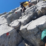
Edit event: Around the lower station of Tiroler Zugspitzbahn and seeing two creeks, small circle
T2 - Around the lower station of Tiroler Zugspitzbahn and seeing two creeks, small circle
15Oct
Sun
08:30
Parking lot at https://goo.gl/maps/9Tb7CGHUE59wEHEo7 between Ebne 41 and Ebne 52, 6632 Ehrwald, Österreich.
 Organized by:
Alex M.
Organized by:
Alex M.
Route
Around the lower station of Tiroler Zugspitzbahn and seeing two creeks, small circle
| Elevation gain |
| Elevation loss |
| Distance |
| Duration |
| Highest altitude |
| Rating |
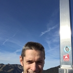
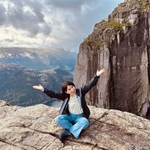
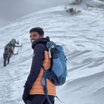
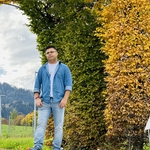
Gallery
Participants
You need to be logged in to see the participants
Weather
°
°
°
°
Description
Hiking in the beautiful scenery of the highest German mountain Zugspitze! Please familiarize yourself with the route http://out.ac/INhVHt before joining.
Necessary:
- ankle-covering hiking boots and
- plenty of water (the exact amount depends on your weight; I recommend ⩾ 2.5 L).
Optional: hiking poles, rain poncho, food, warm clothes (depending on the temperature), gaiters (if there's snow), and crampons (if there's ice).
In case of heavy rain, heavy snow, thunderstorm, or too few participants (also if they don't show up last minute), the hike might be canceled, modified, or moved for safety reasons.
I plan to drive according to http://www.google.de/maps/dir/Fürstenrieder+Str.+249,+81377+München/Ebne+41,+6632+Ehrwald,+Österreich and pick up co-hikers along the way. The price may vary slightly depending on the number of folks in the car and the parking fees.Tidiness rules for the folks who get a ride with my car: (1) keep your dirty hiking gear (e.g., dirty boots and dirty hiking-pole tips) in bags of yours (and sit in the car in relatively clean street shoes or relatively clean flip-flops), (2) don't eat inside (everyone may drink pure water, and the driver may sip a caffeine drink), and if you are really hungry, ask the driver to stop and then eat outside, and (3) someday – and that day may never come – I will call upon you to help me cleaning the car with time or money. Other drivers may (or may not) have their own regulations concerning their cars.The tour is unguided; I'm not a guide. Every hiker acknowledges that he/she has fully read and understood the route description and would be able to hike it alone. He/she is fully responsible for himself/herself and hikes at his/her own risk.
Comments
Zafar A
2 years ago
Hi Alex. This hike is happening right ?
0
|
0
Alex M.
2 years ago
Yes, and if only too few participants show up (e.g., only us two), we'd deviate to an easier and shorter route.
0
|
0
Alex M.
2 years ago
Oh, I see it's raining everywhere nearby—this might cross my plans anyway. I'll check the weather once again in the evening. (Perhaps, Hoher Ifen, though it's somewhat far.)
0
|
0
Zafar A
2 years ago
thanks for the reply . I will wait for further updates :)
0
|
0
Zafar A
2 years ago
but there is a person in the waiting list , maybe you can add them
0
|
0
Alex M.
2 years ago
Technically, I can't move him/her from the waiting list into the participants list. He/she has to do it himself/herself if he/she wishes to hike.
0
|
0
Zafar A
2 years ago
where would be our meeting point ? can you write your contact number here please ?
0
|
0
Alex M.
2 years ago
Please check you e-mails, including your spam folder.
0
|
0
Zafar A
2 years ago
I have checked no email recieved yet. can you email me at zsabdi@outlook.com ?
0
|
0
Alex M.
2 years ago
I've just repaired a low-level error in the map of the route itself, so please update your GPX files (the time got smaller by a few minutes). Further, Wiener Neustädter Hütte has just closed for the winter, including the highest portion of the hike (cf. https://wiener-neustaedter.com). Finally, there's going to be rain between Saturday and Sunday, so the trail is highly likely to be a bit wet. For all these reasons, I'm strongly considering shortening the hike to https://out.ac/INhVHt – in this case we hike 10.1 km and 3:25 h, returning to Munich already around 14:05. (We may also start earlier – if you wish – to have more of the rest of the day in Munich.) Would that be fine? Please yell if that's not o.k. with you.
0
|
0
Alex M.
2 years ago
As announced earlier (and because nobody complained), and due to one more reason (I damaged my right hand a bit, so I prefer to skip the hiking poles myself and take less elevation), I shortened the hike now. There are no huts on the way, so, if at all necessary, we're likely to stop for bio-breaks before and after the hike at petrol stations.
1
|
0
Alex M.
2 years ago
As announced earlier (and because nobody complained), and due to one more reason (I damaged my right hand a bit, so I prefer to skip the hiking poles myself and take less elevation), I shortened the hike now. There are no huts on the way, so, if at all necessary, we're likely to stop for bio-breaks before and after the hike at petrol stations.
0
|
0
2 years ago
Hi Alex, it’s fine for me. I think Veronika would also be ok with that. When and where should we meet you?
0
|
0
Alex M.
2 years ago
Great! You see the meeting time and place in Munich when you click on ”Carpool“ and then ”Show meeting point“.
0
|
0
Юлия Байдуж
2 years ago
Hi Alex how can I join to you tomorrow?
0
|
0
Alex M.
2 years ago
That’s elementary, Watson.
As my car is full as of now, you can add your own car (rent it if you need to) or arrive yourself by public transport to the starting point in Ehrwald.
1
|
0
Юлия Байдуж
2 years ago
I can go with my car. No problem. Thanks!
1
|
0
Юлия Байдуж
2 years ago
Thus we will meet in Ehrwald and will start at 8:30?
1
|
0
Alex M.
2 years ago
Yes. Add your car via ”Carpool“ so that we see you going and communicate via this Web site on need.
0
|
0
Gangadhar M
2 years ago
Hi Alex & Yuliaa,
I hope all is well!
I just noticed that there are seats available in Juliia's car. So i just joined, I just sent an email to Juliia as well! I realised that it is a bit late, but still I am interested in joining you guys. Kindly let me know whats on your mind!
Thanks,
Gangadhar
1
|
0
Юлия Байдуж
2 years ago
Hi, Gangadjar, you can joined. I have a place in my car!
1
|
0
Gangadhar M
2 years ago
Hi Julia, thanks for your response! unfortunately I am not feeling well, may be next time! Thanks though:-).
0
|
0
Alex M.
2 years ago
Shaleen and I have not seen the rest of you for quite a while (50 min). Anyhow, we are proceeding along the route on the current map. Hopefully everything is fine with you all. Just proceed.
0
|
0
2 years ago
we’ll be at the destination in 30 minutes
0
|
0
Shaleen Srivastava
2 years ago
Great to read that, we are already here at parking and will wait for you. 👍🏼
0
|
0
Alex M.
2 years ago
I have not taken any photos this time. To all who took photos: please feel free to upload them here. The presence of photos at all will ensure that we all get proper credit for this hike (points, distance, elevation). To upload, simply click on “Click or Drag here to upload pictures” on the Web page of the hike (http://www.hiking-buddies.com/routes/events/7867). Due to privacy concerns, please don't upload photos with people unless you've been explicitly permitted to post their photos online.
0
|
0