Uploading...
Overall progress...
0%
File progress...
0%
Edit event: Roter Stein (2,336m)
T4 - Roter Stein (2,336m)
 Organized by:
Route
Roter Stein
| Elevation gain |
| Elevation loss |
| Distance |
| Duration |
| Highest altitude |
| Rating |
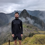
Gallery
Participants
You need to be logged in to see the participants
Weather
°
°
°
°
Description
NOTE: Since weather conditions are changing drastically over time and I planned this hike pretty early, I keep my rights to change the hiking date (but hopefully we can do it)!
NOTE: Please be punctual! Train could be fully packed, so better to be on the safer side and take a seat as early as it is possible.
NOTE: Please check the gain and distance of the hike, it may not be beginner friendly. I do not go with the people who does not complete at least one T3+/T4 hike and >1200m uphill in one day.
Roter Stein (2,366m) offers a breath taking summit panorama although there are several higher summits nearby. Looking towards Zugspitze across Gartnerwand is spectacular as well as the views of the western Mieming Range. To the south you have a look onto the glaciated peaks of Stubai Alps and Öztal Alps. Especially the view of Wildspitze and Hintere Brochkogel is amazing.
Most of the hike is T2/T3 except the descent from the summit towards East is T4 and some sections are secured with the cables.
Good to know
We will meet at Munchen Hbf (Gl. 31). Please be punctual!
The hike should take ca. 7-8 hours with an intermediate pace of 400 mph.
The plan is following:
6:32 - 7:54 (RB 6) München Hbf -> Garmisch
8:04 - 8:43 (RE 60) Garmisch -> Bichlbach Bergwang
9:00 - 17:00 hiking
17:16 - 17:57 (S 7) Bichlbach Bergwang -> Garmisch
18:05 - 19:26 (RB 6) Garmisch -> München Hbf
It may change depending on the weather, hike & availability of the connections.
Sticks may be helpful to keep you safe.
Before the hike please join the WhatsApp group or send me a private message with your phone number.
WhatsApp group: https://chat.whatsapp.com/D9xFV35DnhVICMp4ws6Qpc
Things to bring:
- Deutschland Ticket with ID card;
- passport;
- hiking shoes;
- windproof and waterproof clothes;
- water (at least 3-4 l) and some food;
- sunscreen and sunglasses;
- DAV insurance;
- good energy and stamina.
Optional:
- hiking poles;
- first aid kit.
Note:
- Unjoining is allowed until 12 hours before the start of the event
- The organizer is no professional guide. Participants are responsible for themselves, must do their own research about the route, and must be able to navigate by themselves (in case the group splits for some reason, for example)
Disclaimer: Hiking can be dangerous. I am not a mountain guide. Everybody is responsible for themselves. Please make yourself familiar with the route and its requirements. Additionally, you could download the map, bring a cell phone and a first aid kit.
Comments

Robert Piecyk
2 years ago
Hey! Unfortunately the weather forecast is not so promising as it shows a rain/storm in the afternoon. I will let you know by tomorrow if the hike is postponed.
1
|
0
Robert Piecyk
2 years ago
Hey! Weather forecast changes with every time I am checking. Nevertheless, I will give a try and organise this hike. Still, there is a possibility that we need to re-adjust our plans later (especially if there will be a high risk of storm). We will see what we have to deal with tomorrow. Take rain jacket with yourselves!
1
|
0
Cormac Fleming
2 years ago
Hey Robert, I can no longer unjoin the event, I was hoping the forecast would improve but hopefully it hasn't! Sorry about the short notice.
0
|
0