Uploading...
Overall progress...
0%
File progress...
0%
Edit event: (CH) 🇨🇭 Lugano - Morcote
T3 - (CH) 🇨🇭 Lugano - Morcote
 Organized by:
Route
Lugano - Morcote
| Elevation gain |
| Elevation loss |
| Distance |
| Duration |
| Highest altitude |
| Rating |
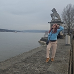
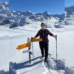
Gallery
Participants
You need to be logged in to see the participants
Weather
°
°
°
°
Description
General information
Weather: Sunny.
Route: T2 If you don't know what the T-Scale is, read this blog (click here).
Pace: Moderate pace. Keeping a minimum pace of 500m gain / hour uphills. We'll split up if pace isn't reached.
Meeting point: Paradiso train station.
Transportation: By car or train. I will be coming by train. It is your responsibility to know when and where to take your transportation to arrive on time to the meeting point.
https://www.schweizmobil.ch/en/hiking-in-switzerland/routes/etappe-01225.html
From https://www.ticino.ch/en/commons/details/The-village-of-Morcote/2713.html
"Morcote is one of the most beautiful villages in Switzerland. In fact, the picturesque village on Lake Lugano is part of the Swiss federal Inventory of sites worthy of protection.
With its characteristic small alleys, the arcades of old patrician homes, valuable architectural monuments and its natural beauty, Morcote is considered “the Pearl of Ceresio”. Of particular architectural interest, is the church of Santa Maria del Sasso, the terraced cemetery and the Tower of the Captain."
The track officially start from Lugano-Paradiso neighborhood, reachable by train or bus from Lugano train station.
Hiking poles not mandatory, but recommended.
Return from Morcote to Lugano train station possible by bus or boat.
Good to know
To do before the hike
- The day of the hike AND one hour before the hike, come have a look at the comments at the bottom of this page to know about potential last minute updates.
Prior to the hike, please download the GPX file and have it imported in a GPS application on your phone. See my Facebook post about GPS apps. You can download the file from this event page. This is very important as I am not profesional guide everyone has the obligation to know where are you going especially if you are slow it is for the safety of everyone and to make this time easy and enjoyable for everyone.
- .
Known bug: Make sure the file you have downloaded has a .gpx extension. If not, just rename it, as it might happen that you get a ".gpx.xml" file instead of just ".gpx" when downloading from a phone.
Schedule (approx.)
- 09h05: We start at Paradiso!
- 14h00: Morcote.
- 14h30 (latest) Lunch
- 14h30 to 16:00 (Max) swimming time and Lunch
- Return to Zurich. Aprox time arrival at Zurich train station maximum at 19:00 End.
You may also go at a slower pace / stay longer at the top (meaning we'd split up).
Do not plan anything right after a hike, as we might come back much later than expected if something happens.
Gear
Make sure you bring the usual hiking gear (good shoes especially). The rest (snacks, water, sunscreen) is up to you, make sure to bring enough, especially when it's very warm. Swimming clothes, towels. Etc.
Additional notes
- Out of respect for the others, please be on time.
- Bring enough water.
- We are not making breaks.
- We will have lunch at the end of the hike.
A few things about Hiking Buddies platform:
- The organizer is no professional guide. Participants are responsible for themselves, must do their own research about the route, and must be able to navigate by themselves (in case the groups split for some reason, for example).
- This is a moderate hike.
- Unjoining allowed until 12 hours before the start of the event.
- If you have a No Show in your profile ( = you did not show up to a hike you signed up to in the past), I may exclude you from the event.
I will take pictures but if you don’t want me to take pictures of you or post them in social media. Let me know!
Transportation
mostly people coming by public transports. Anyone with a car can add it via the Carpool button at the top of this page. If you join by public transports, see the guidelines further down.
Instructions for joining my car
- Click on the Carpool button.
- If there's any available seat, click Join car. You have 12h before the event to unjoin, but the earlier the better so that someone else can join.
How can I join by public transports?
Case 1: You are the first one joining by public transports
- Click on Carpool (top of the page)
- Click on Add a car (even if it is not actually a car)
- Set the number of seats available to 0
- In the field Contact details, write "Public transports"
- The other fields aren't relevant.
Case 2: Someone else already added a fake car for public transports
- Click on Carpool (top of the page)
- Click on Join car
Other frequently asked questions
I don't see the "Join button" - how do I join?
Click on Carpool button, and then Join a car, or Add a car.
Where / when do we meet?
If you are a driver or joining by public transports, you need to be at the "Parking / Starting point" mentioned at the very top of this page. The time is also there. Plan to arrive 5 minutes earlier, at least.
If you are a passenger in a car, click on the carpool button. The meeting point should have been indicated by the driver on that page, as well as the time. Plan to arrive 5 minutes earlier, at least. In case of questions, reach out to your driver directly.
More info will come soon!
Any questions comment below
I accept suggestions
Anything you add to improve our trip is welcome.
- hikes are lived four times when we dream them, when we plan them, when we remember them and when we talk about them.😁
Comments

Lionel Guerraz
2 years ago
Looks like a great hike Lilo!
Do you know if its part of Route 7?
1
|
0
Lilo Vic Morrey
2 years ago
Nop! I have not idea! How to check that .
0
|
0

Kamila Lunae
2 years ago
Is anybody coming from Munich? :(
0
|
0
Lilo Vic Morrey
2 years ago
Not sure! But it will be awesome
0
|
0
Lilo Vic Morrey
2 years ago
It seems that we are going to arrive 1 hour later. There was an accident. I will be taking the train at 07:05 plat. 9 I will be in the begging. If you still available to go.
0
|
0
Matthias Mulder
2 years ago
I'm also on the train, but I'm going to sleep. So, see you in Lugano.
1
|
0