Uploading...
Overall progress...
0%
File progress...
0%
Edit event: Habicht von Gschnitz
T3 - Habicht von Gschnitz
17Sep
Sun
08:15
Parkplatz Feuerstein Gschnitz, Gschnitz 30, 6150 Gschnitz, Österreich; https://goo.gl/maps/8kfzBMysmKbtrbK17
 Organized by:
Alex M.
Organized by:
Alex M.
Route
Habicht von Gschnitz
| Elevation gain |
| Elevation loss |
| Distance |
| Duration |
| Highest altitude |
| Rating |
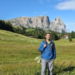
Gallery
Participants
You need to be logged in to see the participants
Weather
°
°
°
°
Description
Hiking to the beautiful Habicht with the gorgeous view from the amazing summit. Please familiarize yourself with the route (here as well as various descriptions on the Web, e.g., http://www.outdooractive.com/de/route/bergtour/stubaier-alpen/habicht-von-obertal-gschnitz-ueber-innsbrucker-huette/11664885 , or http://www.bergfex.at/sommer/tirol/touren/wanderung/1365680,gschnitz--habicht , or http://www.bergsteigen.com/touren/klettersteig/habicht-steig ) before joining.
Necessary:
- ankle-covering hiking boots,
- plenty of water (the exact amount depends on your weight; I recommend ⩾ 4 L).
Optional: climbing gloves, helmet, hiking poles, head lamp, food, and, for beginners, the rest of the via-ferrata gear (harness, set, and rest loop). In the cold season and depending on the weather: warm clothes, crampons, and gaiters.
In case of rain, snow, hail, thunderstorm, or too few participants, the hike might be canceled, modified, or moved.
I plan to drive according to http://www.google.de/maps/dir/Fürstenrieder+Str.+249,+81377+München/Parkplatz+Feuerstein+Gschnitz,+Gschnitz+30,+6150+Gschnitz,+Österreich/@47.5730186,10.79446,9z/data=!3m1!4b1!4m19!4m18!1m5!1m1!1s0x479dd8ef7466ee2f:0xd3c28926f84e95a6!2m2!1d11.5028091!2d48.1129434!1m5!1m1!1s0x479d4f6a7582ccef:0xc7fbec5dd4518d93!2m2!1d11.33077!2d47.0279818!2m4!2b1!6e1!7e2!8j1694935800!3e0?entry=ttu (or a toll-free variant thereof) and pick up co-hikers along the way. The price may vary slightly depending on the number of folks in the car and the parking fees.Tidiness rules for the folks who get a ride with my car: (1) keep your dirty hiking gear (e.g., dirty boots and dirty hiking-pole tips) in bags of yours, (2) don't eat inside (pure water is o.k., and the driver may sip a caffeine drink), and if you are really hungry, ask the driver to stop and then eat outside, and (3) someday – and that day may never come – I will call upon you to help me cleaning the car with time or money. Other drivers may (or may not) have their own regulations concerning their cars.If many folks show up, we build groups according to the vertical speed (e.g., ⩽ 300 m/h, ≈ 375 m/h, and ⩾ 450 m/h).
Comments

L. Kotous.
2 years ago
Is there a place in Munich where I can rent all this?
0
|
0
Alex M.
2 years ago
No. Consider renting not „all this“: buy water instead of trying to rent it. As for the hiking boots, yes, renting is probably very possible, though I have never tried it myself.
1
|
0
Thomas T.
2 years ago
FYI avoiding Mautstrassen takes only a few mins more
0
|
0
Alex M.
2 years ago
@Thomas T. : Are you sure? I updated the link for toll-free. On this route, we'd spend half an hour more per direction ± 15 min if we believe google. But we also have to calculate the time to buy vignette for one direction. In total, the travel-time difference is around (30 min ± 15 min) × 2 - (15 min ± 5 min) = 45 min ± 35 min.
0
|
0
Thomas T.
2 years ago
last time, w/o traffic (early morning) the difference was about 12mins
0
|
0
Alex M.
2 years ago
@Thomas T. Wow, thanks! Did you have two cars, one driving on a toll road, another on a toll-free one, and are you comparing the driving times of the two (all other circumstances being the roughly same, e.g., the number bio-breaks, if any)? As for my URL, as of now, it's specific to Sunday morning (slightly earlier than planned).
0
|
0
Alex M.
2 years ago
@Thomas T. If I set the arrival time to 08:00, I even get 3 h ± 20 min for toll-free travel and 2:25 h ± 15 min for toll travel; the difference for both ways, including buying vignette, would be 2×(3 h ± 20 min) + 15 min ± 5 min - 2×(2:25 h ± 15 min) = 6:15 h ± 45 min - 4:50 h ± 30 min = 1:25 h ± 1:15 min, under the very rough assumption that the road back to Munich takes the same time as the road to Habicht.
0
|
0
Alex M.
2 years ago
@Thomas T. Typo correction: … = 1:25 h ± 1:15 h …
0
|
0
Alex M.
2 years ago
I've just now set the link of the toll road again and adjusted the times for the start of the hike and for meeting in Munich to include the actions of buying a vignette (unless Thomas T. or someone else confirms that a toll-free road takes only insignificantly longer than a toll road) and of taking a bio-break close to the start of the hike. If anyone has an issue with the new times, please tell me so.
0
|
0
Abdelrahman Salim Hammoud
2 years ago
Hey Alex is there room for one more in your car
0
|
0
Alex M.
2 years ago
As of this moment, exactly 1 space is free.
0
|
0