Uploading...
Overall progress...
0%
File progress...
0%
Edit event: Easy hike Wallbergbahn ➡️ Wallberg (900 m EG)
T2 - Easy hike Wallbergbahn ➡️ Wallberg (900 m EG)
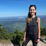
 Organized by:
Route
Wallberg with bahnhof
| Elevation gain |
| Elevation loss |
| Distance |
| Duration |
| Highest altitude |
| Rating |
Gallery
Participants
You need to be logged in to see the participants
Weather
°
°
°
°
Description
All information is here (correct route). Please read the entire text before signing up. The hike will take place only if it does not rain or if it is not too muddy. If necessary, I will postpone the tour and inform you in time.
Hello everyone,
It's hiking time! A brief overview of Wallberg:
"The Wallberg (1722m) is a popular and well-known hiking destination all year round. At the summit awaits a superb 360° view of the Bavarian foothills of the Alps, and the Tegernsee lies practically at your feet."
Here are the key details:
🔔 Participation conditions:
- You are healthy and fit (realistic self-assessment required).
- You arrive on time.
- You are reliable. Cancellations are only possible up to 24 hours before the activity (so others can move from the waiting list to the participant list) ➡️ otherwise, you may not be able to participate in the future.
- You are on the waiting list only if you are actually available at short notice. Otherwise, please cancel (see Rule 3).
- Only individuals with recognizable profile photos and names may participate.
I am immensely grateful for this 🙏.
🎯 Meeting point: 7:45 a.m. in front of platform 32 at the main station.
This allows enough time to buy a coffee/a pretzel or to find a seat for everyone on the train. I will be carrying a gray backpack and a green jacket.
🚆 Journey:
Outward journey
8:03 a.m. - 9:09 a.m. with RB57 towards Tegernsee platform 32
9:17-9:37 a.m. with bus 356 towards Wallberg Wallbergbahn, Rottach-Egern
Return journey
4:17 p.m. - 4:37 p.m. with bus 356 towards Tegernsee station to Tegernsee
4:52 p.m. - 5:57 p.m. with RB 57 towards Munich
💶 Fare: We are traveling with the Deutschlandticket. Everyone is responsible for their own ticket.
🏞️ Route: see here
🚶🏻🚶🏻♀️ Distance & Duration: 11.5 km, on average about 900 meters elevation gain, about 5 hours plus approximately 2 breaks (we'll decide along the way). After reaching the peak, we'll take a break there to eat the food that we've brought with us.
🏔 Difficulty: Easy to moderate hike (do not underestimate the elevation gain physically!) - we maintain a normal, constant walking pace without taking too many breaks. We hike at around 400 meters altitude difference per hour. You should be reasonably free from vertigo and surefooted.
☝🏼 Bring: Small change, food, water, possibly hiking poles, crampons (if there's snow), good mood
🥾 Comfortable, waterproof hiking boots (no sneakers!)
⚠️ Each participant is responsible for their own safety and participates at their own risk. I am not a mountain guide, but rather hiking as a private individual and assume no liability for others. Of course, if needed, we help each other.
😃 I'm looking forward to your company.
Best regards,
Moni
Good to know
Comments
A M
1 year ago
We‘re in the last vagon in the direction of the train.
0
|
0