Uploading...
Overall progress...
0%
File progress...
0%
Edit event: Griesen Schönjöchl Plansee
T2 - Griesen Schönjöchl Plansee
 Organized by:
Route
Griesen Schönjöchl Plansee
| Elevation gain |
| Elevation loss |
| Distance |
| Duration |
| Highest altitude |
| Rating |
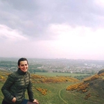
Gallery
Participants
You need to be logged in to see the participants
Weather
°
°
°
°
Description
Hello! Marco described this as ‘Norway in the Alps / fjord-like Plansee’ - I want to see this for myself :-)
Please join the WhatsApp group: https://chat.whatsapp.com/INXb07lYhbP22u7h9sYUPA
This hike is not for beginners as you need to hike 24km and 1000+m elevation.
Meet: 08:15 at start of platform 28 HBF
Train departs MUC HBF: 08:32
Arrive Griesen at 10:19
Hike duration approx 8.5 hours
Depart Heiterwang-Plansee bf: 19:11
Medium pace preferred, please keep the whole day open as this is a long hike. I might cancel the event if the weather changes. I am open to negotiating the start time but the next quickest train isn’t til 08:32 so it may put us on the back foot.
The huts are not open unfortunately so please bring your own food/bier/schnapsl.
Weather: Forecast looks warm and sunny 😎 but bring layers as it will be cooler and windy in the mountains. Not sure how much snow is still lying there so bring spikes just incase.
WhatsApp group: I will create a group the day or so before.
Things to bring:
- IDs
- Hiking poles
- Maybe spikes just incase (Idk the conditions there)
- Hiking boots
- Rain jacket
- 49€ ticket.
- Food/atleast 1 litre water for the way
- Suncream
- Download GPX file
- A good smile 😊
- DAV membership ;)
I am not a mountain guide; please ensure you download the GPX.
Text from Marco who originally create the route:
Norway in the Alps: Who wouldn't be amazed by the fjord-like Plansee, framed by densely forested mountains?
We start our hike in Griesen, Germany. The tour has almost no increase in altitude for several km. We cross a bridge near a chapel and we walk long next to the Naidernach, there is a lot of sparse forest. There are enough views of the striking mountain giants of the Ammergau Alps and the Wetterstein Mountains.
Only after a longer stretch the path rises, leads past a barn and at an altitude of 900 m reaches the point "Beside the three waters", where the wild Schobertal comes down from the left. In the further course, the forest road turns to the left, crosses the Naidernach on a bridge and rises significantly in a few sweeping loops. Almost 100 meters further up, you come to a triangle where you continue straight ahead. Behind a beautiful, open valley floor you reach the shore of the Plansee at the picturesque Seewinkl.
On the eastern shore of the Plansee rises the small peak of the Schönjöchl, mostly covered with light forest.
Schönjöchl is a peaceful mountain on the north-eastern shore of Lake Plansee in Austria. This mountain of the Ammergau Alps is not particularly high at 1661 meters, but it has a lot to offer. What makes this mountain so special is its location directly on the Plansee. This means that you have a wonderful view of the all lake and the surrounding mountains from the summit. On the way to the summit you will come to one of the best points to get a view of Lake Plansee, you can admire it along its all length and it looks like a Norwegian fjord. You only get such a view at this point on the Schönjöchl hike.
But you also have a great view from the summit, even if it is very overgrown overall due to its low altitude. On a clear day you can even see the Zugspitze, Germany's highest mountain. The views are simply breathtaking and definitely worth the effort of the hike. We go down the same way down till Plansee. We hike along all Plansee to get wondeful reflections of surrounding mountains. No surprise King Ludwig loved it here and wanted to build another palace in this location. We reach after crossing a bridge Heiterwangersee and finally Heitwerwang Plansee bahnhof. It is a technically difficult hike but you need good fitness for such long hike.
Please unjoin the event well in advance, if you don't plan to come. You cannot unjoin the event, when it is starting in less than 12 hours.
Disclaimer: Hiking can be dangerous. I am not a mountain guide. Everybody is responsible for her/himself. Make yourself familiar with the route and its requirements. It's recommended to download a map and bring a cell phone and first aid kit for emergencies.
Comments

Deborah
1 year ago
Guys I think I will change the meet time to 08:15 and get the 08:32 train instead. It’s a bit more civilised! Obviously this means we get back two hours later. Would you vote with a 👍 if you’re cool with it :-)
9
|
0
Verginiya Vii
1 year ago
yes
1
|
0

Marco Mecarozzi
1 year ago
Enjoy this Trail! It Is very Scenic especially in the second part and with Sunny weather, Plansee Is Always great Place to be. 😊
1
|
0
Deborah
1 year ago
Thanks Marco! I wanted to do this since I saw your original event (which always gets booked out ;-) ) looking forward to it - and I also see you created another great hike for tomorrow which I also want to do! #hikinginspo !! Have fun 🤩
0
|
0
Deborah
1 year ago
If you’re in the event Please join the WhatsApp group: https://chat.whatsapp.com/INXb07lYhbP22u7h9sYUPA
0
|
0