Uploading...
Overall progress...
0%
File progress...
0%
Edit event: [Intermediate Hike & Swim] Lenggries-Fockenstein-Bad Wiessee
T2 - [Intermediate Hike & Swim] Lenggries-Fockenstein-Bad Wiessee
 Organized by:
Route
[Hike & Swim] Lenggries-Fockenstein-Bad Wiessee*
| Elevation gain |
| Elevation loss |
| Distance |
| Duration |
| Highest altitude |
| Rating |
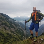
Gallery
Participants
You need to be logged in to see the participants
Weather
°
°
°
°
Description
Hi guys,
Weather is going to be good so I wanted to go for a hike.
The T2 hike is 6 hours long, with 1000m of elevation. Beginners are welcome but make sure that you are fit enough, preferably 350m+/hour, as this will allow us more leeway and also time to relax at the lake.
Huts are likely to be closed so bring your own food and drinks. The plan is that we will spend some time at the lake at the end of the hike and relax. The aim is to be back in Munich late afternoon.
Event is subject to change and canellation depending on the weather.
Post a comment or write me directly so I can create a WA group.
Let me know if you need a Komoot link or the Hiking Buddies GPX file is already sufficient.
Good to know
- I will meet you at Harras at 8:25 (Train leaves 8:37). People meeting at HBF should be there at 8:15. (for the BRB RB56 leaving at 8:29). Please be on time as the train comes once ever hour. Make sure that you are in the right train as well as they split off after Holzkirchen I believe!
- We will arrive at Lenggries at 9:41
- From there we will hike up Fockenstein (1564m) and then down to Bad Wiessee, and take a swim there.
- From Bad Wiessee we will need to take Bus 359 to go around Tegernsee, to Tegernsee Bf. There, BRB RB57 (departing every 30 mins) will take us back to Munich.
Kindly remember to pack the following essentials:
- food and drinks as per your needs.
- sundry cash
- swim gear (as seen fit)
- rain/sun protection according to the latest weather forecast (most probably sunny)
- Alpenverein / mountain insurance recommended
- first aid kit for emergencies recommended
- headlamp for emergencies recommended
Disclaimer: Please note that this list is not exhaustive and every participant should conduct their own research and self-assessment before joining. Additionally, please be advised that I am not a mountain guide and hiking can be risky. Therefore, you are responsible for your own safety and must familiarize yourself with the route and its requirements. I recommend downloading a map and bringing a cell phone for emergencies.
Comments

Darius Lai
1 year ago
WA Link: https://chat.whatsapp.com/Dbsfe-KUQaBd2G0L1KAZaZx
0
|
0
Andreas N
1 year ago
Hi Darius, the link doesn't work for me. Can you check? Thx
0
|
0
Darius Lai
1 year ago
Hi, updated link also in the description
0
|
0
Davide Gaino
1 year ago
Hi guys! Where shall we meet? I am at platform 34
0
|
0