Uploading...
Overall progress...
0%
File progress...
0%
Edit event: *Changed Plan: [Hike & Swim] Tegernsee to Schliersee over Baumgartenschneid
T4 - *Changed Plan: [Hike & Swim] Tegernsee to Schliersee over Baumgartenschneid
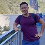
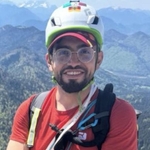
 Organized by:
Route
[Via Ferrata A/B & Swim] Hammersbach-Riffeltorkopf-Eibsee
| Elevation gain |
| Elevation loss |
| Distance |
| Duration |
| Highest altitude |
| Rating |
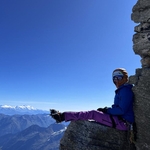
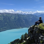
Gallery
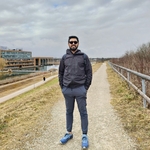
Participants
You need to be logged in to see the participants
Weather
°
°
°
°
Description
Updated: [Hike & Swim] Tegernsee to Schliersee over Baumgartenschneid
WhatsApp Group: https://chat.whatsapp.com/JU4YqjVgfbv5Lw3SkSoNLA
Hi, due to weather conditions, the original plan has been changed.
The new route is from Tegernsee to Schliersee. You may find the GPX File here:
[Hike & Swim] Tegernsee to Schliersee over Baumgartenschneid (hiking-buddies.com)
Train leaves at 8:37 from Harras and 8:30 at HBF. You are more than welcome to join us from either location.
[Hike & Swim] Hammersbach-Riffeltorkopf-Eibsee
Hike might be cancelled depending on weather conditions
Route Description
Komoot Link: https://www.komoot.com/de-de/tour/1517605986?share_token=a9roVofAGr6OqbURMDs7q9Wn1TOq9u9jI3L2u6QmMcHr6rE1fd&ref=wtd
Bergtour Online: Riffelspitze | Schwere Wanderung (bergtour-online.de) (Except we won't go to Riffelspitze)
This is a longer hike (6:30h - 7h).
The aim is to at least have some time at Eibsee and be back at Munich around 7. We will start a bit earlier at 7:30 as it takes around 2 hours to get to Hammersbach, also it is a long way from Eibsee.
It is possible that we go through the Hollentalklamm (7.5 EUR entry), or alternately pick a different path around it.
Important Information
According to Komoot there are at least some T4 exposed parts, possibly harder (Hiking Buddies say Via Ferrata A/B). There will also be some steep parts secured by wire. Please take appropriate clothing / gear with you. I recommend that you take Via-Ferrata gear with you, better be on the safer side.Highly preferred that you are fit (~400m/h altitude) such that we can make the connections in time, be back in Munich not too late, and will at least have some time at the lake.There is a medium possibility that there will be snow (although we are in late April). It is recommended to bring spikes to be safe.It is assumed that you can handle yourself. Please also turn back if you feel unwell / unable to continue.You may also bring swim gear if you want to take a dip at the Eibsee at the end.There will be two huts on our ascent but not sure if they will be open (bring food and drinks as per your needs)Whatsapp Link will be posted once somebody texts me their WA number (at least 2 participants in order to create a WA Group).
Other Essentials
food and drinks (see above)swim gear (see above)sundry cashrain/sun protection according to the latest weather forecastAlpenverein / mountain insurance recommendedVia Ferrata kit recommendedfirst aid kit for emergencies recommendedheadlamp for emergencies recommended
Disclaimer: Please note that this list is not exhaustive and every participant should conduct their own research and self-assessment before joining. Additionally, please be advised that I am not a mountain guide and hiking can be risky. Therefore, you are responsible for your own safety and must familiarize yourself with the route and its requirements. I recommend downloading a map and bringing a cell phone for emergencies
Good to know
Hinfahrt:
08:30: BRB RB 57, Munich HBF -> Tegernsee / 8:37 Harras
09:39: Tegernsee, Arrival
Heimfahrt
15:27: BRB RB55, Schliersee -> Munich HBF (every XX:27 and XX:58)
16:57: Munich, Arrival
7:32 RB6, Munich HBF -> Garmisch-Partenkirchen (G-P)8:56 Arrival9:14 Bus 9840, G-P Bahnhof (Post)9:37 Arrival, Hammersbach Bushalt, Grainau
Heimfahrt
17:10 Bus 9840, Eibsee Bushalt -> G-P Bahnhof (Post) [Leaves every hour]17:51 Arrival18:05 RB6, G-P Bahnhof -> Munich HBF19:26 Arrival
Comments
Darius Lai
1 year ago
Guys, it looks like there will be snow on Saturday. The route will be a bit more difficult and probably will take longer, as we are slower in snow.
Doing a quick survey, who still wants to go on Saturday? Make sure you have gaiters and spikes just in case).
Now would be a good time to drop out if you want.
Post your comments below.
0
|
0
Darius Lai
1 year ago
Alternately, I will change the route to a lower location.
1
|
0
Radina Hadgiivanova
1 year ago
I’ve done this hike before. I’m not sure it can be completed as posted in the current conditions. There are some cables on the way down from the Riffelscharte. If those are covered in snow that section will most likely not be doable.
1
|
0
Darius Lai
1 year ago
Thanks Radina, in this case I'm proposing three alternate routes:
1) [Hike & Swim] Farchant-Wank
2) [Hike & Swim] CastleNeuschwanstein - Alpsee
3) [Hike & Swim] Tegernsee to Schliersee over Baumgartenschneid
Feel free to post your comments and I will make the changes latest tomorrow. Unfortunately I can't change the GPX file anymore, and I won't delete and recreate the event to be fair to the people who joined before.
1
|
0
Darius Lai
1 year ago
Hey guys, post your preferences for substitute:
1) [Hike & Swim] Farchant-Wank
2) [Hike & Swim] CastleNeuschwanstein - Alpsee
3) [Hike & Swim] Tegernsee to Schliersee over Baumgartenschneid
0
|
0
Radina Hadgiivanova
1 year ago
3
0
|
0
Michael Umov
1 year ago
Hi, for some reason I am not able to join the whatsApp group, I am getting the error message: "Could not load. Please try again."
Anyone else having similar issues?
0
|
0
Nestor
1 year ago
I have the same issue,the Link is not working
2
|
0
Darius Lai
1 year ago
Updated, there was an additional dash
0
|
0

Laura Goudkamp
1 year ago
same here!
0
|
0
Darius Lai
1 year ago
WA updated
1
|
0
Rahmaan
1 year ago
I am not feeling that well so i cannot attend the hike tomorrow. Wish you all fun and safe hike!!
0
|
0
Sai narayanan
1 year ago
sorry guys. cannot join due to ankle pain. have a great hike.
0
|
0