Uploading...
Overall progress...
0%
File progress...
0%
Edit event: Panoramic tour from Leutasch to Ehrwald. The Eagle Tour
T3 - Panoramic tour from Leutasch to Ehrwald. The Eagle Tour
 Organized by:
Route
Panoramic tour from Leutasch to Ehrwald. The Eagle Tour
| Elevation gain |
| Elevation loss |
| Distance |
| Duration |
| Highest altitude |
| Rating |
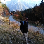
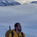
Gallery
Participants
You need to be logged in to see the participants
Weather
°
°
°
°
Description
As of Wed evening, the forecast for Sunday in Bergfex has 4 hours of sun and a little bit of rain.
Note that will we take taxi from Mittenwald to Leutasch, I estimate around 10Euros pp but please be flexible and bring cash for that.
It is a long but technically easy tour, we will be walking at a medium pace, hikers who exercise weekly and do not mind a bit of rain, or wanna test their new rain gear, are welcome. PLEASE press the JOIN button if you really plan to come, i dont appreciate unjoins at any time after that, esp because of the taxi
Here the description by Marco
"Long but technically rather Easy hike in Austria from Leutasch to Ehrwald that is part of the famous Adlerweg.
It’s a long journey of about 20 kilometres starting in Leutasch. From there we will be walking along Leutascher Ache River and Gaistalbach Creek till we reach at the end of Gaistal Valley a magnificently remote place with old growth forest. Then when we will follow Ganghoferweg trail passing close to Hämmermoosalm and further into the valley to Gaistalalm and Tillfussalm. The route runs all the time between Mieming and Wetterstein Mountain Range with peaks that are becoming more and more impressive as you hike up, all of them well above 2000 m. A panoramic hike that should never get too steep will take us to Igelsee lake where Leutascher Ache River has its sources.
We finally walk down till Ehrwald towered by the austrian side of Zugspitze"
If you don't know the T-Scale, read this blog (click here).
We go with Deutschland ticket and TAXI. Be 08.00 on time, no room for delays, the train departs soon after.
Kindly remember to pack the following essentials:
- food and drinks
- cash for taxi, hut
- rain/sun protection according to the latest weather forecast
- headlamp
- Alpenverein / mountain insurance recommeded
- first aid kit for emergencies recommeded
Disclaimer: Please note that this list is not exhaustive and every participant should conduct their own research and self-assessment before joining. Additionally, please be advised that I am not a mountain guide and hiking can be risky. Therefore, you are responsible for your own safety and must familiarize yourself with the route and its requirements. I recommend downloading a map and bringing a cell phone for emergencies.
Good to know
Comments
Fabio B
1 year ago
What will be the expected temperature?
Open weather map shows a dramatic -7, Bergfex displays -2/-4 with 12cm snow 🌨️
0
|
0
Ioannis P.
1 year ago
Forecasts vary per website and altitude. Dress well Fabio :)
0
|
0
Fabio B
1 year ago
yeah yeah yeah ...
0
|
0

Viktoria
1 year ago
The train we are going there is RE61, right?
0
|
0
Ioannis P.
1 year ago
right
0
|
0