Uploading...
Overall progress...
0%
File progress...
0%
Edit event: [Switzerland] 75. Thursday's after-work Uetliberg (from Albisgütli)
T2 - [Switzerland] 75. Thursday's after-work Uetliberg (from Albisgütli)
 Organized by:
Route
Uetliberg (from Albisgütli)
| Elevation gain |
| Elevation loss |
| Distance |
| Duration |
| Highest altitude |
| Rating |
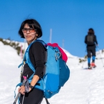
Gallery
Participants
You need to be logged in to see the participants
Weather
°
°
°
°
Description
General information
Meeting point: Near the bench at the start of the trail. Maps link: https://goo.gl/maps/LgCULujv3g9gct269

Easily accessible by public transport.
By bike, you need a little uphill endurance which could be a good warmup activity.
There is also payable parking.
Starting time: 18h30. That is the starting time, we don't wait for latecomers
Pace: beginner-friendly
Route: T2. Because not so good weather is expected we will use the panoramic route to ascent and the main lanterna route to descent. We will need approximately 40 minutes to go up.
Weather: Most probably we will have some intermittent rain but temperatures are not so low anymore, still sem excitement during the hike is expected. The event is held In any weather, bring a rain jacket or (and) an umbrella in rainy weather.
Gear
Recommended: hiking or approach boots, rain jacket or poncho or umbrella
Comments
Ashutosh Kumar
1 year ago
hello
0
|
0
elena
1 year ago
Hi there, unfortunately all my train connections from St.Gallen to Zuerich have been cancelled due to a technical problem 😪. I’m afraid I won’t be able to join tonights hike…
0
|
0

Borut Jansa
1 year ago
No worries, next time.
1
|
0