Uploading...
Overall progress...
0%
File progress...
0%
Edit event: Ettaler Mandl und Laber/Speed hike/after work
T5 - Ettaler Mandl und Laber/Speed hike/after work
 Organized by:
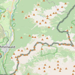
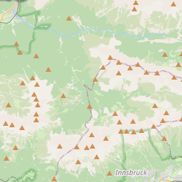
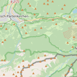
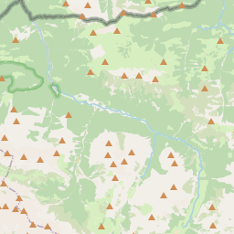
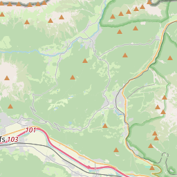
Route
Ettaler Mandl und Laber
| Elevation gain |
| Elevation loss |
| Distance |
| Duration |
| Highest altitude |
| Rating |
Gallery
Participants
You need to be logged in to see the participants
Weather
°
°
°
°
Description
It is hard to find a good weather already in July.
Platform 28
I am planning to do this tour in fast peace 550-600 hm/hr
We will take a train at 9:30 latest back to Munich from Oberammergau.
Small section of via ferrata A/B so think about bringing set if you needed.
Headlamp
Good to know
**Disclaimer**
Please read the following carefully before participating in the hike:
1. **Self-Guided Activity**: This event is not a guided tour. The organizer is merely facilitating the coordination of participants. Each individual is responsible for their own actions, choices, and judgments.
2. **Self-Navigation**: Every participant is responsible for navigating themselves on the suggested route. You must have the necessary skills, experience, and equipment to independently complete the hike.
3. **Personal Responsibility**: You are fully responsible for your own safety and well-being during the hike. This includes assessing your fitness for the activity, ensuring you have adequate equipment, preparing for all weather conditions, and having sufficient supplies. If professional rescue services are required, you will be responsible for the costs.
4. **Insurance**: By participating, you confirm that you have sufficient insurance coverage, such as membership with the German Alpine Club (DAV), Mountain Rescue Service (Bergrettung), or a similar organization, to cover any potential accidents or emergencies that may occur during the hike.
5. **Acknowledgment of Risk**: By joining this hike, you acknowledge and accept that hiking involves inherent risks, which can lead to injuries or death. You participate at your own risk.
6. **Liability Release**: The organizer holds no responsibility for any injuries, accidents, or deaths that might result directly or indirectly from this event. The organizer does not warrant the accuracy of the event description.
7. **Group Dynamics**: If you decide to leave the group (e.g., going ahead or stopping without reason) or do not bring the required gear, you are officially considered to have left the group, and the group will not search for you.
By joining this event, you accept and agree to the terms outlined above. Please be aware that you participate at your own risk and responsibility.
T5 - Wörner and Mittenwalder Höhenweg (UIAA climbing up to I+/II & A/B)
 Organized by:
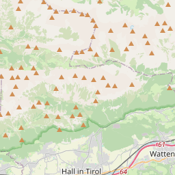
 Route
Wörner and Mittenwalder Höhenweg


1016 m
1056 m
14.5 Km
05:38
1686 m
1062
4.58 Km T1
6.79 Km T2
0.11 Km T5
Participants
Weather
7/8/2024
RefreshWind: 5 km/h
Calm
Precipitation: NaN mm
7/8/2024
5 km/h NaN mm
15:00h-18:00h

20°
7/8/2024
5 km/h 0.3 mm
18:00h-21:00h

16°
7/8/2024
7 km/h NaN mm
21:00h-00:00h

15°
7/9/2024
7 km/h NaN mm
00:00h-03:00h

15°
Description
Not beginner friendly, Alpine Hiking experience ((UIAA climbing up to I+/II & A/B))
Plans may change due to weather-
I welcome experienced hikers who can keep up with the group(this would rather fast pace in non technical parts). Please bring necessary equipment, including a via ferrata set, helmet, and your ID for border crossing
Note that I am not a mountain guide, so you are responsible for your own safety. A WhatsApp group will be set up for updates and coordination 12 hours before hike.
Helmed is required & via ferrata set is recommended for hohenweg.
Disclaimer: You are responsible for yourself. Hiking can be dangerous, I am not a mountain guide and this is not a guided tour. Make yourself familiar with the route and its requirements. It is recommended to have DAV Membership/Insurance.
About:
Mittenwalder The Wörner is an alpine highlight on the Bavarian side of the Karwendel. The Bavarian Karwendel has relatively modest dimensions compared to the overall area of this mountain range. Of the four major rock formations, only the Northern Chain touches the Bavarian responsibilities. The state border with Austria runs directly along the vertical axis of this mountain range. The town of Mittenwald in Upper Bavaria is the central starting point for excursions into the northern Karwendel bastion. Compared to the Austrian side, the area accessible from there has been somewhat civilized through the construction of paths. The hotspot is certainly the Karwendelbahn cable car, specifically the rocky surroundings of its mountain station, as well as the heavily trafficked Mittenwald Ridgeway that starts from there.
In contrast, the classic Karwendel range is known for its primitive nature and restrained development. Those who want to experience this from Mittenwald and are blessed with the necessary skills set their sights on the mighty Wörner. The mountain is a true Karwendel peak with everything that entails: a long approach, significant elevation gain, and requiring the use of hands to climb. Despite its difficulty, the Wörner is frequently climbed. For those who don't want to tackle the entire challenge in one go, it can be done in two parts with an overnight stay at the Hochlandhütte. While this doesn't make the technical difficulties (climbing up to grade II) any easier, it means you won't be struggling with your stamina reserves when the going gets tough.
The mountain tour via the normal route on the Wörner falls into the category of easy climbing tours.
T4+ II
Advance from Wörnersattel over the narrow grassy ridge to the rock base of the Wörner. The start of the normal route is unmistakable. A sign, with a thought-provoking note regarding the expected difficulties, marks the beginning.
Expansive views into the summit flank
Expansive views into the summit flank
The first barrier is overcome with easy scrambling (I). Red markings show the ideal line to the summit from this point onward. The terrain eases a bit above this first hurdle. Move upwards in the extreme walking terrain immediately to the right of the northwest ridge. In the typically shattered rock of the Karwendel, this is no trivial matter. At approximately 2,300 meters, the route veers to the right of the ridge crest.
The final meters to the summit
The final meters to the summit
Traverse into the west flank with some ups and downs. This stage has a decent trail, but due to the crumbly ground, it must be navigated carefully. An unmistakable red arrow painted on the rock ends the traverse. Here, the actual climbing begins – the arrow directs the summit aspirant to make contact with the rock. About 180 vertical meters remain to the geological zenith.
The first meters immediately represent the crux of the tour. A steep rock step with small holds requires concentrated climbing (II). The subsequent section is quite airy, as the terrain drops steeply to the Wörnerboden below. Ascend skyward through the rock in a sweeping leftward arc (continuous I). Finally, the terrain eases a bit and the summit push ends via walking terrain at the Wörner cross (2,476 m).
Tour description: Descent
Carefully scramble down the west flank to Wörnersattel, return to the mountaineers' accommodation, and finish our alpine tour with the hike back to Mittenwald. For many (including myself), returning via the ascent route is the preferred way.
For those who enjoy varied round tours, the district offers alternatives for the return route. For example, a descent from Wörnersattel to the northeast and a return via Seinsgraben is conceivable. The section between Hochlandhütte and Dammkar also offers some variants. With a good topographic map, you can plan something individually. However, you should not lose sight of the length of the trails.
What appears as a short detour on a map often turns into a relentless endurance test on site (this applies, for example, to the mentioned return via Seinsgraben).
Mittenwald Höhenweg
we will take following connection :

Good to know
.
**Disclaimer**
Please read the following carefully before participating in the hike:
1. **Self-Guided Activity**: This event is not a guided tour. The organizer is merely facilitating the coordination of participants. Each individual is responsible for their own actions, choices, and judgments.
2. **Self-Navigation**: Every participant is responsible for navigating themselves on the suggested route. You must have the necessary skills, experience, and equipment to independently complete the hike.
3. **Personal Responsibility**: You are fully responsible for your own safety and well-being during the hike. This includes assessing your fitness for the activity, ensuring you have adequate equipment, preparing for all weather conditions, and having sufficient supplies. If professional rescue services are required, you will be responsible for the costs.
4. **Insurance**: By participating, you confirm that you have sufficient insurance coverage, such as membership with the German Alpine Club (DAV), Mountain Rescue Service (Bergrettung), or a similar organization, to cover any potential accidents or emergencies that may occur during the hike.
5. **Acknowledgment of Risk**: By joining this hike, you acknowledge and accept that hiking involves inherent risks, which can lead to injuries or death. You participate at your own risk.
6. **Liability Release**: The organizer holds no responsibility for any injuries, accidents, or deaths that might result directly or indirectly from this event. The organizer does not warrant the accuracy of the event description.
7. **Group Dynamics**: If you decide to leave the group (e.g., going ahead or stopping without reason) or do not bring the required gear, you are officially considered to have left the group, and the group will not search for you.
By joining this event, you accept and agree to the terms outlined above. Please be aware that you participate at your own risk and responsibility.
Comments