Jubiläumsgrat (Ehrwald > Garmisch) | 2962m
| Elevation gain |
| Elevation loss |
| Distance |
| Duration |
| Highest altitude |
| Rating |
Route Information
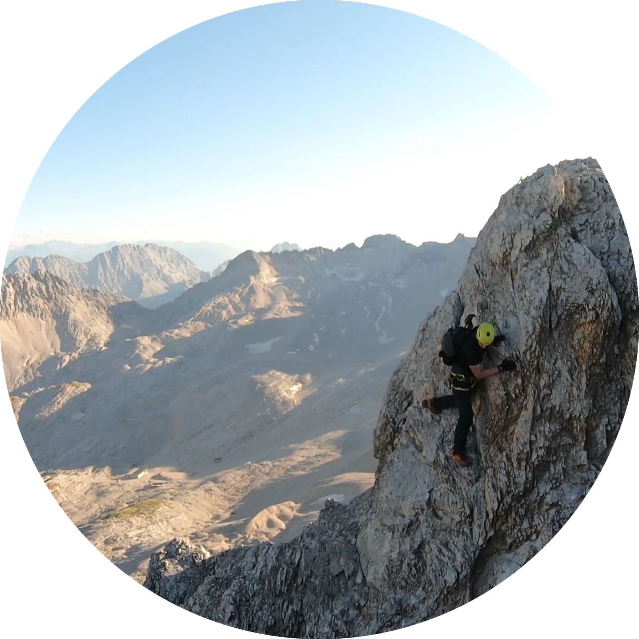
Jubiläumsgrat connects two famous mountains Zugspitze and Alpspitze from West to East. There are several peaks in the middle of the ridge: three Höllentalspitze and Vollkarspitze (2,618 m). The route is a high alpine tour and not a via ferrata route. In 2000/2001 winter and in autumn 2001 Vollkarspitze broken off in two rockfalls and fell into Matheisenkar. Since then the ascent to Vollkarspitze from West to East is very steep and slightly overhang is the key point of the whole ridge and is rated as via ferrata difficulty grade D. To do this ridge without cable car help, you need to be very very fit.
Automatic direction calculation (experimental feature, please provide feedback)
By car: Navigate using Google maps
By public transport:
Train station near start point: Ehrwald Zugspitzbahn (0.1 Km from start point)
Bus stop near start point: Ehrwald Hotel Feneberg (279 m from start point)
Bus stop near start point: Ehrwald Schmiede (311 m from start point)
Train station near end point: Garmisch-Partenkirchen (0.1 Km from end point)
Bus stop near end point: Achenfeldstraße (381 m from end point)
Bus stop near end point: Chamonixstraße (398 m from end point)
------
Automatic hut detection (experimental feature, please provide feedback)
Wiener-Neustädter-Hütte (2209 m):
Website: Homepage
Phone: 06764770925
Wikipedia: Wikipedia page
Location: Google maps
Münchner Haus (2959 m):
Website: Homepage
Phone: +49 8821 2901
Location: Google maps
Barbarahaus (1652 m):
Location: Google maps
Kreuzeckhaus (1652 m):
Website: Homepage
Phone: +49 8821 2202
Wikipedia: Wikipedia page
Location: Google maps
AGV Drehmöser Hutte
Location: Google maps
------
Whoever decides to do this route should know what to expect there, bring adequate equipment and have necessary alpine experience.
| Technical Difficulty | Very Difficult | |||||||||||
|---|---|---|---|---|---|---|---|---|---|---|---|---|
| Gear | Hiking Boots , Helmet , Gloves | |||||||||||
| Popularity | 3 | |||||||||||
Route statistics
| Highest point | 2962m | |||||||||||
|---|---|---|---|---|---|---|---|---|---|---|---|---|
| Total gain | 2353m | |||||||||||
| Total loss | 2618m | |||||||||||
| Duration | 17h04m | |||||||||||
| Distance | 28.6Km | |||||||||||
| Rating | 3186 | |||||||||||
Best Season
Forecast
Author